Galápagos Santa Cruz Flooding Alert 2026: Baltra Airport Updates, Island Road Conditions, and Travel Guide

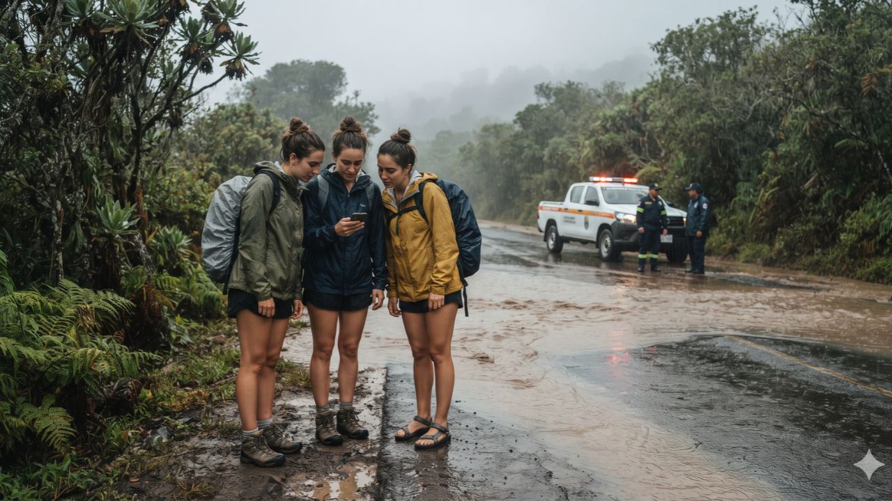
While the Galápagos archipelago is celebrated globally for its semi-arid coastal volcanic fields and drought-adapted marine iguanas, an extraordinary storm system overwhelmed highland drainage basins on Santa Cruz Island on 31 October 2026, triggering local emergency mobilizations and a temporary operational suspension at Baltra's Ecological Airport. The intense rainfall flooded roadways across the residential and farming districts of Bellavista, Santa Rosa, Aguacatal, Miramar, Divino Niño, and La Cascada, prompting the Dirección del Parque Nacional Galápagos, civil protection units, firefighters, police, and military personnel to launch community assistance and road-clearing operations. While local reports confirmed one casualty and two injuries, authorities confirmed that the emergency does not constitute an archipelago-wide tourism shutdown, with maritime excursions and hotel operations adjusting protocols to ensure visitor safety.
Baltra Flight Suspensions and Santa Cruz Roadway Impacts
The severe storm system prompted aviation regulators to issue Notice to Air Missions NOTAM C1796/26, scheduling a temporary four-hour closure of Baltra’s Seymour Ecological Airport (GPS) between 09:00 and 13:00 Galápagos local time on 31 October 2026. Heavy surface runoff and water accumulation along airport access roads required emergency clearing before passenger transfers could safely resume. Because Baltra serves as the primary aviation gateway for visitors traveling to Santa Cruz Island via the Itabaca Channel, flight adjustments created ripple effects for travelers connecting through mainland hubs in Quito and Guayaquil.
Simultaneously, Ecuador’s National Institute of Meteorology and Hydrology (INAMHI) issued an urgent weather advisory warning of persistent heavy rainfall and thunderstorms across the Galápagos province extending through 23:00 on 1 November 2026. Disaster management teams continue monitoring regional oceanic and atmospheric indicators linked to El Niño patterns, which periodically produce elevated ocean temperatures and intense localized squalls across the equatorial Pacific.
The most acute ground transit bottlenecks center along the central trans-island highway connecting the Itabaca Channel ferry dock in the north with the southern harbor hub of Puerto Ayora. Debris flows, standing water, and road shoulder erosion across the upland zones of Santa Rosa and Bellavista led municipal authorities to restrict non-essential vehicle traffic, requiring tour operators to reroute or delay scheduled airport shuttle caravans.
| Infrastructure / Sector | Operational Status | Governing Agency | Direct Impact on Travelers |
|---|---|---|---|
| Baltra Airport (GPS) | Reopening following NOTAM C1796/26 suspension | DGAC & Ecogal Airport Authority | Flights between mainland Quito/Guayaquil and Baltra undergoing schedule re-timing. |
| Trans-Island Highway | Partial restrictions around Bellavista & Santa Rosa | Municipal Council & Transit Police | Delays on transfers between Itabaca Channel and Puerto Ayora; heavy vehicle controls. |
| INAMHI Severe Weather Alert | Active through 23:00 on 1 November 2026 | National Weather Service (INAMHI) | Persistent rainfall warnings; monitoring of regional El Niño equatorial weather shifts. |
| Puerto Ayora Town Center | Operational with localized drainage management | Santa Cruz Municipal Emergency Committee | Hotels, restaurants, and dive centers open; coastal docks operating under harbor master advisories. |
| Wildlife Reserves & Trails | High-elevation trails subject to safety evaluations | Galápagos National Park Directorate | Lowland coastal sites open; muddy highland tortoise reserves operating modified access. |
The disruptions directly impact passenger logistics between the mainland and island accommodations. Travelers arriving through Mariscal Sucre International Airport (UIO) in Quito or José Joaquín de Olmedo International Airport (GYE) in Guayaquil are advised to monitor flight boards before traveling to departure gates, as mainland departures depend on local airfield reception capacity.
| Transit Segment / Route | Standard Transit Time | Current Weather Impact | Recommended Traveler Action |
|---|---|---|---|
| Baltra Airport to Itabaca Canal | 10 minutes by airline bus | Normal transit once airfield clears | Confirm bus dispatch with airline ground handlers. |
| Itabaca Channel Crossing | 10 minutes by passenger ferry | Operating with minor weather delays | Follow maritime safety instructions; secure waterproof luggage covers. |
| Itabaca Canal to Puerto Ayora | 45–60 minutes overland highway | Road delays through Bellavista highlands | Allow an additional 60–90 minutes for airport transfers. |
| Puerto Ayora Harbor Excursions | Day-boat departures to nearby isles | Subject to port authority clearance | Check with yacht operators regarding sea swell and boarding conditions. |
What Makes Galápagos Island Geography Vulnerable to Flash Deluges
Inscribed in 1978 as the very first UNESCO World Heritage site, the Galápagos Islands are characterized by dramatic ecological stratification. Santa Cruz Island rises from arid sea-level scrublands dominated by prickly pear cacti (Opuntia) into lush, mist-shrouded upland Scalesia forests and agricultural highlands reaching elevations above 800 meters.
During anomalous tropical moisture surges, rainfall concentrates over the volcanic highlands around Santa Rosa and Bellavista. The island’s porous basaltic rock and ancient lava tubes can only absorb a finite volume of water before subterranean drainage systems fill to capacity. When heavy storms exceed absorption thresholds, surface torrents carve rapidly through volcanic ravines, washing red highland soil across paved roads toward Puerto Ayora’s sheltered southern bay.
Despite these localized storm events, the natural environment demonstrates evolutionary resilience. Giant tortoises (Chelonoidis porteri) in the highland reserves of El Chato and Primicias utilize seasonal mud wallows to cool their shells and deter parasites. Meanwhile, marine iguanas and coastal sea lions along Puerto Ayora's waterfront rocks retreat to sheltered lava benches, naturally adapted to equatorial sea surges.
Visitor Insider Tips: Weather Delays, Gear, and Transit Hacks
Travelers currently visiting or preparing to depart for the Galápagos can protect their itineraries using these practical strategies:
- Pack Industrial Waterproof Dry Bags: The transition from Baltra Airport across the Itabaca Channel involves open-air luggage handling. Store passports, camera bodies, electronic chargers, and essential medications inside heavy-duty submersible dry sacks rather than standard water-resistant backpacks.
- Double Transfer Windows for Mainland Flights: If departing Puerto Ayora for Baltra Airport to catch a mainland flight to Quito or Guayaquil, arrange your private taxi or cooperative bus departure four to five hours ahead of flight time. Road crews clearing runoff debris in Bellavista can cause unexpected vehicular holds.
- Highland Excursion Footwear: If visiting upland giant tortoise ranches or the Gemelos twin craters, expect thick, sticky volcanic mud. Rent rubber knee-high boots (botas de caucho) at ranch entrances rather than ruining personal hiking shoes, and carry a compact trekking pole for traction along slick clay paths.
- Maintain Emergency Contact Channels: Register your trip with consular authorities. American citizens should enroll in the Department of State's Smart Traveler Enrollment Program (STEP). In the event of an urgent medical or safety crisis, dial ECU 911 for emergency coordination. Comprehensive medical evacuation insurance remains indispensable due to the archipelago's remote geographical position 1,000 kilometers from mainland trauma facilities.
- Understand Strict Biosecurity Compliance: The weather emergency does not waive environmental rules. All travelers must still obtain the mandatory Galápagos Transit Control Card (TCT) at mainland airports, pay the national park entrance fee, and submit all luggage to strict biosecurity scanning by the Agency for the Regulation and Control of Biosecurity and Quarantine for Galápagos (ABG) to prevent the introduction of invasive seeds and organic contaminants.
Cultural and Environmental Context: Community Solidarity and Island Preparedness
Extreme weather events in the Galápagos bring the relationship between island residents, national park conservationists, and the tourism sector into sharp relief. Puerto Ayora and its satellite highland farming villages house roughly 15,000 permanent residents who supply island hotels with locally grown produce, coffee, and dairy.
When flash flooding strikes residential zones like Divino Niño and Miramar, the local community relies on organized mutual aid. Neighborhood associations work alongside municipal workers and park rangers to divert floodwaters from family homes and clear road arteries. For travelers, demonstrating patience with altered excursion schedules and supporting locally owned restaurants, artisan bakeries, and municipal guides provides immediate economic support to families navigating property repairs.
In addition, these intense storms offer a reminder of the climate vulnerabilities facing fragile island ecosystems. The Galápagos marine ecosystem depends on cold, nutrient-rich upwellings from the Cromwell and Humboldt currents. When warm El Niño ocean waters settle around the archipelago, terrestrial vegetation flourishes under torrential rains while marine species face reduced food supplies. By adhering strictly to marked trails and listening to park naturalist guides, visitors ensure their presence does not place additional pressure on wildlife habitats recovering from severe storms.
FAQ: Visiting Galápagos and Santa Cruz 2026
Is Baltra Airport open following the flooding on Santa Cruz Island?
Yes. Baltra’s Seymour Airport underwent a temporary four-hour suspension on 31 October under NOTAM C1796/26, with flight operations resuming under monitored safety procedures.
Are Galápagos cruises and wildlife tours completely cancelled?
No. Tourism has not been shut down. Selected highland trails and road transfers may experience temporary delays or itinerary changes, but coastal boat tours and cruises continue operating.
How do travelers get between Baltra Airport and Puerto Ayora during storms?
Travelers take an airport bus to the Itabaca Channel, board a passenger ferry across the channel, and take an overland bus or licensed taxi across Santa Cruz highway into Puerto Ayora.
What entry documents are required for Galápagos travel during the alert?
Standard rules remain mandatory: a valid passport, the Galápagos Transit Control Card (TCT), proof of a return flight ticket, national park entry fee payment, and biosecurity baggage clearance.
[As equatorial sea mists roll across ancient black lava and giant tortoises tread quietly through drenched highland ferns, the Galápagos endures as nature's ultimate sanctuary of survival and grace.]
Related Travel Guides
The Insider Guide to Puerto Ayora Coffee Houses, Itabaca Ferry Hacks, and Tortoise Ranch Trails, According To Reddit (Coming Soon)
This article is for informational purposes. Flight routes, passenger regulations, visa rules, and transit advisories are subject to change by airlines and aviation authorities. Readers are advised to verify schedules and travel documentation with relevant carriers and border agencies before departure.
Related Stories

United Airlines Launches Nonstop Newark to St. Croix Flights: US Virgin Islands Travel Guide and Crucian Heritage

Panama Reconnects with Venezuela as Copa Airlines Launches Margarita Island Flights: Caribbean Travel Guide and Route Network