
Eastern Europe Travel 2027: Bieszczady Trails, Danube Delta Biospheres, and Slow Rail Expeditions
Eastern Europe and the South Caucasus prepare for the UN 2027 Sustainable Tourism Year with cross-border hiking trails, Danube Delta reserves, and heritage slow rail networks.

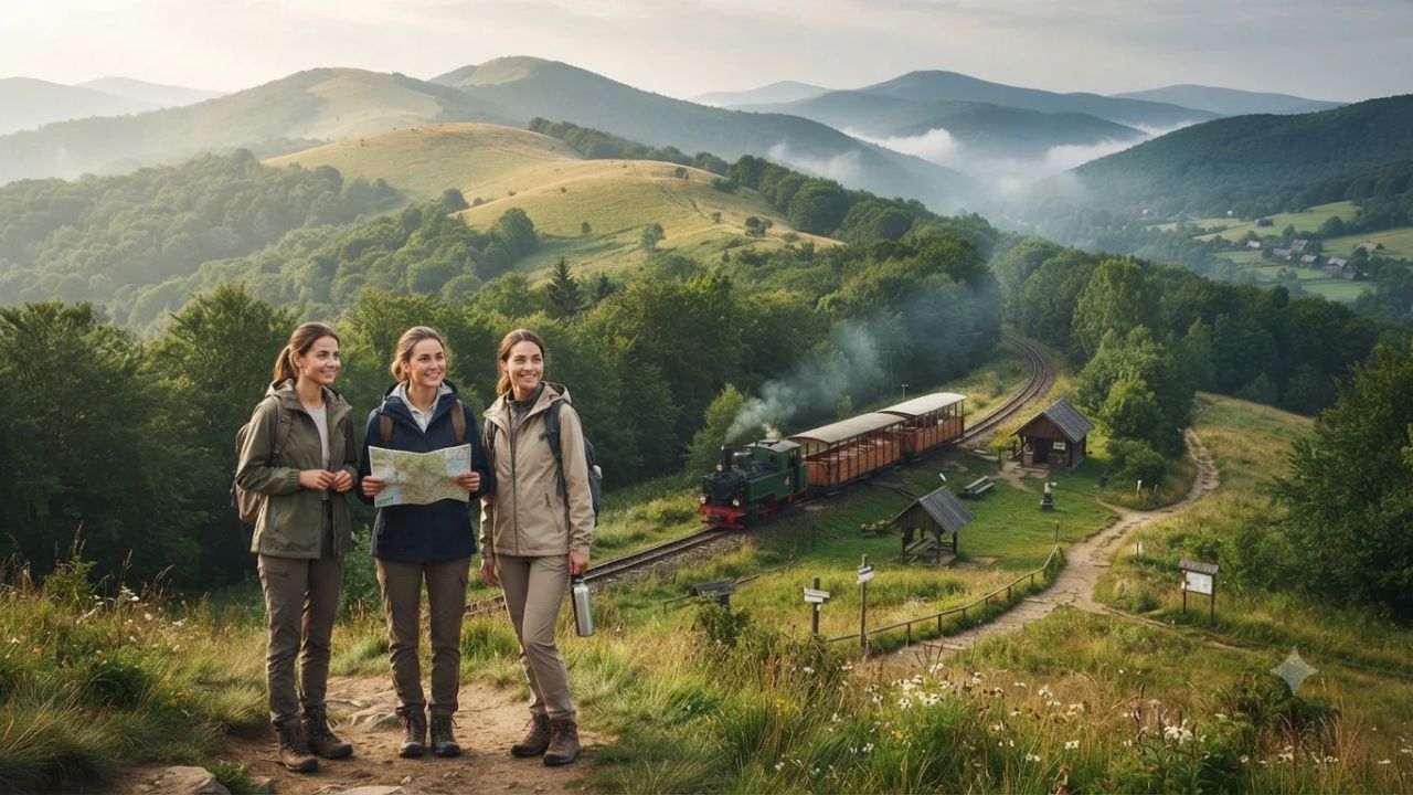
While over 1.52 billion global international tourist arrivals in 2025 poured into conventional Mediterranean and Western European corridors, remote wilderness corridors across Eastern Europe retain up to 85% of visitor spending within rural host communities. In response to severe carrying-capacity limits and infrastructure strain across Western hubs, the United Nations General Assembly adopted resolution A/RES/78/260, officially designating 2027 as the International Year of Sustainable and Resilient Tourism. Facilitated globally by UN Tourism, this international policy vehicle is redirecting traveller journeys toward low-density rural frontiers spanning the Carpathian arc, the Dinaric Alps, Black Sea wetland estuaries, and narrow-gauge heritage railways.
Across eleven sovereign nations, regional planning authorities and environmental ministries have united to construct continuous transboundary trekking trails and low-impact transit corridors that safeguard fragile biospheres while empowering local pastoral villages.
The Sub-Carpathian Arc: Transboundary Ridges and Primeval Beech Forests
The Carpathian mountain system forms an unbroken 1,500-kilometre geological arc stretching through Central and Eastern Europe. Holding the continent's largest remaining virgin temperate forest ecosystems, these mountains provide sanctuary to thriving populations of Eurasian brown bears, grey wolves, and Eurasian lynx. Historically divided across separate border regimes, the Sub-Carpathian corridor is now connected into a continuous hiking network spanning southeastern Poland, western Ukraine, and northern Romania.
In Poland’s Subcarpathian Voivodeship, Bieszczady National Park (Bieszczadzki Park Narodowy) anchors the northern sector of this integrated network. Encompassing 292 square kilometres, more than 70% of the park operates under strict ecological reserve governance, requiring hikers to remain strictly on marked footpaths across high-elevation alpine meadows (polonynas). Routes across Połonina Wetlińska, Połonina Caryńska, and the summit of Tarnica Peak (1,346 metres) connect directly with cultural trails featuring the historic timber architectural heritage of native Boyko and Lemko communities. These routes pass UNESCO World Heritage-listed wooden Orthodox and Greek Catholic tserkvas at Smolnik nad Sanem and Turzańsk.
Across the Ukrainian border, the corridor continues through the Carpathian Biosphere Reserve and the Chornohora massif, ascending to Ukraine's highest summit at Mount Hoverla (2,061 metres). Supported by multilateral environmental accords, regional forestry directorates maintain marked paths, mountain shelters, and certified rural homestays across Zakarpattia and Ivano-Frankivsk. Further south, the trail weaves through Maramureș and the Apuseni Mountains in Romania, combining limestone plateaus, traditional haymaking fields, and fortified wooden hamlets under guidance from the Romanian Ministry of Economy, Digitalisation, Entrepreneurship and Tourism.
At the core of this conservation effort is the protection of the UNESCO World Heritage site for Ancient and Primeval Beech Forests of the Carpathians and Other Regions of Europe. Managed buffer zones surround virgin stands in Poland’s Bieszczady, Ukraine’s Uholka-Shyrokyi Luh forest reserve, and Romania’s Maramureș reserves, equipped with elevated timber boardwalks and low-impact bivouac zones that prevent root compaction and protect centuries-old pastoral grazing rights (sałasznictwo).
| Mountain Sector | Administering Authority | Core Protected Terrain | Trail Infrastructure & Blazes | Key Biosphere & Cultural Assets |
|---|---|---|---|---|
| Bieszczady Ridge (Poland) | Bieszczadzki Park Narodowy / Ministry of Climate | Połonina Wetlińska, Połonina Caryńska, Tarnica (1,346 m) | Standardised red and blue blazes; eParki digital entry quotas | UNESCO primeval beech stands, Boyko and Lemko timber tserkvas |
| Chornohora & Maramureș (Ukraine) | Carpathian Biosphere Reserve / Ministry of Environment | Mount Hoverla (2,061 m), Uholka-Shyrokyi Luh old-growth forests | Standardised blazes; CSTP GIS trail mapping | Europe's largest virgin beech reserves, alpine sheep farming |
| Maramureș & Apuseni (Romania) | Ministry of Economy, Digitalisation, Entrepreneurship & Tourism | Rodna Mountains National Park, Apuseni Natural Park | Upgraded trail markers; certified rural boarding-house registry | Traditional wood architecture, karst gorges, artisan agritourism |
Multilateral governance is anchored by the Carpathian Convention, established in 2003. During the 11th Meeting of the Working Group on Sustainable Tourism held on 10–11 March 2026 in Rzeszów, Poland, ministerial delegations rolled out the Central Mountains Project and adopted the updated Carpathian Sustainable Tourism Platform (CSTP) to unify trail markers, cross-border GIS mapping, and trail carrying-capacity quotas.
Secret Littoral Sanctuaries: From Sinemorets to the Danube Delta and Baltic Bogs
Travel demand is increasingly shifting toward temperate marine shorelines and pristine peatlands across the Black Sea and Baltic basins:
- Bulgaria’s Strandzha Coast & Sinemorets: Spanning 1,161 square kilometres, Strandzha Nature Park meets the sea around Sinemorets. The Veleka River estuary forms a geological sandspit where freshwater currents collide with sea surf, protecting rare plant species like the sea daffodil (Pancratium maritimum). Vehicular access is banned on secluded coves like Lipite Beach and Silistar, safeguarding nesting marine birds and loggerhead sea turtles.
- Romania’s Danube Delta Biosphere Reserve: Covering 5,165 square kilometres (with 3,510 square kilometres in Romania), this UNESCO biosphere reserve shelters 300 bird species and over 30% of the world’s wintering red-breasted geese (Branta ruficollis), alongside extensive breeding colonies of great white pelicans. The Administration of the Danube Delta Biosphere Reserve (ARBDD) in Tulcea enforces mandatory digital permits and strict channel speed limits. At the mouth of the river, roadless Sfântu Gheorghe connects via passenger boat along the 108-kilometre branch carrying 23% of the Danube's discharge. Nearby Letea Forest features 12-metre-high sand dunes, subtropical maritime English oaks, Greek lianas (Periploca graeca), and 3,500 wild horses, accessible exclusively through regulated cart trails and low-speed electric safari vehicles.
- Georgia’s Colchic Rainforests & Adjara Wetlands: Inscribed by UNESCO in 2021 across 31,253 hectares, Mtirala National Park receives up to 4,500 millimetres of annual rainfall, making it the wettest inhabited area in Eurasia. Down on the coastal plain, the Kobuleti Protected Areas preserve the ancient Ispani 1 and Ispani 2 percolation bogs, where elevated boardwalks permit views of insectivorous sundew plants (Drosera) and the autumn flyway of over 1,000,000 migrating birds of prey.
- Baltic Bogs of Estonia and Latvia: Estonia’s Soomaa National Park spans 390 square kilometres and is famous for its spring "fifth season" floodplains. During drier periods, visitors traverse peat moss using traditional bog shoes (räätsad). In Latvia, the 381-square-kilometre Ķemeri National Park features a 3.4-kilometre Great Ķemeri Bog Boardwalk suspended over sulfur springs, moss layers, and stunted Scots pines, both protected by strict dark-sky lighting ordinances for night astronomy.
| Wetland & Coastal Zone | Territorial Authority | Area & Legal Status | Permitting & Transport Conditions | Signature Wildlife & Flora |
|---|---|---|---|---|
| Sinemorets & Strandzha (Bulgaria) | Ministry of Environment and Water | 1,161 km² Nature Park | Strict motor vehicle bans; foot access only | Sea daffodil, Veleka sandspit, loggerhead sea turtles |
| Danube Delta (Romania) | ARBDD / Ministry of Environment | 5,165 km² UNESCO Biosphere Reserve | Mandatory digital ARBDD passes; channel speed limits | Great white pelicans, red-breasted geese, 3,500 Letea feral horses |
| Colchic Rainforests (Georgia) | Agency of Protected Areas | 31,253 ha UNESCO World Heritage | Ranger-guided registrations; boardwalk footways | Relic broad-leaved boxwood, Ispani mires, 1,000,000+ migrating raptors |
| Soomaa & Ķemeri (Estonia & Latvia) | RMK (Estonia) & Daba (Latvia) | 390 km² (Soomaa); 381 km² (Ķemeri) | Bog shoes (räätsad) required off-boardwalk; dark-sky lighting rules | Sphagnum peat moss, fifth-season floodplains, sulfur springs |
Rewilding the Dinaric Alps: Peaks of the Balkans and Primeval Sutjeska
The limestone massifs of the Western Balkans have established cross-border trekking circuits to stimulate mountain community economies and protect wildlife corridors:
The premier route is the Peaks of the Balkans trail, a 192-kilometre circular trek spanning 10 to 12 daily stages across the Accursed Mountains (Prokletije / Bjeshkët e Nemuna) through northern Albania, eastern Montenegro, and western Kosovo. Originally mapped with support from GIZ, the trail crosses the Three-Border Peak (Trekufiri / Tri Kufiri, 2,366 metres). A unified digital cross-border permit protocol allows international hikers to cross unmanned frontiers seamlessly. Rather than building large resorts, the circuit routes income directly into traditional stone watchtowers (kulas), family guesthouses in Theth and Valbona, and seasonal high-pasture shepherd cabins (katuns), while conserving habitat for the critically endangered Balkan lynx (Lynx lynx balcanicus).
Further northwest, Bosnia and Herzegovina’s Sutjeska National Park protects 17,250 hectares beneath Maglić Mountain (2,386 metres). Inside lies the 1,400-hectare Perućica Strict Nature Reserve, one of the last primary forests in Europe. Home to 300-year-old beech and silver fir trees exceeding 60 metres in height and the 75-metre Skakavac Waterfall, access to Perućica is strictly restricted to licensed park rangers and small research parties to prevent soil compaction and forest disturbance.
| Daily Trek Stage | Sovereign Border Transition | Mountain Passes & Elevation Change | Lodging Type |
|---|---|---|---|
| Stage 1: Plav to Vusanje | Montenegro (Prokletije NP) | Bor Summit, Grlja Waterfall (+1,050 m / -1,100 m) | Village stone guesthouses |
| Stage 2: Vusanje to Theth | Montenegro to Albania | Ropojana Valley, Peja Pass / Qafa e Pejës (+1,110 m / -1,440 m) | Historic Theth family kulas |
| Stage 3: Theth to Valbona | Albania (Valbona Valley NP) | Valbona Pass 1,759 m (+1,175 m / -940 m) | Valley eco-lodges, rural homestays |
| Stage 4: Valbona to Çerem | Albania (via Prosllopit Pass) | Qafa e Persllopit 2,039 m (+1,215 m / -1,005 m) | Rustic shepherd homestays |
| Stage 5: Çerem to Dobërdol | Albania (High alpine pastures) | Sub-alpine glacial bowls (+1,025 m / -440 m) | Seasonal shepherd huts (katuns) |
| Stage 6: Dobërdol to Milishevc | Albania to Kosovo (Tri Kufiri) | Three-Border Peak 2,366 m (+915 m / -980 m) | Alpine timber cabins |
| Stage 7: Milishevc to Rekë e Allagës | Kosovo (Rugova Canyon) | Lumbardhi i Pejës basin (+700 m / -1,100 m) | Family farm stays |
| Stage 8: Rekë e Allagës to Drelaj | Kosovo (Rugova Valley) | Hajla mountain foothills (+750 m / -880 m) | Traditional village pensions |
| Stage 9: Drelaj to Babino Polje | Kosovo to Montenegro | Čakor Pass 1,849 m (+1,150 m / -1,100 m) | Mountain eco-chalets |
| Stage 10: Babino Polje to Plav | Montenegro (Prokletije NP) | Hrid Lake, Bogićevica ridges (+720 m / -1,250 m) | Lakeside town pensions |
Slow Rail Expeditions: Restoring Historic Narrow-Gauge Mountain Lines
To provide zero-emission transit alternatives to highway traffic, Eastern European transport authorities are integrating heritage mountain railways with regional trail networks:
- Čierny Hron Forestry Railway (Slovakia): Built as a 760-millimetre industrial timber network spanning 130 kilometres through the Slovenské rudohorie mountains, this line was restored by local volunteers over a 17-kilometre core route between Čierny Balog and Vydrovo. Awarded the Council of Europe Landscape Award diploma, vintage steam and diesel locomotives carry hikers directly to the Vydrovo Forestry Open-Air Museum and mountain trailheads.
- Bieszczady Forest Railway (Poland): Operating on a 750-millimetre narrow gauge from Majdan near Cisna, open-sided mountain coaches run to Przysłup and Balnica along the Slovak border, distributing trail access along national park boundaries without private automobile emissions.
- Tbilisi–Yerevan Cross-Border Rail (Georgia & Armenia): Operated jointly by Georgian Railway and South Caucasus Railway, this daily passenger sleeper service snakes through northern Armenia's rocky Debed River gorge, providing direct train access to the UNESCO monastic complexes of Haghpat and Sanahin.
| Heritage Rail Route | Track Gauge & Route Distance | Operating Season & Rolling Stock | Primary Transit & Conservation Purpose |
|---|---|---|---|
| Čierny Hron Forestry Railway (Slovakia) | 760 mm narrow gauge; 17 km line | May to September; vintage steam & diesel locomotives | Car-free hiker transit to Vydrovo Open-Air Museum and Vepor trails |
| Bieszczady Forest Railway (Poland) | 750 mm narrow gauge; Majdan to Balnica/Przysłup | Seasonal summer schedule; historic steam engines & open cars | Disperses trail arrivals across Bieszczady National Park buffer zones |
| Tbilisi to Yerevan Express (Georgia/Armenia) | 1,520 mm broad gauge; cross-border line | Year-round daily service; classic sleeper rolling stock | Car-free passage through Debed River gorge to Haghpat & Sanahin |
Visitor Insider Tips
- Cross-Border Trekking Permits: For the Peaks of the Balkans circuit, submit digital border clearance paperwork at least 15 days before your trip through licensed regional guiding associations in Plav, Shkodra, or Peja to ensure smooth clearance at unmanned border points.
- Danube Delta Waterway Navigation: Avoid uncertified private speedboats that create excessive wake in shallow channels. Book licensed electric boats or rowing excursions from Tulcea or Sfântu Gheorghe to access Letea Forest and pelican feeding grounds quietly.
- Trail Etiquette in Bieszczady: Purchase daily national park passes online via the Polish eParki platform prior to arrival. Foot traffic on Połonina Wetlińska and Połonina Caryńska must remain strictly between trail boundary ropes to protect rare alpine grass communities.
- Booking Heritage Rail Journeys: Reserve weekend tickets for the Bieszczady Forest Railway and Čierny Hron lines at least three weeks in advance during the peak autumn foliage months of September and October.
Cultural and Environmental Context
The transition toward decentralised, low-impact tourism addresses severe economic leakage. While conventional Mediterranean resort models often lose up to 70% of gross tourism revenue to overseas operators and hotel chains, community-managed tourism in Maramureș, the Accursed Mountains, and Adjara retains an estimated 75% to 85% of total traveller expenditure locally. Funds flow directly into family guesthouses, local mountain guides, artisanal cheese producers, and village transport operators, helping slow rural depopulation across highland farming valleys.
Simultaneously, rigorous management frameworks prevent trail erosion and habitat disturbance. Digital entry quotas, designated boardwalk corridors across peat bogs, and mandatory ranger escorts in strict reserves like Perućica ensure that human presence remains balanced with the preservation of primeval forests and carnivore corridors.
FAQ: Visiting Eastern Europe 2027
What is the best season to hike the Peaks of the Balkans?
The optimal hiking window runs from mid-June to late September, when high mountain passes like Peja Pass and Valbona Pass are clear of snow and highland shepherd huts (katuns) are actively open.
How do I arrange permits to enter Perućica Primeval Forest?
Independent entry into the Perućica Strict Nature Reserve is prohibited. Guided visits must be booked in advance through the Sutjeska National Park administrative headquarters in Tjentište, accompanied by an official park ranger.
Do I need separate visas for cross-border Balkan hiking?
Non-EU citizens must verify Schengen and Balkan visa eligibility for Albania, Montenegro, and Kosovo. Trekkers must carry approved trilateral border-crossing permits submitted in advance through local mountain tourism agencies.
What are the main transport hubs for the Bieszczady Mountains?
The primary gateway is Rzeszów-Jasionka Airport or Kraków Airport, connected by regional PKP passenger trains to Sanok and Zagórz, followed by local bus links to Majdan, Cisna, and Ustrzyki Górne.
Related Travel Guides
- Asia Long-Distance Trails 2027: South Korea, Japan, Taiwan, and Bhutan
- Nordic Year-Round Luxury and Zero-Emission Arctic Wellness 2026
- Europe Travel Demographics and Seasonal Dispersion Trends 2026
- Southern Africa Responsible Tourism and Transfrontier Wilderness Guide 2026
Slow mountain rails, community-run high-pasture guesthouses, and protected virgin old-growth forests define a balanced, regenerative future for Eastern European exploration.
Disclaimer
This article is for informational and educational purposes only. It does not constitute legal, financial, or professional advice. While we strive to provide accurate and up-to-date information, travel policies, regulations, and conditions change rapidly. Always verify information with official sources before making travel decisions. Nomad Lawyer makes no representations about the accuracy, reliability, completeness, or suitability of the information provided. Readers should consult qualified professionals for advice specific to their circumstances. The views expressed in this article are those of the author and do not necessarily reflect the views of Nomad Lawyer.
Kunal K Choudhary
Co-Founder & Contributor
A passionate traveller and tech enthusiast. Kunal contributes to the vision and growth of Nomad Lawyer, bringing fresh perspectives and driving the community forward.
Learn more about our team →