Croatia Adriatic Coast Guide 2026: Navigating 1,777km of Coastline and 1,200 Islands

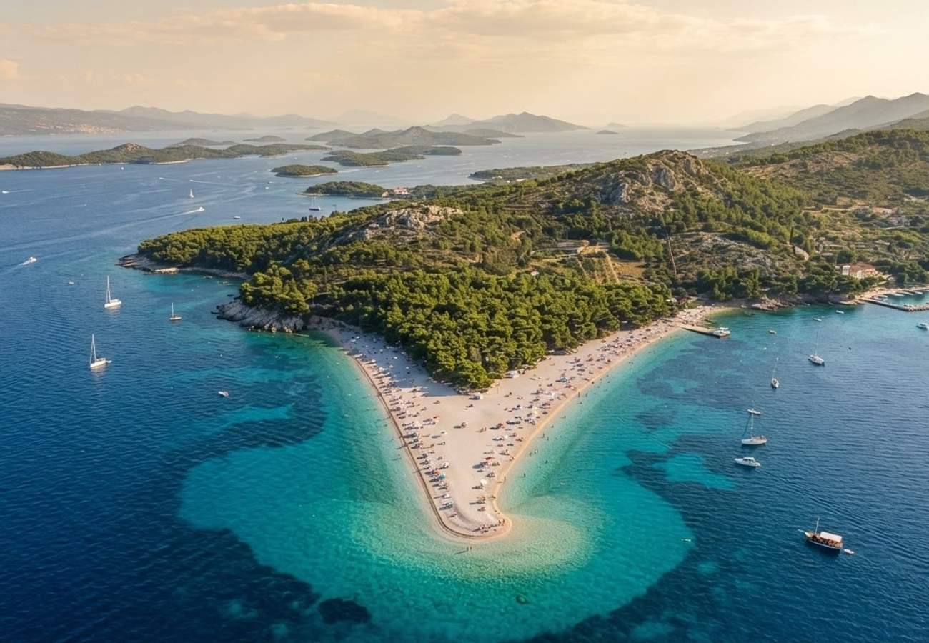
Image generated by AI
Croatia is leveraging its 1,777km-long Adriatic coastline and network of nearly 1,200 islands to position itself as a primary Mediterranean alternative to Italy and Greece. From the V-shaped shores of Brač to the eco-protected zones of Istria, the region offers a diversified transit infrastructure for varied traveler profiles.
The Croatian coastal identity is defined by its geological diversity. While pebble beaches are the standard for rocky coves, the country maintains several key sandy stretches for families and specific high-energy hubs for the youth market. A critical advantage for international visitors is the public accessibility of these shores, which prevents the "resort lockdown" common in other Mediterranean destinations.
Adriatic Coastal Specifications and Use Cases
The following table outlines the primary coastal hubs, their regional locations, and their specific utility for different traveler demographics.
| Beach | Island/Region | Primary Use Case | Key Infrastructure/Feature |
|---|---|---|---|
| Zlatni Rat | Brač | Scenic/Windsurfing | Changing V-shaped shoreline |
| Dubovica | Hvar | Relaxation | Sheltered white-pebble cove |
| Sveti Jakov | Dubrovnik | City-Break Escape | 160-step descent; Old Town views |
| Stiniva | Vis | Nature/Adventure | Cliff-enclosed bay; boat access |
| Zrće | Pag | Nightlife/Festivals | High-capacity entertainment hubs |
| Šunj | Lopud | Family Travel | Sandy shores; shallow water |
| Stračinska | Šolta | Seclusion | Remote, low-traffic setting |
| Punta Rata | Brela | Watersports | High-clarity water; snorkeling |
| Lubenice | Cres | Remote Exploration | Steep cliff descent; boat access |
| Veruda Island | Istria | Eco-Tourism | Car-free; protected eco-beach |
Regional Transit Hubs: Detailed Breakdown
The Brač and Hvar Axis Zlatni Rat on Brač remains the regional benchmark for scenic tourism. Located 1km west of Bol, the beach is accessible via a 30-minute walk or nearby parking. For those seeking a contrast, Dubovica on Hvar provides a sheltered white-pebble environment 10km east of Hvar Town, acting as a decompression zone for those visiting the island's high-density nightlife districts.
The Dubrovnik Perimeter Navigating the Dubrovnik coast requires a choice between accessibility and seclusion. Sveti Jakov, located 1km southeast of the Old Town, is reachable via public transport, taxi boat, or a 160-step stone descent. For sandy alternatives, Šunj on Lopud Island requires a boat transfer from Dubrovnik followed by a walk through pine woods or a golf-cart taxi from the harbor.
The Pag and Vis Extremes Pag Island’s Zrće Beach operates as a specialized entertainment zone from June through September, featuring extensive parking and DJ infrastructure. Conversely, Vis Island’s Stiniva beach is a logistical challenge; most visitors arrive by boat and swim through a narrow cliff passage, though a steep trekking route exists for hikers.
Traveler Logistics Guide: Navigating the Adriatic
From a ground-level perspective, the best way to navigate the Croatian coast is to avoid relying on a single transit mode. The geography of 1,200 islands makes a hybrid approach essential.
Booking Connections and Layovers
- Island Hopping: Utilize the catamaran networks connecting Split and Dubrovnik to the outer islands. Book ferry tickets at least 48 hours in advance during the July-August peak to avoid capacity issues.
- Last-Mile Transit: On islands like Lopud or Cres, standard rentals are often impractical. Prioritize golf-cart taxis or local boat charters for reaching remote shores like Lubenice.
- Optimal Timing: To access high-demand, narrow-entry beaches like Stiniva, arrive before 09:00. This minimizes boat traffic congestion at the narrow cliff opening.
Digital and Customs Policies Travelers entering Croatia should ensure their passports are valid for at least three months beyond their intended stay. For those arriving via the EU, the transition is seamless; however, non-EU citizens should maintain digital copies of their travel insurance and accommodation vouchers, as these are occasionally requested at ferry terminals.
Equipment and Supplies Because many of the most secluded beaches (such as Stračinska or Lubenice) have zero commercial infrastructure, travelers must carry a minimum of 2 liters of water and portable shade. Pebble beaches are the norm; high-quality water shoes are a non-negotiable requirement for safety and comfort.
Infrastructure Impact Assessment
The shift toward "eco-beaches," exemplified by Veruda Island in Istria, indicates a strategic move toward sustainable tourism. By implementing car-free zones and protecting marine life, Croatia is attempting to mitigate the environmental degradation caused by mass tourism. This diversification—balancing high-energy hubs like Zrće with protected zones like Veruda—ensures that the regional tourism economy is not dependent on a single traveler demographic, thereby increasing long-term economic resilience.
The Adriatic's strength lies in its variety, offering a spectrum from high-octane festivals to absolute silence.
Related Travel Guides
This article is for informational purposes. Flight routes, passenger regulations, visa rules, and transit advisories are subject to change by airlines and aviation authorities. Readers are advised to verify schedules and travel documentation with relevant carriers and border agencies before departure.
Related Stories

European Mass Protests Disrupt Travel Across France, Italy, Belgium, and Turkey in 2026

Spain Tourism 2030 Strategy: New Logistics and Regulations for Barcelona, Madrid, and the Islands