
Costa Rica’s Caribbean Coast Road Trip: Driving from San José to Cahuita, Puerto Viejo, and Manzanillo
A comprehensive travel guide to Costa Rica's southern Caribbean coast road trip from San José to Puerto Viejo, Cahuita, and Manzanillo during the idyllic Caribbean summer.

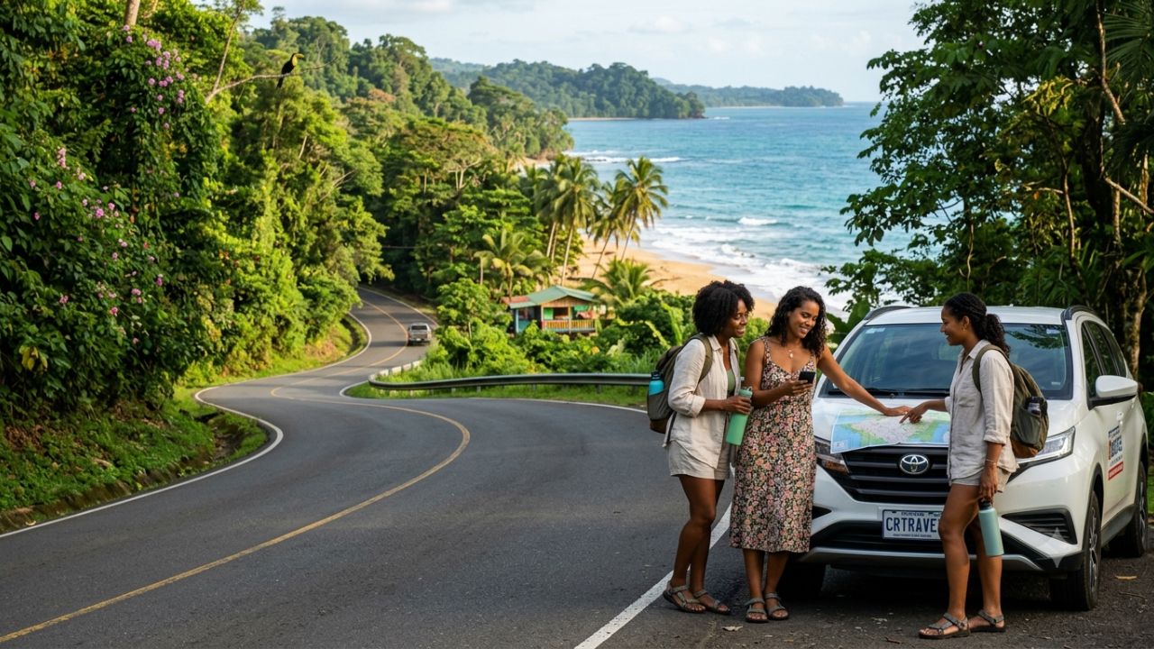
The southern Caribbean coast of Costa Rica offers tranquil turquoise waters, Afro-Caribbean culture, and vibrant wildlife refuges along Route 36.
Costa Rica’s southern Caribbean coastline in Limón Province offers one of Central America’s most distinct road trip adventures, linking the mist-draped peaks of the Central Valley with vibrant Afro-Caribbean surf hamlets, tranquil coastal rainforests, and protected marine refuges. While most international tourists flock to the resort corridors of the Pacific coast, travelers embarking on the overland drive from San José eastward uncover a cultural and ecological tapestry defined by coconut-infused culinary traditions, reggae rhythms, and uncrowded beaches stretching all the way to the Panamanian border.
Departing the capital along National Route 32, road-trippers trace a dramatic topographical descent. Mountain switchbacks through the cloud forests of Braulio Carrillo National Park yield to vast coastal plains lined with agricultural plantations, before giving way to National Route 36 and the laid-back rhythm of the Caribbean sea.
Journey Breakdown: Southern Caribbean Coastal Destinations
Unlike self-contained resort destinations, the charm of Limón’s southern coastline lies in its contiguous string of coastal settlements. Each village along Route 36 offers distinct topography, accommodation styles, and outdoor excursions:
| Destination | Distance from San José | Dominant Vibe | Signature Attractions | Best Suited For |
|---|---|---|---|---|
| Cahuita | ~200 km (3.5–4.5 hrs) | Serene, eco-conscious, traditional | Cahuita National Park, coral reef snorkeling, walking trails | Wildlife lovers, families, quiet retreats |
| Puerto Viejo de Talamanca | ~215 km (4.5–5 hrs) | Energetic, multicultural, vibrant | Salsa Brava reef break, night markets, international dining | Surfers, social travelers, culinary enthusiasts |
| Playa Cocles | ~218 km (4.5–5.2 hrs) | Active surf haven, lush backdrop | Beach break surfing, boutique jungle lodges, wellness yoga | Surfers, active couples, eco-boutique stays |
| Punta Uva | ~223 km (5–5.5 hrs) | Scenic, tranquil, secluded | Sloth point overlook, calm emerald bays, sea kayaking | Swimmers, paddleboarders, honeymooners |
| Manzanillo | ~228 km (5–5.5 hrs) | Untamed, end-of-the-road frontier | Gandoca-Manzanillo Wildlife Refuge, coral formations | Birders, trail hikers, off-grid adventurers |
From the Central Valley to the Lowlands: Route 32 Logistics
The overland journey begins in San José, exiting through the Zurquí tunnel along Route 32. This mountain highway cuts directly through the protected canopies of Braulio Carrillo National Park, providing breathtaking views of mist-covered ridges, cascading roadside waterfalls, and dense bromeliad canopies.
Drivers descend roughly 1,100 meters in elevation over 60 kilometers, moving from the brisk mountain air of the capital into tropical lowland humidity near Guápiles and Siquirres. From the port city of Limón, Route 36 winds south along the coastline, where road conditions flatten and coastal breezes welcome motorists toward Cahuita and Puerto Viejo.
Key Driving Guidelines for Route 32 and Route 36
- Highway Mountain Weather: Route 32 through Braulio Carrillo is prone to dense fog and sudden rainfall. Plan departures from San José between 6:00 AM and 8:00 AM to navigate the mountain corridor in clear daylight.
- Vehicle Selection: While Route 32 and Route 36 are paved two-lane highways, an SUV or crossover vehicle with higher ground clearance is strongly recommended to handle speed bumps, unpaved driveway approaches, and sudden tropical downpours.
- Fuel and Logistics: Fill your fuel tank in Guápiles, Siquirres, or Limón. Gas stations south of Puerto Viejo are sparse, so keep at least a half-tank buffer when venturing toward Manzanillo.
- Real-Time Navigation: Maintain offline maps or active GPS via local SIM cards, as landslides or heavy cargo truck movements on Route 32 can occasionally cause single-lane delays monitored by the Costa Rican Ministry of Public Works and Transport.
Cahuita National Park: Pristine Rainforests and Coastal Coral Reefs
Cahuita serves as the gateway to the southern Caribbean, maintaining an unhurried, Creole-speaking community ambiance. The town is globally celebrated for Cahuita National Park, managed cooperatively between local community stewards and the National System of Conservation Areas (SINAC).
The park’s coastal trail winds beneath tropical almond and sea grape trees directly alongside white-sand shores. Visitors frequently encounter white-faced capuchin monkeys, two-toed and three-toed sloths, green iguanas, and yellow eyelash vipers within steps of the trail. Just offshore lies one of Costa Rica's most extensive coral reef systems, protecting over 35 species of coral and hundreds of tropical marine species.
Unlike commercial parks in the Central Pacific, Cahuita retains a community-funded donation model at its town entrance (Playa Blanca), emphasizing conservation awareness and local guide stewardship.
Exploring Puerto Viejo, Cocles, Punta Uva, and Manzanillo
South of Cahuita, the coastline shifts into an interconnected string of beaches, each separated by small headlands and jungle corridors:
Puerto Viejo de Talamanca: Culture and Culinary Heritage
Puerto Viejo forms the commercial and cultural epicenter of the region. Its streets blend Afro-Costa Rican traditions with Bribri Indigenous heritage and global traveler influences. Diners can sample authentic rondón (a slow-simmered coconut fish and root vegetable stew), pan bon, and rice and beans cooked in fresh coconut milk with Caribbean habanero chili (chile panameño). Offshore, the formidable Salsa Brava reef break tests seasoned international surfers.
Playa Cocles: Surf Breaks and Active Wellness
Just two kilometers south of Puerto Viejo, Playa Cocles offers golden sands and reliable beach break waves suitable for intermediate surfers. The strip features organic open-air cafes, boutique surf camps, and yoga shalas tucked under towering rainforest trees.
Punta Uva: Sheltered Bays and Sloth Habitats
Punta Uva is widely considered the most picturesque beach on Costa Rica's Caribbean coast. Its calm, emerald-green waters are shielded from heavy swells by a prominent jungle promontory. Sea kayakers can paddle from the ocean directly into the freshwater estuary of the Rio Gandoca, watching howler monkeys traverse the treetops above.
Manzanillo: The Edge of Gandoca-Manzanillo Refuge
Route 36 terminates at the quiet fishing village of Manzanillo. Here, visitors enter the Gandoca-Manzanillo National Wildlife Refuge, a critical sanctuary for manatees, nesting leatherback sea turtles, tapirs, and over 350 resident bird species. The hiking trail from the park entrance leads past dramatic cliff overlooks to the iconic Punta Mona headland.
The 'Caribbean Summer': Why September and October Offer Peak Conditions
A unique microclimate defines Costa Rica’s Caribbean slope. While the Pacific coast and Central Valley experience their heaviest rainfall during September and October, the Caribbean coast experiences its clearest, driest, and sunniest period of the year—a seasonal phenomenon locally called the Veranillo del Caribe (Caribbean summer).
| Month / Season | Caribbean Coast Weather Pattern | Pacific Coast Weather Pattern | Travel Recommendation |
|---|---|---|---|
| Feb – Mar | Relatively dry, sunny mornings, calm seas | Peak dry season, hot, arid conditions | Ideal for cross-country combined itineraries |
| Apr – Aug | Tropical humidity, periodic afternoon showers | Green season, occasional rain showers | Great for lush greenery, low crowds |
| Sep – Oct | Caribbean Summer: Warm, calm ocean, minimal rain | Peak rainy season, heavy afternoon storms | Top window for Caribbean snorkeling & diving |
| Nov – Jan | Increased rainfall, energetic surf swells | Transition to dry season, rising holiday arrivals | Prime window for seasoned wave surfing |
Official data from the Costa Rica Tourism Board (ICT) highlights September and October as optimal months for Caribbean road travel, offering glassy sea conditions for paddleboarding, transparent water for coral reef snorkeling, and pleasant driving conditions along coastal routes.
Practical Road Trip Tips for Independent Travelers
- Rent Locally or Upon Arrival at SJO: Major rental agencies operate convenient collection hubs near Juan Santamaría International Airport (SJO). Secure comprehensive insurance covering foreign road travel and gravel secondary roads.
- Embrace Bicycle Culture Locally: Once settled in Puerto Viejo or Cocles, many visitors park their cars and rent standard beach cruiser bicycles. The flat coastal strip along Route 36 is lined with bike-friendly shoulders linking beaches and restaurants.
- Respect Ocean Currents: While Punta Uva and Manzanillo have sheltered coves, Playa Cocles and surrounding open breaks frequently develop strong rip currents. Observe lifeguard flags and swim only within marked zones.
- Support Community-Led Guides: Hiring a local guide at Cahuita National Park or the Gandoca-Manzanillo Refuge dramatically improves wildlife spotting while directing revenue straight into conservation-focused households.
Related Travel Guides
- Maldives and Japan Tourism Tax Overhaul: Asian Holiday Costs Analysis
- Andalucía Autumn Tourism Boom: Hotel Occupancy and Rural Flights Surge
- European Rail Expansion 2026: Sweden and Austria Transform Cross-Border Routes
Frequently Asked Questions
How long does it take to drive from San José to Puerto Viejo?
The drive typically takes between 4.5 and 5.5 hours covering approximately 215 kilometers, depending on truck traffic through Braulio Carrillo National Park and weather conditions along Route 32.
Do I need a 4x4 vehicle for Costa Rica's Caribbean coast?
A 4x4 vehicle is not mandatory for Route 32 or Route 36, as both main highways are paved. However, a crossover or SUV with higher ground clearance is recommended for secondary beach lanes and lodge driveways.
When is the best time of year to visit Puerto Viejo and Cahuita?
September and October offer the sunniest weather and calmest seas during the region's Caribbean summer. February and March also provide favorable weather with reduced rainfall.
Can you swim in Cahuita and Punta Uva?
Yes, both Cahuita and Punta Uva feature sheltered coral bays that offer calm, swimming-friendly waters suitable for families, kayakers, and snorkelers. Always check local conditions before entering open breaks like Cocles.
Disclaimer
This article is for informational and educational purposes only. It does not constitute legal, financial, or professional advice. While we strive to provide accurate and up-to-date information, travel policies, regulations, and conditions change rapidly. Always verify information with official sources before making travel decisions. Nomad Lawyer makes no representations about the accuracy, reliability, completeness, or suitability of the information provided. Readers should consult qualified professionals for advice specific to their circumstances. The views expressed in this article are those of the author and do not necessarily reflect the views of Nomad Lawyer.
Naina Thakur
Contributor & Travel Specialist
Travel enthusiast and legal writer covering visa regulations, responsible tourism, and cultural journeys across global destinations.
Learn more about our team →