
Central US Flash Flood Threat: Texas, Oklahoma, Kansas, and Missouri Face 3-Inch Deluges from 14 to 16 October
A slow-moving weather system packing atmospheric moisture 2 to 3 standard deviations above normal threatens Texas, Oklahoma, Kansas, and Missouri with 3-inch rainfall and flash flooding.

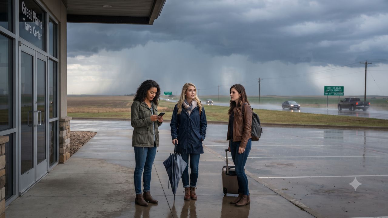
Atmospheric moisture values surging two to three standard deviations above historical norms are set to trigger localized rainfall totals exceeding 3 inches (76 millimeters) across the central United States between 14 and 16 October 2026. Official multi-day forecasts issued by the NOAA Weather Prediction Center (WPC) establish a Level 2 "Slight Risk" of excessive rainfall across a continuous corridor stretching from the Texas Permian Basin through central Oklahoma, eastern Kansas, and western Missouri.
Issued at 3:52 AM Eastern Daylight Time on 12 October 2026, the WPC advisory outlines a slow-moving mid-latitude frontal boundary interacting with an upper-level low-pressure system descending from the Rockies. For cross-country motorists, commercial truckers, regional airline passengers, and autumn outdoor campers, this atmospheric configuration creates a heightened threat of repetitive training thunderstorms where high-intensity rainfall repeatedly crosses the same geographic basins, rapidly exceeding 3-hour and 6-hour flash flood guidance thresholds.
Meteorological Evolution: Synoptic Dynamics and Risk Categorization
The developing storm system marks a seasonal transition as tropical moisture plumes from the Gulf of Mexico are drawn northward ahead of a cold frontal boundary. NOAA’s Excessive Rainfall Outlook (ERO) defines risk levels based on the mathematical probability of rainfall exceeding flash-flood guidance within 25 miles of any given point:
- Tuesday, 13 October: Marginal Risk (Level 1 of 4). Isolated thunderstorms begin firing along the dryline across the Southern and Central Plains, generating localized downpours with isolated runoff risk.
- Wednesday, 14 October: Slight Risk (Level 2 of 4). The frontal boundary stalls across the Southern High Plains, Central Plains, and the Lower Missouri Valley. Deep moisture advection supports training storm cells, creating scattered flash flooding in low-lying corridors.
- Thursday, 15 October: Slight Risk (Level 2 of 4). Widespread rainfall bands persist along the slow-moving boundary, compounding soil saturation and elevating runoff across central Oklahoma, eastern Kansas, and western Missouri.
- Friday, 16 October: The formal 4-day outlook applies to the 24-hour cycle concluding at 12:00 UTC on 16 October, marking an evolving transition zone as the frontal trough pushes toward the Mississippi Valley.
The comparative breakdown below details the forecast schedule, meteorological metrics, and regional impact zones identified across federal meteorological guidance:
| Forecast Date Window | NOAA Flood Risk Tier | Primary Geographic Impact Zone | Atmospheric Triggers & Modeled Rainfall | Potential Infrastructure & Travel Hazard |
|---|---|---|---|---|
| 13 October 2026 | Marginal Risk (Level 1 of 4) | Central & Southern Plains | Developing convective storms; isolated runoff | Slick highway surfaces, minor street ponding |
| 14 October 2026 | Slight Risk (Level 2 of 4) | Southern High Plains to Lower Missouri Valley | Moisture 2–3 standard deviations above normal; >3 inches localized | Highway culvert overflow, underpass inundation |
| 15 October 2026 | Slight Risk (Level 2 of 4) | Southern & Central Plains, Western Missouri | Overlapping rain bands; high training potential | Low-water crossing washouts, river rise |
| Ending 12:00 UTC 16 Oct | Evolving Outlook (Day 4) | Lower Missouri Valley & Central Plains | Frontal boundary progression eastwards | Residual standing water, delayed agricultural runoff |
| Texas (Regional) | High Plains & Permian Basin | Lubbock, Midland-Odessa, panhandle fringes | Intense thunderstorm downpours over semi-arid soils | Rapid arroyo runoff, Interstate 20 ponding |
| Oklahoma (Regional) | Western & Central Oklahoma | Oklahoma City metro, I-35 and I-40 corridors | Deep moisture convergence along frontal surface | Urban drainage backup, turnpike spray hazards |
| Kansas (Regional) | Eastern Kansas & Flint Hills | Wichita, Topeka, Kansas City perimeter | Repeated cellular storms over saturated river basins | Low-water bridge closures, US-54/US-69 delays |
| Missouri (Regional) | Western Missouri & River Valley | Kansas City metro, Joplin, Ozark fringes | High-volume runoff funneling into tributaries | Flash flooding on secondary roads, campsite hazards |
State-by-State Travel Corridors and Surface Transportation Exposure
The geographic alignment of the rainfall corridor places several critical transcontinental highway arteries directly in the path of repeated downpours:
- Texas Permian Basin and High Plains: Semi-arid clay soils characteristic of West Texas possess low natural absorption rates. Rapid deluges exceeding one inch per hour across Interstate 20 and US Route 84 create immediate flash runoff hazards across caliche roads and rural oilfield transport routes.
- Oklahoma Turnpike Network: Central Oklahoma acts as the primary atmospheric hinge point. Heavy convective cells traversing the Interstate 35 and Interstate 40 junction around Oklahoma City threaten major freight and passenger routes, where hydroplaning risks and sudden visibility drops frequently trigger multi-vehicle pileups.
- Eastern Kansas and Flint Hills: In eastern Kansas, agricultural watersheds and low-water crossings along US Route 54 and State Highway 99 are vulnerable to rapid creek swelling, cutting off detour access for rural travelers.
- Western Missouri and Lower Missouri Valley: In urban centers like Kansas City and regional routes through Joplin, stormwater drainage systems face sudden pressure from localized 3-inch accumulations, threatening depressed interstate sections and subterranean parking structures.
Motorists are strongly advised to consult live road condition tools managed by state transportation departments, including DriveTexas, KanDrive, the Oklahoma Department of Transportation portal, and the MoDOT Traveler Information Map, before setting out on long-distance road trips.
Aviation and Commercial Transit Vulnerabilities
While the NOAA discussion primarily assesses hydrological flash flood hazards, the convective storms responsible for the heavy rainfall will directly affect commercial flight schedules. Hub airports in Dallas-Fort Worth (DFW), Dallas Love Field (DAL), Oklahoma City Will Rogers World (OKC), and Kansas City International (MCI) lie adjacent to or within the active frontal zone.
Under Federal Aviation Administration (FAA) air traffic management protocols, multi-cell thunderstorm lines trigger convective SIGMET advisories, requiring en-route air traffic controllers to implement ground stops and wide airborne holding patterns. Even when terminal runways remain clear of standing water, lightning strikes require ground crews to suspend ramp refueling and baggage handling operations, generating downstream departure delays that reverberate across transcontinental airline networks.
Expert Analysis: The Fall Flash Flood Trap and Traveler Strategy
For travelers planning mid-October journeys through the Central Plains, the direct consequence of a multi-day Slight Risk event is that hazards manifest primarily on secondary rural corridors rather than interstate mainlines. Autumn travelers frequently miscalculate flash flood risks because soil appears dry prior to storm onset. However, when moisture anomalies reach two to three standard deviations above normal, precipitation rates overwhelm surface tension, converting road culverts into torrential chutes within 20 minutes.
The operational pressure this creates means that vacationers heading to state parks, fall foliage campgrounds, or river recreation sites in the Ozarks or Kansas Flint Hills face isolation if gravel access roads are cut by swollen creeks.
To navigate the mid-October system safely, travelers should adhere to non-negotiable logistics protocols:
- Never Drive Through Standing Water: The National Weather Service principle "Turn Around, Don't Drown" remains mathematically sound. Six inches of fast-moving water can knock over an adult, while 12 inches can float a standard passenger vehicle.
- Monitor Real-Time Gauge Telemetry: Travelers in low-lying valleys should reference automated river gauge monitoring operated by the National Weather Service (NWS) rather than relying exclusively on general smartphone weather icons.
- Program Regional Aviation Padding: Passengers booking connecting flights through Dallas-Fort Worth or Kansas City on 14 and 15 October should avoid short 45-minute connection buffers, opting instead for morning departures or multi-hour layovers that withstand FAA thunderstorm holding programs.
Key Takeaways
- Multi-Day Heavy Rain Event: Texas, Oklahoma, Kansas, and Missouri face persistent heavy rainfall and flash flood risks from 14 to 16 October 2026.
- Extreme Atmospheric Moisture: Storm moisture values will sit two to three standard deviations above normal, supporting localized rainfall totals exceeding 3 inches (76 mm).
- Consecutive Slight Risk Days: NOAA's Weather Prediction Center has designated 14 and 15 October as Level 2 Slight Risk days for excessive rainfall and runoff.
- Critical Highway Corridors Exposed: Interstate 20, Interstate 35, Interstate 40, and Interstate 70 face localized surface flooding, reduced visibility, and hydroplaning conditions.
- Flight Gate Delays Likely: Convective thunderstorm lines across North Texas, Oklahoma City, and Kansas City are projected to trigger FAA ground delays and ramp lightning closures.
FAQ: Central US Flood Risk and Travel 2026
What dates are the heaviest rainfall and flood risks expected in the Central Plains?
The highest risk occurs between Wednesday, 14 October, and Thursday, 15 October 2026, with an initial marginal threat developing on 13 October and residual runoff continuing into 16 October.
How much rain is forecast to fall across Texas, Oklahoma, Kansas, and Missouri?
Computer forecast models project localized rainfall totals exceeding 3 inches (76 millimeters), with intense rainfall rates capable of overwhelming municipal and rural drainage networks.
What does a NOAA "Slight Risk" of excessive rainfall mean?
A Slight Risk (Level 2 of 4) means there is at least a 15% probability of rainfall exceeding flash-flood guidance within 25 miles of a location, signaling scattered, potentially dangerous flash flooding.
Where can drivers verify real-time road closures during the storm?
Motorists should verify route safety using official state transportation tools: DriveTexas (Texas), KanDrive (Kansas), Oklahoma DOT traveler updates, and the MoDOT Traveler Information Map (Missouri).
When extreme atmospheric moisture collides with a stalled autumn front, travelers who respect the velocity of rising water protect both their schedules and their lives.
Related Travel Guides
Disclaimer
This article is for informational and educational purposes only. It does not constitute legal, financial, or professional advice. While we strive to provide accurate and up-to-date information, travel policies, regulations, and conditions change rapidly. Always verify information with official sources before making travel decisions. Nomad Lawyer makes no representations about the accuracy, reliability, completeness, or suitability of the information provided. Readers should consult qualified professionals for advice specific to their circumstances. The views expressed in this article are those of the author and do not necessarily reflect the views of Nomad Lawyer.
Kunal K Choudhary
Co-Founder & Contributor
A passionate traveller and tech enthusiast. Kunal contributes to the vision and growth of Nomad Lawyer, bringing fresh perspectives and driving the community forward.
Learn more about our team →