
10 Best New Zealand Scenic Drives Reddit Travelers Recommend in 2026
Looking for the most breathtaking scenic drives in New Zealand in 2026? Reddit travelers on r/newzealand rank the top 10 bucket-list highways across the North and South Islands, from the Milford Road to the Forgotten World Highway.

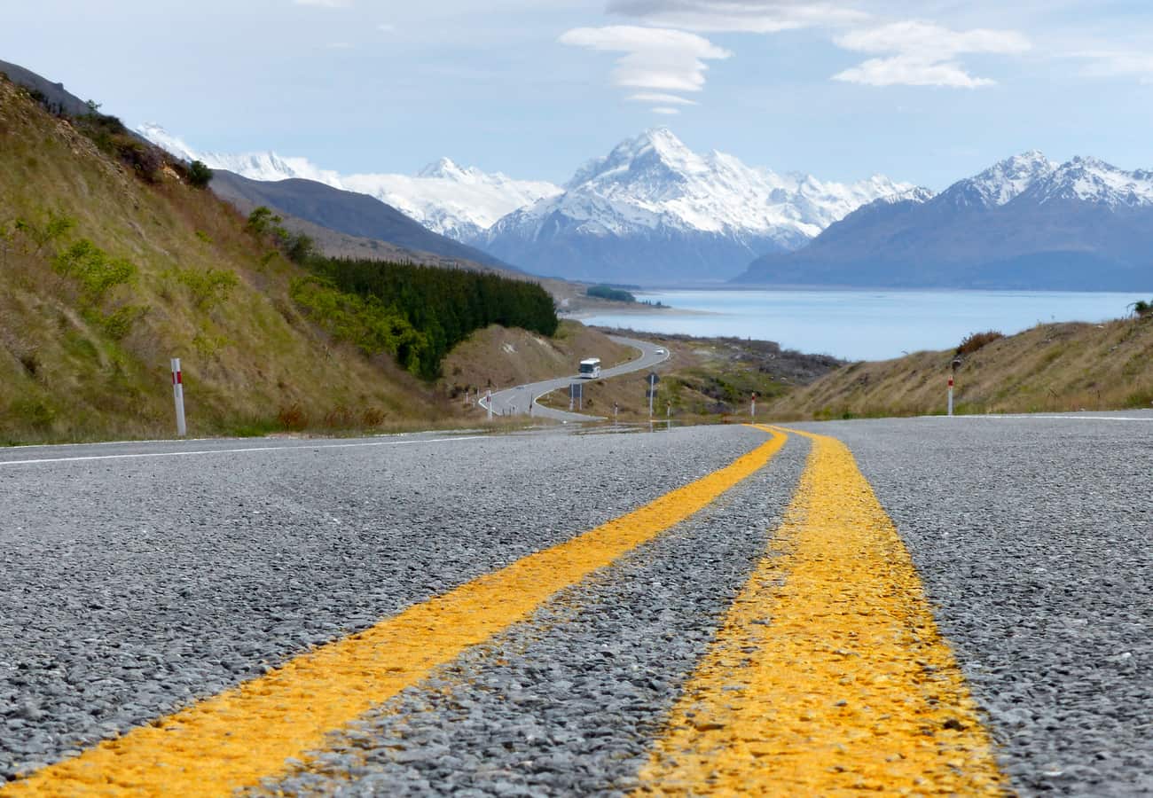
State Highway 80 carving along the shores of Lake Pukaki straight toward the soaring glaciated crown of Aoraki / Mount Cook
Few countries can rival the sheer density of world-class scenic byways packed into New Zealand’s two islands. Within a few hours of driving, you can journey from volcanic alpine deserts with active steaming craters to mossy subtropical beech rainforests, turquoise glacial fjordlands, and golden coastal surf beaches.
Synthesizing firsthand driving accounts, vehicle clearance advice, and hidden roadside pullouts discussed across r/newzealand, r/roadtrip, and r/travel, here is the definitive ranking of the 10 best New Zealand scenic drives for 2026.
State Highway 80 carving along the shores of Lake Pukaki straight toward the soaring glaciated crown of Aoraki / Mount Cook.
1. The Milford Road / State Highway 94 (Te Anau to Milford Sound)
Widely heralded on Reddit as the greatest alpine drive in the Southern Hemisphere, the 119-kilometer Milford Road (State Highway 94) cuts through the heart of Fiordland National Park's glaciated wilderness.
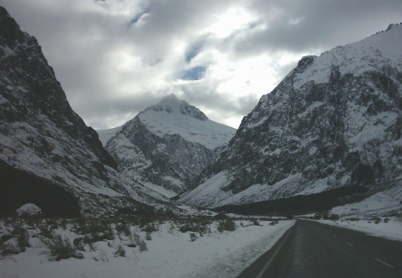 The winding asphalt of the Milford Road enveloped by sheer vertical granite walls in Fiordland.
The journey begins across the reflective waters of the Mirror Lakes before entering the vast glacier-carved Eglinton Valley. Drivers then ascend into the upper Hollyford Valley and pass through the historic 1.2-kilometer Homer Tunnel—a hand-hewn single-lane tunnel blasted through solid granite. Emerging on the western side, the road descends steep switchbacks past hundreds of spontaneous waterfalls cascading down sheer 1,000-meter cliffs directly into the sea at Milford Sound.
- Distance: 119 km (74 miles) one way
- Driving Time: 2.5 to 3 hours without stops (allocate 4–5 hours for photography)
- Reddit Tip: Avoid the morning caravan of tour buses departing Queenstown and Te Anau between 9:00 AM and 11:30 AM. Leave Te Anau at dawn (around 6:30 AM) to experience the Homer Tunnel and fjord lookouts in complete silence.
2. Mount Cook Road / State Highway 80 (Lake Pukaki to Mount Cook Village)
Stretching 55 kilometers along the western shoreline of Lake Pukaki, State Highway 80 provides an uninterrupted view of New Zealand's highest peak, Aoraki / Mount Cook (3,724 meters).
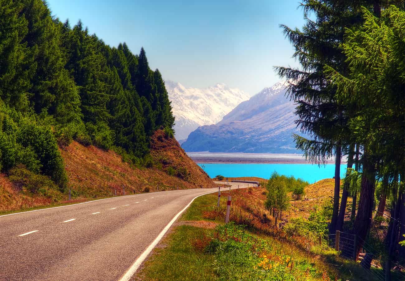 Milky turquoise glacial waters of Lake Pukaki framing the soaring alpine pyramid of Aoraki / Mount Cook.
The visual contrast on this drive is mesmerizing: the intensely milky turquoise color of the lake (caused by suspended glacial flour scattering sunlight) juxtaposed against the golden brown tussock grass of the Mackenzie Basin and the blinding white glacial ice ahead. At the end of the road lies Mount Cook Village, the gateway to the Hooker Valley Track and the Tasman Glacier viewpoint.
- Distance: 55 km (34 miles)
- Driving Time: 1 hour
- Reddit Tip: Peter’s Lookout, located approximately halfway along the lake, offers the definitive postcard photo composition looking down the winding blacktop directly into the base of Mount Cook.
3. The West Coast Highway / State Highway 6 (Punakaiki to Haast)
Hugging the rugged western coastline between the Southern Alps and the crashing Tasman Sea, State Highway 6 is a thrilling, untamed coastal journey.
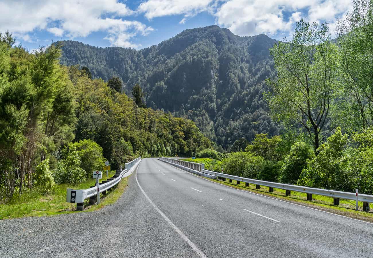 State Highway 6 hugging dense rainforest cliffs along the wild West Coast corridor.
Highlights include the natural surge pools and layered pancake rock formations of Punakaiki, the lush temperate nikau palm groves of Paparoa National Park, and the ice tongues of Fox and Franz Josef Glaciers descending straight into temperate rainforest. South of Lake Paringa, the road turns inland across Knights Point Lookout—where elephant seals often sunbathe on offshore rocks—before crossing the Haast River Bridge.
- Distance: 340 km (211 miles)
- Driving Time: 5 hours
- Reddit Tip: West Coast sandflies are notoriously fierce. Keep vehicle windows closed when parked near water, and apply local repellent before stepping outside.
4. Queenstown to Glenorchy & Paradise (Lake Wakatipu)
Departing Queenstown’s bustling resort center, this 46-kilometer route hugs the sinuous northern shoreline of Lake Wakatipu beneath the jagged peaks of the Humboldt and Richardson mountain ranges.
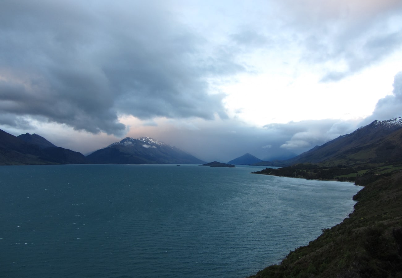 Dramatic alpine mountain silhouettes reflected across the glacial waters of Lake Wakatipu.
The road twists through native beech forest before opening onto the sleepy settlement of Glenorchy, famed for its iconic red wharf shed. Past Glenorchy, gravel tracks continue across braided riverbeds into the valley of "Paradise," where ancient mossy beech forests provided the setting for Lothlórien and Isengard in The Lord of the Rings.
- Distance: 46 km (28 miles) to Glenorchy (68 km to Paradise)
- Driving Time: 45 minutes to 1.5 hours
- Reddit Tip: Bennett’s Bluff lookout is the premier photography stop, offering an elevated viewing platform overlooking the lake's bends and distant glaciated peaks.
5. The Desert Road / State Highway 1 (Tongariro National Park, North Island)
Cutting across the high volcanic plateau of the North Island, the Desert Road section of State Highway 1 is unlike any other landscape in New Zealand: a windswept, barren alpine tundra framed by three active volcanoes.
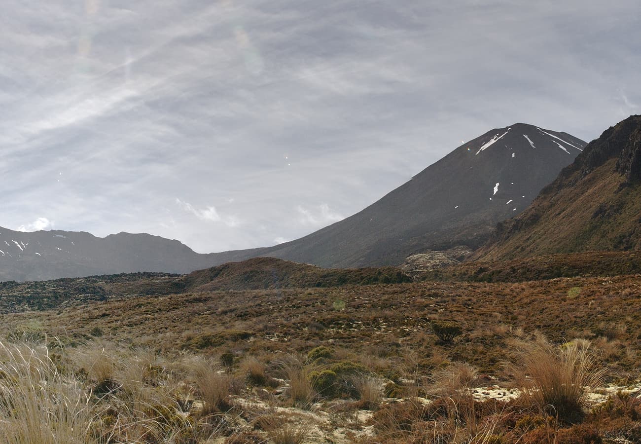 The soaring volcanic cones of Mount Tongariro and Mount Ngauruhoe rising from the Rangipo Desert.
Reaching an altitude of 1,074 meters (3,524 feet), the road passes through the Rangipo Desert, an arid landscape created by centuries of volcanic tephra and ash deposits. Drivers are treated to views of the steaming crater of Mount Ruapehu (2,797 m), the conical peak of Mount Ngauruhoe (famously depicted as Mount Doom in cinema), and Mount Tongariro.
- Distance: 63 km (39 miles) between Rangipo and Waiouru
- Driving Time: 1 hour
- Reddit Tip: The Desert Road is susceptible to sudden winter blizzards and black ice. Check Waka Kotahi (NZ Transport Agency) highway updates before traversing the plateau between June and September.
6. The Thermal Explorer Highway (Rotorua to Taupo via Wai-O-Tapu)
Traveling between the geothermal capital of Rotorua and the massive caldera of Lake Taupo, the Thermal Explorer Highway showcases New Zealand’s subterranean power.
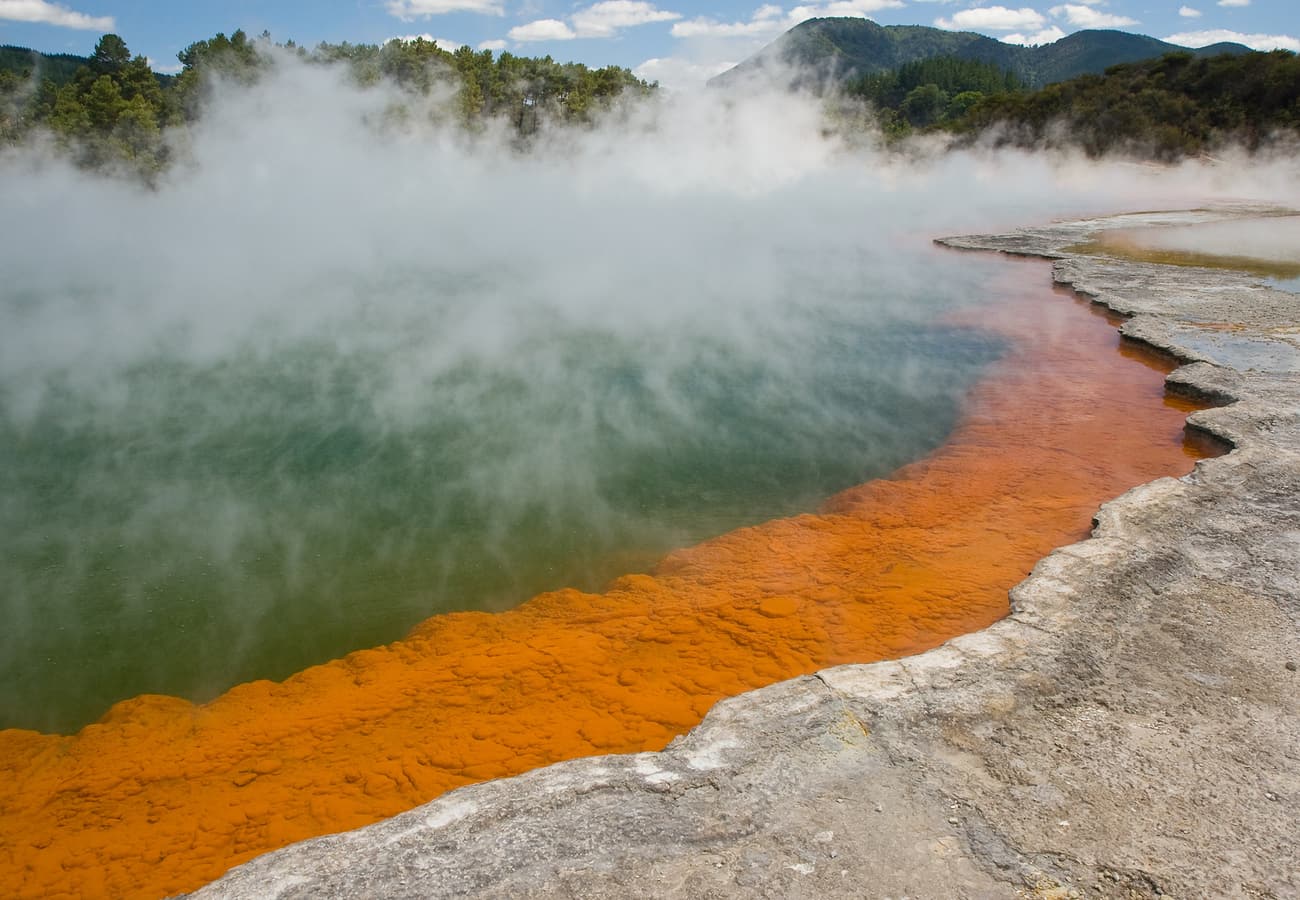 The surreal, brightly colored mineral springs and steaming waters of Champagne Pool in Wai-O-Tapu.
Along State Highway 5, the route passes roadside steam vents, bubbling mud pools, and the geothermal wonderland of Wai-O-Tapu, famed for the neon-orange and emerald waters of the Champagne Pool and the Lady Knox Geyser. Continue south to visit Huka Falls, where 220,000 liters of water per second funnel through a narrow granite gorge into Lake Taupo.
- Distance: 80 km (50 miles)
- Driving Time: 1 hour
- Reddit Tip: Pull off at Kerosene Creek near Rainbow Mountain for a soak in a completely natural, free thermal hot spring creek surrounded by native bush.
7. The Forgotten World Highway / State Highway 43 (Stratford to Taumarunui)
For travelers seeking an adventurous off-the-beaten-path journey through rural New Zealand, the Forgotten World Highway (State Highway 43) offers a journey back in time.
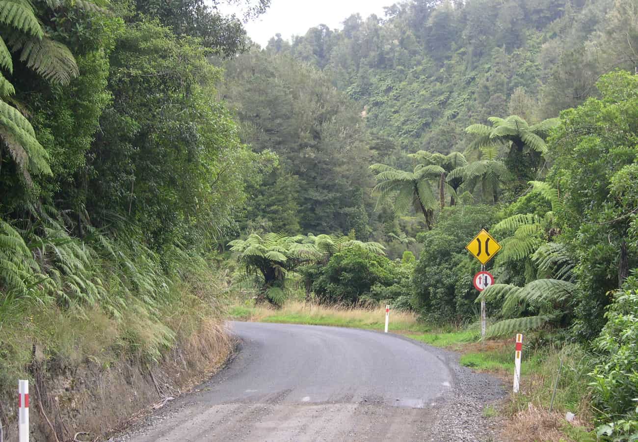 The winding, unsealed gravel corridor of the remote Forgotten World Highway through native bush.
Snaking across four mountain saddles, a single-lane hand-carved historic tunnel (the Moki Tunnel or "Hobbit’s Hole"), and the lush Tangarakau Gorge, this route includes a 12-kilometer unsealed gravel section. Halfway along the drive lies the self-proclaimed "Republic of Whangamomona," an eccentric historic settlement that declared independence in 1989; bring your passport into the Whangamomona Hotel to get it officially stamped.
- Distance: 150 km (93 miles)
- Driving Time: 3 to 4 hours
- Reddit Tip: There are zero petrol stations along the entire 150-kilometer corridor between Stratford and Taumarunui. Fill your fuel tank completely before entering the highway.
8. The Coromandel Peninsula Loop (Thames to Hahei & Cathedral Cove)
Winding along the pohutukawa-fringed coastlines of the North Island's Coromandel Peninsula, this scenic coastal drive connects idyllic surf bays, native kauri forests, and geothermal beaches.
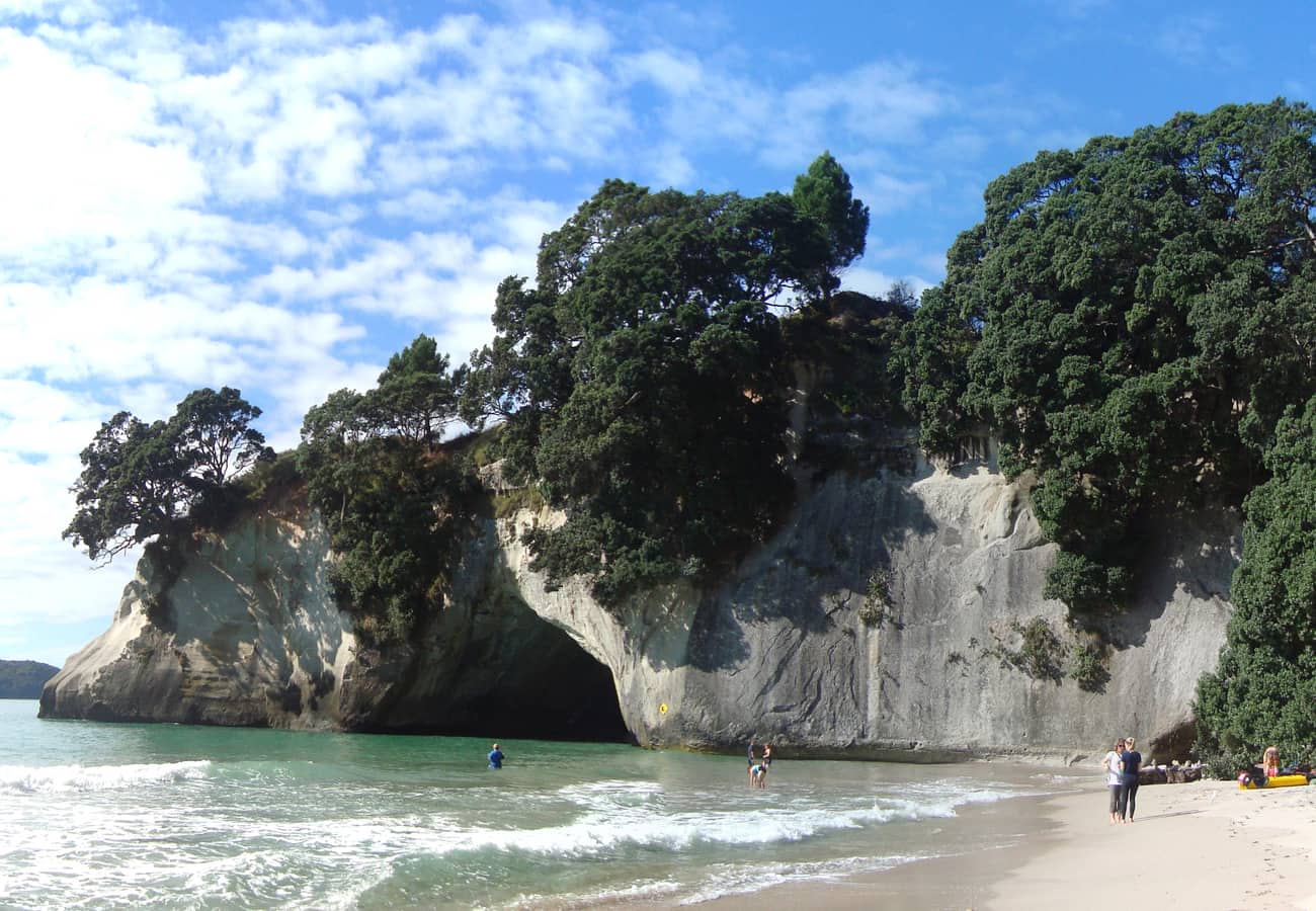 The magnificent sea-carved limestone archway and white sands of Cathedral Cove in the Coromandel.
Starting in Thames, the road clings to the Firth of Thames beneath crimson-flowering pohutukawa trees (New Zealand’s Christmas tree) before crossing the rugged volcanic spine to Hahei. Here, visitors can hike or boat to the famous limestone arch of Cathedral Cove and visit Hot Water Beach, where you can rent a spade at low tide and dig your own personal hot mineral spa in the ocean sand.
- Distance: 130 km (81 miles)
- Driving Time: 2.5 hours
- Reddit Tip: Check the tide timetable for Hot Water Beach before arriving; the underground geothermal spring is only accessible two hours before and two hours after low tide.
9. Twin Coast Discovery Highway to Cape Reinga (Northland)
Stretching to the northernmost tip of New Zealand, State Highway 1 terminates at the sacred promontory of Cape Reinga (Te Rerenga Wairua).
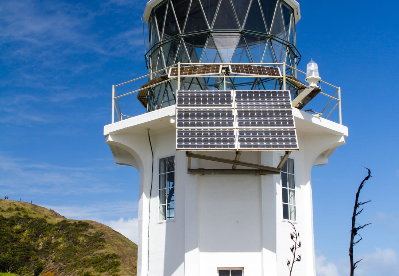 Cape Reinga Lighthouse perched on windswept bluffs where the Tasman Sea and Pacific Ocean collide.
This is a deeply sacred place in Māori cosmology: the windswept headland where the spirits of the deceased leap into the ocean to return to their ancestral homeland of Hawaiki. Looking out from the historic lighthouse, travelers can witness the turbulent collision of two massive bodies of water: the moody greenish Tasman Sea crashing directly into the deep blue Pacific Ocean. Along the drive north, travelers can also detour to explore giant sand dunes at Te Paki or cruise along the hard-packed sands of Ninety Mile Beach.
- Distance: 215 km (134 miles) from Paihia to Cape Reinga
- Driving Time: 3 hours one way
- Reddit Tip: Do not attempt to drive standard rental cars onto Ninety Mile Beach; rental vehicle insurance policies strictly forbid beach driving due to deep soft sand and sudden incoming tides.
10. The Crown Range Road (Wanaka to Queenstown)
Reaching an altitude of 1,076 meters (3,530 feet), the Crown Range Road is the highest paved public road in New Zealand, delivering an alpine shortcut between Wanaka and Queenstown.
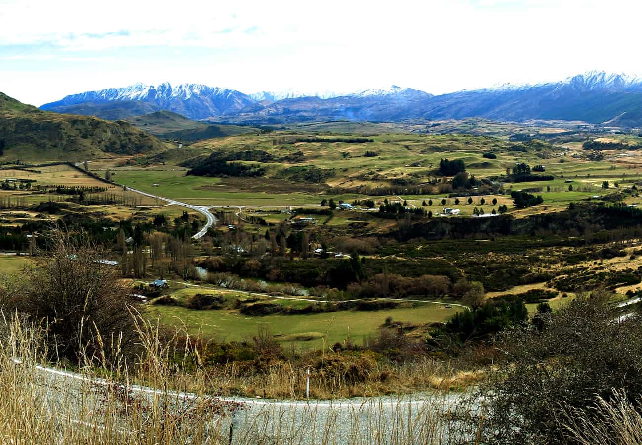 The high-altitude switchbacks and golden tussock peaks of the Crown Range Road.
The road winds up the Cardrona Valley past the historic 1863 Cardrona Hotel before ascending the Crown Terrace via a series of steep, dramatic hairpin switchbacks. At the summit lookout, the entire Wakatipu basin unfolds beneath you, from Lake Wakatipu and the Remarkables to Queenstown Airport nestled on the valley floor.
- Distance: 69 km (43 miles)
- Driving Time: 1 to 1.5 hours
- Reddit Tip: In winter (June to October), always carry snow chains and check the morning road report; icy conditions frequently require chains to be fitted on 2WD vehicles.
Summary Comparison of New Zealand Scenic Drives
| Scenic Drive | Island | Distance | Ideal Duration | Top Highlight | Best Season |
|---|---|---|---|---|---|
| Milford Road (SH94) | South | 119 km | Half Day | Homer Tunnel & Mitre Peak fjord views | Nov – Apr |
| Mount Cook Road (SH80) | South | 55 km | 1–2 Hours | Milky-blue Lake Pukaki & Aoraki | Oct – Apr |
| West Coast Highway (SH6) | South | 340 km | 1–2 Days | Pancake Rocks, glaciers & rainforest | Jan – Apr |
| Queenstown to Glenorchy | South | 46 km | Half Day | Lake Wakatipu & Lord of the Rings sets | Year-Round |
| The Desert Road (SH1) | North | 63 km | 1 Hour | Rangipo volcanic plateau & Mount Doom | Nov – Apr |
| Thermal Explorer Highway | North | 80 km | Half Day | Wai-O-Tapu geothermal Champagne Pool | Year-Round |
| Forgotten World Highway | North | 150 km | Full Day | Moki Tunnel & Whangamomona Republic | Oct – Apr |
| Coromandel Peninsula | North | 130 km | 1–2 Days | Cathedral Cove & Hot Water Beach | Dec – Mar |
| Cape Reinga Highway | North | 215 km | Full Day | Where Tasman Sea and Pacific Ocean collide | Year-Round |
| Crown Range Road | South | 69 km | 1.5 Hours | Highest paved alpine pass & Cardrona Pub | Nov – Apr |
Essential Tips for Driving New Zealand's Scenic Highways
- Drive on the Left: New Zealand vehicles drive on the left side of the road. Keep left at all times, especially when pulling out from scenic roadside viewing lookouts onto empty rural highways.
- One-Lane Bridge Protocols: When approaching single-lane bridges, the vehicle facing the larger white arrow has priority; vehicles facing the smaller red arrow must yield to oncoming traffic.
- Respect Campervan Etiquette: If you are driving a slower campervan or motorhome on winding roads, use the designated slow-vehicle pullouts to allow queued local traffic behind you to pass safely.
- Download Offline Maps: Cellular signals frequently drop completely in mountainous and remote coastal areas (Milford Sound, West Coast gorges, and the Forgotten World Highway). Download offline GPS regions in Google Maps or Maps.me prior to departing.
Frequently Asked Questions
Which scenic drive is the most famous in New Zealand?
The Milford Road (State Highway 94) in Fiordland National Park is widely recognized as New Zealand's most famous and spectacular scenic highway, drawing international acclaim for its towering granite peaks, glacial valleys, and dramatic descent into Milford Sound.
Are New Zealand's scenic drives suitable for standard rental cars?
Yes. With the exception of off-road sand tracks and the 12-kilometer gravel section of the Forgotten World Highway (which is still easily driven in dry conditions with care), all top scenic drives in New Zealand are fully sealed, high-standard asphalt highways suitable for standard 2WD rental cars.
When is the best time of year to experience New Zealand scenic drives?
The optimal driving window is December to March (Kiwi summer) and April (autumn). During these months, mountain passes are free of snow, daylight hours are long (up to 15 hours of daylight in the South Island), and weather conditions are most stable for hiking and photography.
Related Travel Guides
- 10 Best New Zealand South Island Road Trips Reddit Travelers Recommend in 2026
- 10 Best Australia Road Trips Reddit Travelers Recommend in 2026
- 10 Best Sydney to Melbourne Road Trip Stops Reddit Travelers Recommend in 2026
- 10 Best Scenic Drives for a USA Bucket-List Road Trip Reddit Travelers Recommend in 2026
Disclaimer
This article is for informational and educational purposes only. It does not constitute legal, financial, or professional advice. While we strive to provide accurate and up-to-date information, travel policies, regulations, and conditions change rapidly. Always verify information with official sources before making travel decisions. Nomad Lawyer makes no representations about the accuracy, reliability, completeness, or suitability of the information provided. Readers should consult qualified professionals for advice specific to their circumstances. The views expressed in this article are those of the author and do not necessarily reflect the views of Nomad Lawyer.
Raushan Kumar
Founder & Lead Developer
Full-stack developer with 11+ years of experience and a passionate traveller. Raushan built Nomad Lawyer from the ground up with a vision to create the best travel and law experience on the web.
Learn more about our team →