
10 Best Iceland Ring Road Stops Reddit Travelers Recommend in 2026
Embarking on Iceland's legendary Route 1 in 2026? Reddit travelers on r/VisitingIceland rank the 10 best Ring Road stops, from Skógafoss and Reynisfjara to Jökulsárlón, Stuðlagil Canyon, and Goðafoss.

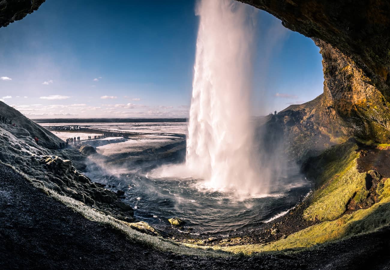
Seljalandsfoss plunging 60 meters from mossy volcanic cliffs along Iceland's southern Ring Road
Encircling 1,322 kilometers (821 miles) of otherworldly subarctic volcanic terrain, Iceland's Route 1—affectionately known as the Ring Road—is widely celebrated across r/VisitingIceland and r/roadtrip as the world’s most cinematic driving circuit. In a single week, drivers traverse black volcanic sands, thunderous glacier-fed waterfalls, iceberg lagoons, geothermal steam vents, and sheer ocean fjords.
Drawing upon thousands of firsthand trip reports, winter driving warnings, and photography advice from Reddit travelers, here is the curated guide to the 10 best Iceland Ring Road stops for 2026.
Seljalandsfoss plunging 60 meters from mossy volcanic cliffs along Iceland's southern Ring Road.
1. Seljalandsfoss Waterfall & Gljúfrabúi (South Iceland)
Located just 120 kilometers southeast of Reykjavík, Seljalandsfoss is one of Iceland’s most recognizable and interactive waterfalls, dropping 60 meters (197 feet) over former coastal cliffs.
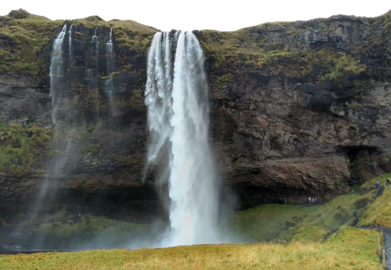 The slippery walking trail leading directly behind the roaring water veil of Seljalandsfoss.
What makes Seljalandsfoss legendary is the walking path that circles completely behind the cascading torrent of water, offering a view through the liquid veil out onto the green southern coastal plains. Reddit travelers strongly advise packing waterproof shell pants, a rain jacket, and waterproof camera protection—the billowing mist will soak through ordinary clothes in seconds. Before returning to your car, walk 500 meters north along the cliff base to Gljúfrabúi, a "hidden" waterfall tucked inside a narrow vertical rock crevice.
2. Skógafoss Waterfall & The Fimmvörðuháls Steps (South Coast)
Just 30 kilometers east of Seljalandsfoss, Skógafoss delivers raw geological power: a massive 25-meter-wide and 60-meter-tall vertical wall of thunderous water plunging straight onto a flat gravel riverbed.
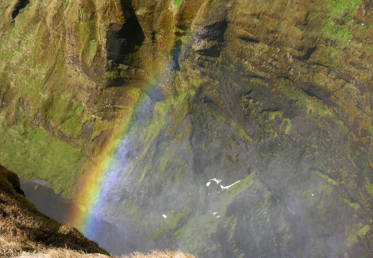 Skógafoss plunging 60 meters onto the riverbed, frequently creating brilliant double rainbows in the mist.
Because of the massive volume of spray produced by the falls, brilliant single and double rainbows frequently illuminate the canyon on sunny days. Reddit photographers love that you can walk right up to the base of the falls (ensure waterproof gear is zipped up). On the right-hand side of the falls, a steep metal staircase with 527 steps climbs to an observation platform and marks the trailhead for the famous Fimmvörðuháls alpine hiking trail.
3. Reynisfjara Black Sand Beach & Reynisdrangar Basalt Stacks (Vík)
Located near the coastal village of Vík í Mýrdal, Reynisfjara is Iceland’s most famous black sand beach, flanked by towering hexagonal basalt columns and soaring sea cliffs.
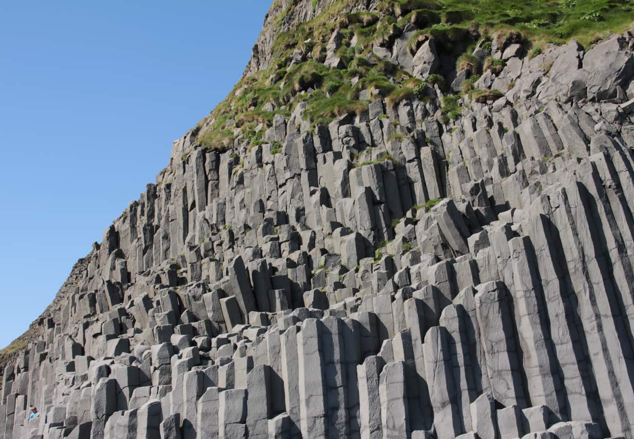 Hexagonal basalt columns of Garðar and crashing North Atlantic waves at Reynisfjara.
Looking out to sea, the jagged basalt sea stacks of Reynisdrangar rise dramatically from the roaring North Atlantic surf. Critical safety warning from Reddit: Reynisfjara is infamous for deadly "sneaker waves"—rogue swells that surge tens of meters higher up the shore without warning. Never turn your back on the ocean, stay well behind the posted warning lights, and keep children far away from the water's edge.
4. Fjaðrárgljúfur Canyon (Kirkjubæjarklaustur Region)
Carved through volcanic palagonite rock over two million years of glacial meltwater runoff, Fjaðrárgljúfur is a fairy-tale canyon snaking 100 meters deep and two kilometers long.
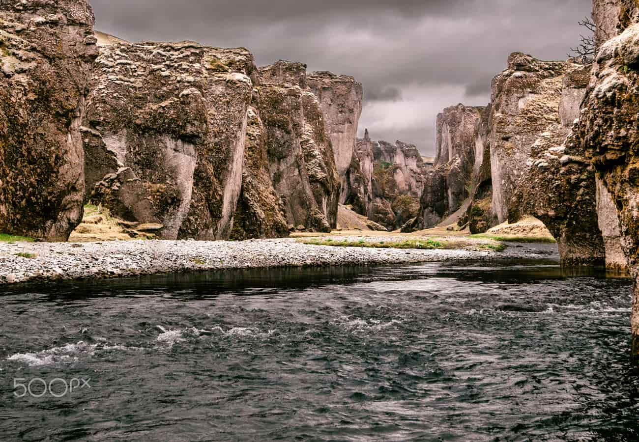 The emerald mossy ledges and serpentine curves of Fjaðrárgljúfur Canyon in southern Iceland.
The canyon gained global viral fame in recent years, prompting the Environment Agency of Iceland to install elevated boardwalks and designated viewing platforms to protect the fragile subarctic moss from foot traffic. Reddit hikers recommend walking the 1.5-mile trail along the upper eastern rim to the uppermost viewpoint, where the Fjaðrá river tumbles over a scenic waterfall into the chasm.
5. Jökulsárlón Glacier Lagoon & Diamond Beach (Vatnajökull)
Situated at the southern foot of Breiðamerkurjökull (an outlet glacier of the massive Vatnajökull ice cap), Jökulsárlón is an enchanting glacial lagoon filled with giant floating icebergs.
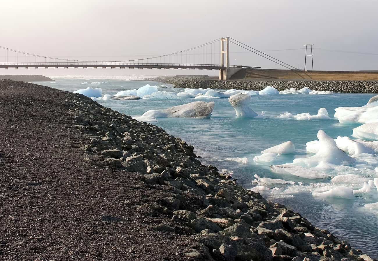 Ancient luminous blue icebergs drifting through the Jökulsárlón Glacier Lagoon toward the ocean.
The icebergs—calved from the glacier face—drift slowly across the deep lagoon toward the open sea, glowing in surreal shades of electric blue and striped with black volcanic ash from ancient eruptions. Watch for harbor seals swimming among the ice floes. Directly across Route 1, the icebergs wash ashore onto the pitch-black volcanic sand of Diamond Beach (Breiðamerkursandur), glistening in the sunlight like polished diamonds.
6. Vestrahorn & Stokksnes Peninsula (Höfn, East Iceland)
Rising 454 meters sheer out of black volcanic sand dunes and shallow tidal lagoons, the jagged gabbro mountain ridge of Vestrahorn on the Stokksnes peninsula is one of Iceland’s premier landscape photography locations.
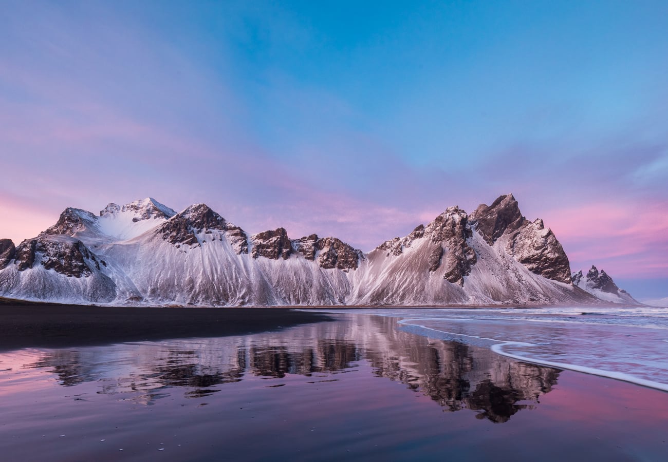 The brooding, tooth-like jagged peaks of Vestrahorn towering over black sand dunes on the Stokksnes Peninsula.
When the tide recedes, a thin sheet of seawater remains on the hard-packed black sand, creating a mirror reflection of the spiky mountain peaks. Reddit photographers recommend visiting around sunset or during the midnight sun in June. Stokksnes is on private land; pay the small admission fee at the Viking Café, which also provides access to an authentic abandoned Viking village movie set built in 2010.
7. Stuðlagil Canyon (Jökuldalur Valley, East Iceland)
Stuðlagil Canyon boasts the largest and most concentrated collection of basalt rock columns in Iceland, bordering a vibrant turquoise-blue glacial river.
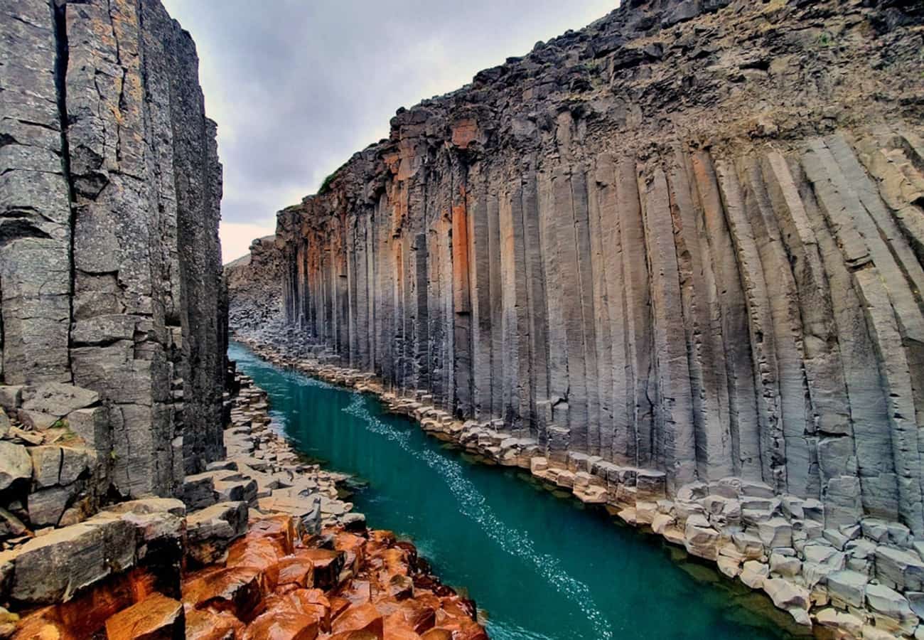 Magnificent vertical geometric basalt columns flanking the turquoise waters of Stuðlagil Canyon.
Remarkably, Stuðlagil was hidden beneath the churning, silty waters of the Jökulsá á Dal river for centuries until the construction of the Kárahnjúkar hydroelectric plant in 2009 lowered water levels, revealing the dramatic vertical geometric basalt organ pipes. Reddit travelers recommend driving to the eastern parking lot (Parkplatz Klaustursel) and hiking 5 kilometers along the riverbank to scramble down onto the basalt columns directly above the turquoise water.
8. Hverir Geothermal Area & Lake Mývatn (North Iceland)
Located at the foot of Mount Námafjall near Lake Mývatn, Hverir is a boiling geothermal expanse of bubbling sulfur mud pools, roaring fumaroles, and steaming volcanic vents.
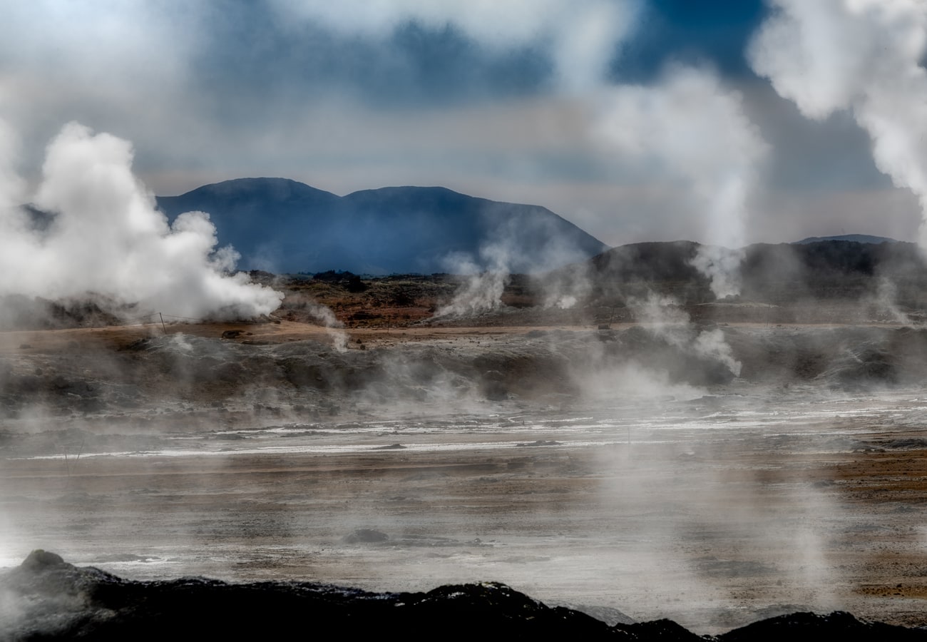 Boiling mud caldrons and steaming sulfur fumaroles across the Martian landscape of Hverir.
The ground is saturated in vivid mineral colors—streaked with ochre, copper green, and sulfuric yellow—and the air is thick with the scent of sulfur. Wooden boardwalks guide visitors safely across the scalding ground. After walking through Hverir, Reddit drivers suggest relaxing at the nearby Mývatn Nature Baths (Jarðböðin við Mývatn), a geothermal mineral lagoon often described as North Iceland’s more tranquil alternative to the Blue Lagoon.
9. Goðafoss: The Waterfall of the Gods (North Iceland)
Positioned directly along the Ring Road between Lake Mývatn and Akureyri, Goðafoss is one of the most culturally significant and visually harmonious waterfalls in Iceland.
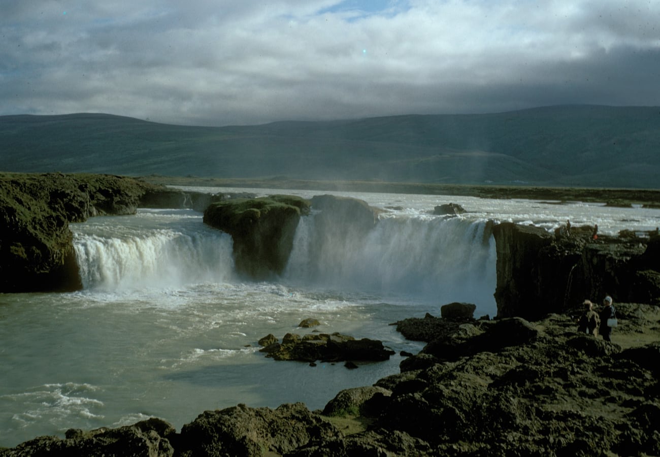 The semicircular curving amphitheater of Goðafoss plunging 12 meters into a turquoise basin.
Falling 12 meters across a semicircular curving rim 30 meters wide, the waterfall earned its name ("Waterfall of the Gods") in the year 1000 AD, when the lawspeaker Þorgeir Ljósvetningagoði cast his pagan statues of the Norse gods (Thor, Odin, and Freyr) into the churning falls to signify Iceland's official adoption of Christianity. Paved viewing platforms on both the east and west banks provide outstanding viewpoints without strenuous hiking.
10. Hvítserkur "Dragon Rock" Sea Stack (Vatnsnes Peninsula)
Protruding 15 meters out of Húnaflói bay off the eastern shore of the Vatnsnes Peninsula, Hvítserkur is a jagged volcanic monolith that resembles a prehistoric dragon or troll drinking from the ocean.
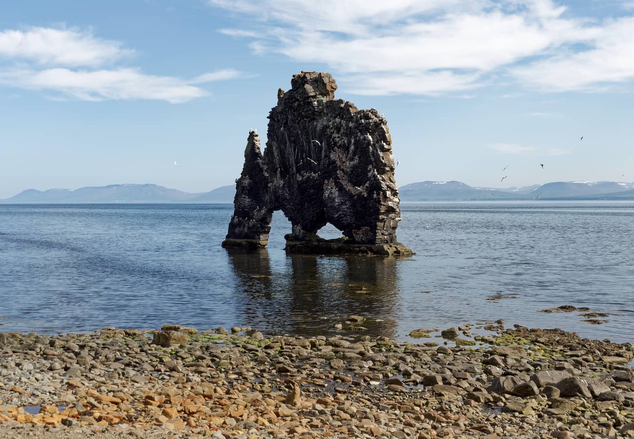 The bizarre 15-meter basalt sea stack of Hvítserkur sculpted by marine erosion in Húnaflói bay.
Geologically, the sea stack is the eroded remnant of an ancient volcanic plug. Two large natural arches at the base give it the appearance of an animal on four legs. Reddit travelers recommend timing your visit for low tide, which allows you to walk across the black sand beach directly to the base of the stack. The surrounding Vatnsnes Peninsula is also Iceland’s premier destination for observing harbor seal colonies basking on coastal rocks.
Iceland Ring Road Stops Summary
| Stop # | Landmark | Region | Ideal Duration | Top Highlight |
|---|---|---|---|---|
| 1 | Seljalandsfoss | South Coast | 1–2 Hours | Walking behind the roaring 60-meter water veil |
| 2 | Skógafoss | South Coast | 2 Hours | Massive waterfall mist & 527-step cliff staircase |
| 3 | Reynisfjara Beach | Vík | 1–2 Hours | Basalt columns & wild North Atlantic sneaker waves |
| 4 | Fjaðrárgljúfur | Southeast | 2 Hours | Fairy-tale moss-covered canyon trail |
| 5 | Jökulsárlón & Diamond Beach | Southeast | Half Day | Glowing blue icebergs washed onto black sand |
| 6 | Vestrahorn (Stokksnes) | East Coast | 2–3 Hours | Jagged mountain reflections & Viking movie set |
| 7 | Stuðlagil Canyon | East Iceland | 3–4 Hours | Colossal basalt columns flanking turquoise river |
| 8 | Hverir & Lake Mývatn | North Iceland | Half to Full Day | Bubbling sulfur mud pools & geothermal hot springs |
| 9 | Goðafoss | North Iceland | 1 Hour | Historic "Waterfall of the Gods" amphitheater |
| 10 | Hvítserkur Sea Stack | Northwest | 2 Hours | Dragon-shaped basalt stack & coastal seal watching |
Essential Tips for Driving Iceland's Ring Road
- Check Vedur.is and SafeTravel.is Daily: Iceland’s subarctic weather changes with astonishing rapidity. Gales exceeding 100 km/h and sudden blizzards can occur even in shoulder seasons. Check road conditions at SafeTravel.is and wind forecasts at Vedur.is every morning before turning the ignition key.
- Hold Car Doors with Two Hands: Icelandic winds are legendary for catching open car doors and bending them backward against the hinges—a costly damage claim not covered by basic rental insurance. Park into the wind and hold doors firmly with both hands.
- Single-Lane Bridges: The Ring Road still features dozens of narrow, single-lane wooden and concrete bridges, particularly across southeastern glacial outwash plains (sandur). The driver who arrives closest to the bridge has the right of way; slow down to 30 km/h and yield politely.
- Comprehensive Insurance (Sand & Gravel Protection): Reddit travelers strongly recommend opting for Gravel Protection (GP) and Sand and Ash Protection (SAP). Loose volcanic gravel on side roads and flying basalt chips from oncoming semi-trucks will crack windshields and chip paintwork.
- Strictly No Off-Road Driving: Driving off designated roads is strictly illegal in Iceland and carries thousands of dollars in criminal fines. Subarctic moss and volcanic soils take decades or centuries to recover from tire ruts.
Frequently Asked Questions
Which direction is best to drive Iceland's Ring Road: clockwise or counter-clockwise?
Reddit travelers overwhelmingly favor driving counter-clockwise (heading south from Reykjavík toward Vík, Jökulsárlón, and the Eastfjords first). This puts the famous south coast waterfalls and glacier lagoons at the beginning of the trip while your energy is highest, and positions the sun behind you for optimal afternoon photography at Vík and Jökulsárlón.
How many days are needed to drive the full Iceland Ring Road?
The absolute minimum recommended duration in summer is 7 to 8 days, but 10 to 12 days is strongly advised to explore without driving 6+ hours every day. In winter (November to March), attempting the full Ring Road in less than 10 to 14 days is dangerous due to short daylight hours (4 to 5 hours) and frequent mountain pass closures.
Can you drive the Ring Road in a standard 2WD vehicle?
Yes, between May and September, the entire Ring Road is paved asphalt and easily driven in a standard 2WD economy car or campervan. However, if traveling between October and April, or if you plan to detour onto highland F-roads, a 4WD vehicle with studded winter tires is mandatory.
Related Travel Guides
Disclaimer
This article is for informational and educational purposes only. It does not constitute legal, financial, or professional advice. While we strive to provide accurate and up-to-date information, travel policies, regulations, and conditions change rapidly. Always verify information with official sources before making travel decisions. Nomad Lawyer makes no representations about the accuracy, reliability, completeness, or suitability of the information provided. Readers should consult qualified professionals for advice specific to their circumstances. The views expressed in this article are those of the author and do not necessarily reflect the views of Nomad Lawyer.
Raushan Kumar
Founder & Lead Developer
Full-stack developer with 11+ years of experience and a passionate traveller. Raushan built Nomad Lawyer from the ground up with a vision to create the best travel and law experience on the web.
Learn more about our team →