
10 Best Iceland Scenic Road Trips Reddit Travelers Recommend in 2026
Planning an epic driving holiday in Iceland in 2026? Reddit travelers on r/VisitingIceland rank the top 10 scenic road trips, from the Ring Road and Golden Circle to the Westfjords, Diamond Circle, and Landmannalaugar.

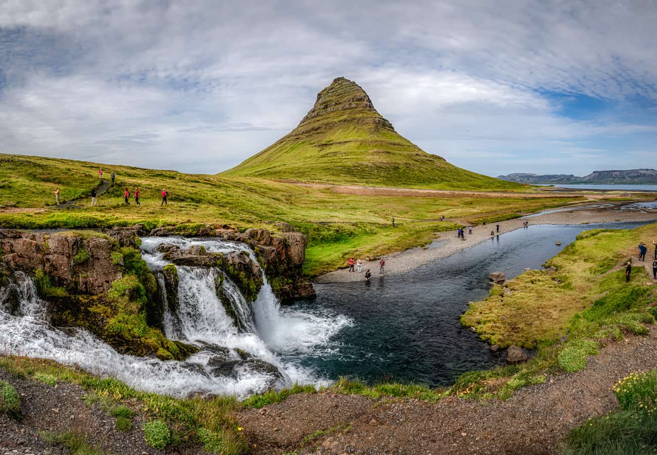
Mount Kirkjufell reflected in calm coastal waters on Iceland's magical Snæfellsnes Peninsula
With its primeval blend of active volcanic calderas, sprawling ice caps, cascading glacier waterfalls, and deep oceanic fjords, Iceland is universally regarded across r/VisitingIceland and r/roadtrip as one of the ultimate driving destinations on the planet. While the Ring Road remains the famous headline circuit, Iceland offers a rich tapestry of distinct regional road trips—from half-day geothermal loops to multi-day wilderness expeditions across remote gravel peninsulas.
Drawing upon thousands of firsthand itineraries, seasonal road condition reports, and local driving safety advisories from the Reddit travel community, here is the curated ranking of the 10 best Iceland scenic road trips for 2026.
Mount Kirkjufell reflected in calm coastal waters on Iceland's magical Snæfellsnes Peninsula.
1. The Classic Ring Road / Route 1 (Full Island Circuit)
Encircling 1,322 kilometers (821 miles) of subarctic volcanic landscapes, the Ring Road is Iceland’s defining road trip adventure, connecting virtually all of the country's primary geographical zones.
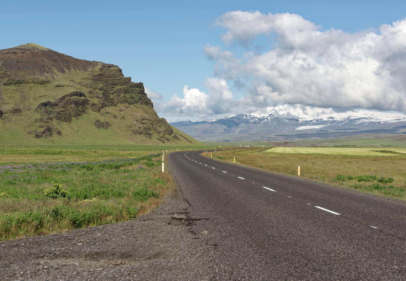 Route 1 carving through mossy volcanic plains and subarctic mountains in southern Iceland.
Beginning and ending in Reykjavík, the highway takes drivers past the iconic waterfalls of Seljalandsfoss and Skógafoss, across the black volcanic sands of Vík, alongside floating icebergs at Jökulsárlón Glacier Lagoon, through the steep mountain fjords of the East, and across the volcanic moonscapes of Lake Mývatn and Goðafoss in the North. Reddit road trippers advise budgeting at least 10 to 12 days to comfortably experience the entire loop without spending 7+ hours behind the wheel each day.
- Distance: 1,322 km (821 miles)
- Recommended Time: 10 to 14 days
- Best Season: May to September
- Reddit Tip: Drive counter-clockwise (heading south first) to tackle the major waterfalls and glacier lagoons while your energy is fresh, keeping the sun behind you for optimal afternoon photography.
2. The Golden Circle Route (South-West Iceland)
The Golden Circle is Iceland’s most popular day trip, looping 300 kilometers from Reykjavík into the geothermal heartland of the southwest.
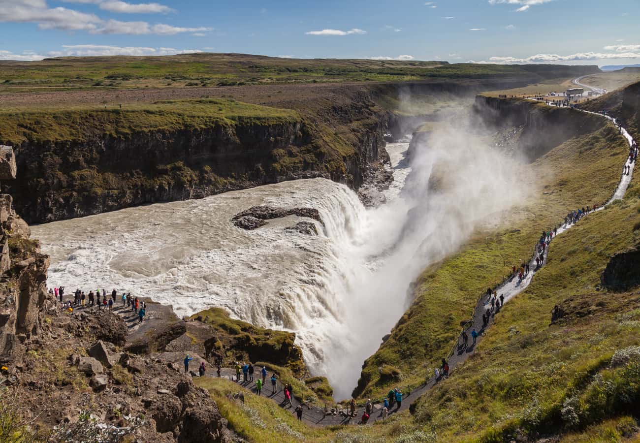 The thunderous two-tiered curtain of Gullfoss cascading 32 meters into the Hvítá River canyon.
The route connects three world-class attractions: Þingvellir National Park, a UNESCO World Heritage site where you can walk through the tectonic rift valley separating the North American and Eurasian continental plates; the Geysir Geothermal Area, where Strokkur erupts boiling water 20 to 30 meters into the sky every 6 to 10 minutes; and Gullfoss, a thunderous two-tiered waterfall plunging into the Hvítá River canyon.
- Distance: 300 km (186 miles) loop
- Recommended Time: 1 full day
- Best Season: Year-round
- Reddit Tip: Avoid the tour bus crowds (10:00 AM to 3:00 PM) by departing Reykjavík before 7:30 AM or enjoying the sites under the late evening midnight sun between June and July.
3. Snæfellsnes Peninsula Loop: "Iceland in Miniature" (West Iceland)
Jutting 90 kilometers into the Atlantic Ocean west of Borgarnes, the Snæfellsnes Peninsula is affectionately dubbed "Iceland in Miniature" because it contains every iconic geological feature of the country in one compact region.
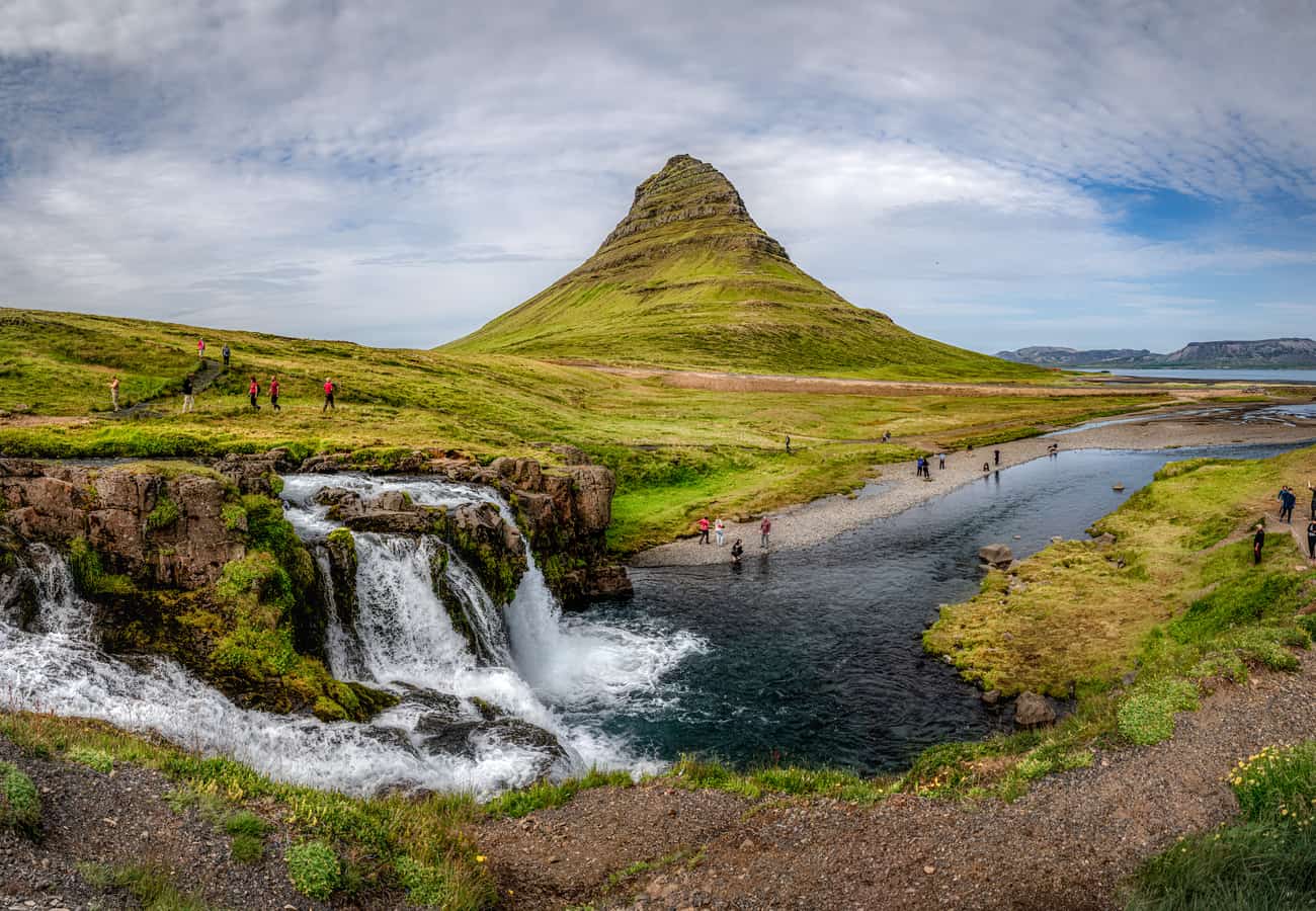 Mount Kirkjufell—the "Arrowhead Mountain"—framed by cascading waterfalls in Grundarfjörður.
At its western tip lies the glacier-capped stratovolcano of Snæfellsjökull (immortalized in Jules Verne’s Journey to the Center of the Earth). Along the northern coast, the conical silhouette of Mount Kirkjufell rises dramatically above Grundarfjörður, while the southern coastline features the black pebble beach of Djúpalónssandur, the basalt sea arches of Arnarstapi, and the historic black wooden church of Búðakirkja.
- Distance: 260 km (162 miles) loop from Borgarnes
- Recommended Time: 2 days
- Best Season: Year-round (May to October for optimal coastal hiking)
- Reddit Tip: Do not rush this drive in a single day trip from Reykjavík; stay overnight in Stykkishólmur or Grundarfjörður to witness Kirkjufell illuminated by midnight sun or the aurora borealis.
4. South Coast Glacier & Waterfalls Drive (Reykjavík to Jökulsárlón)
For travelers who have only 4 to 5 days in Iceland, the South Coast drive along Route 1 delivers the absolute highest concentration of jaw-dropping natural landmarks.
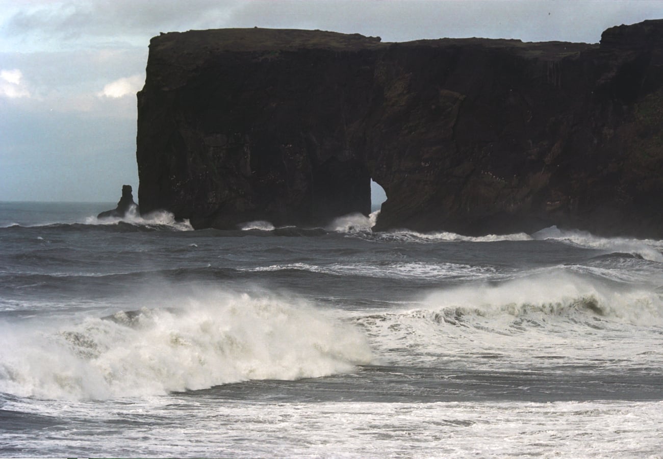 The dramatic coastal cliffs and giant volcanic sea arch at Dyrhólaey overlooking black sand beaches.
Driving southeast from the capital, the route passes the cascading falls of Seljalandsfoss and Skógafoss, the puffin-nesting cliffs and natural arch of Dyrhólaey, the basalt columns and black sands of Reynisfjara in Vík, and the moss-draped walls of Fjaðrárgljúfur Canyon. The drive reaches its climax at Skaftafell glacier hiking trailheads and the floating blue icebergs of Jökulsárlón Glacier Lagoon and Diamond Beach.
- Distance: 380 km (236 miles) one way
- Recommended Time: 3 to 4 days
- Best Season: Year-round
- Reddit Tip: Respect the extreme wind warnings along the southern sands (sandur). When yellow or orange wind alerts are issued on Vedur.is, pull over in a town and wait; gale-force crosswinds routinely blow vehicles off the highway.
5. The Diamond Circle (North-East Iceland)
The Diamond Circle is North Iceland’s magnificent 250-kilometer touring loop, offering a dramatic, rugged counterpart to the southern Golden Circle.
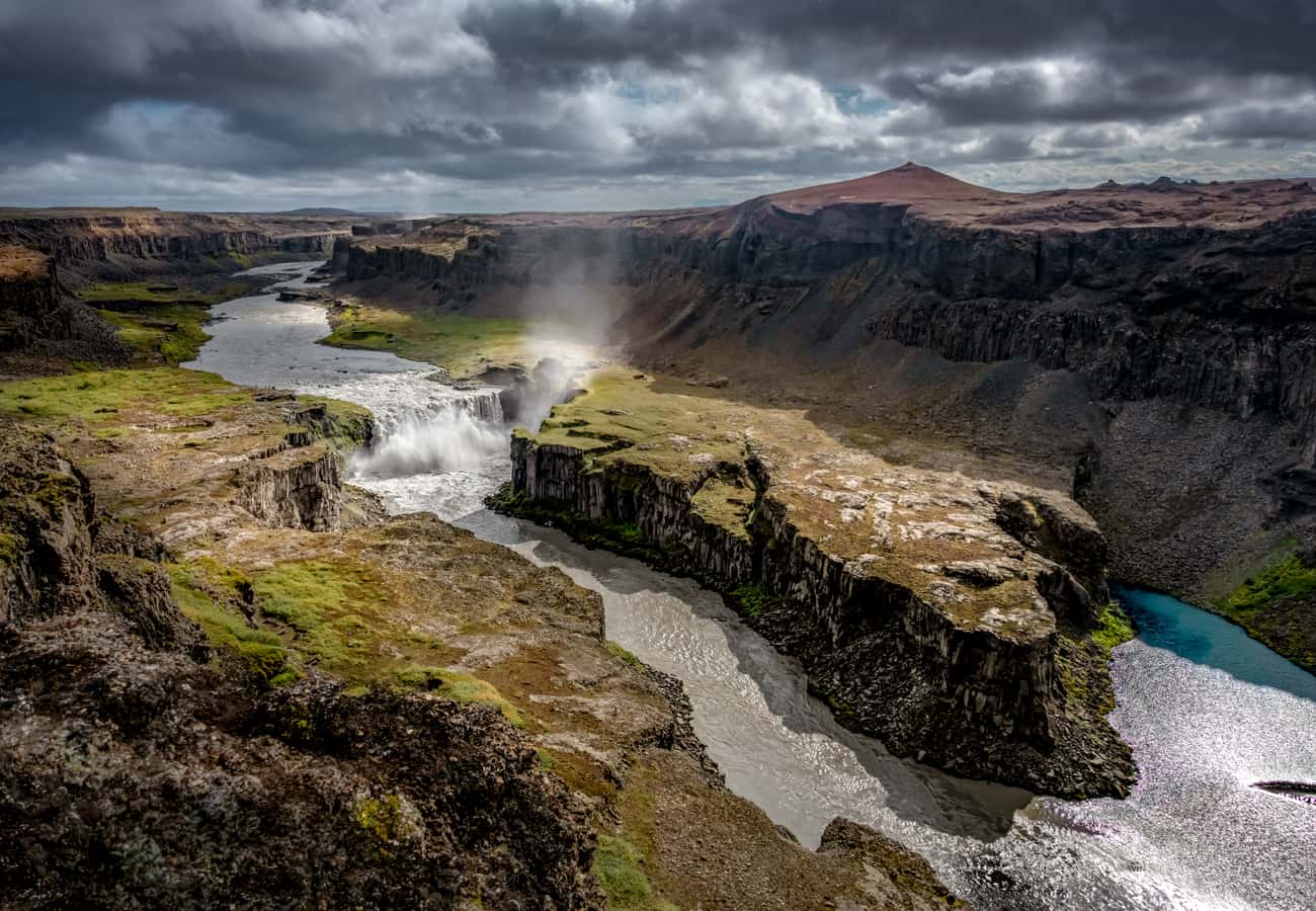 The massive glaciated canyon of Jökulsárgljúfur and cascading torrents of Hafragilsfoss.
Starting from the whale-watching capital of Húsavík on Skjálfandi Bay, the loop visits the horseshoe-shaped forested canyon of Ásbyrgi (legendary footprint of Odin’s eight-legged steed Sleipnir). From Ásbyrgi, the road heads south through Vatnajökull National Park to Dettifoss—the most powerful waterfall in Europe—where 500 cubic meters of glacier water per second plunge over a 45-meter cliff with earth-shaking force. The route concludes amid the boiling mud pools and pseudocraters of Lake Mývatn.
- Distance: 250 km (155 miles)
- Recommended Time: 2 to 3 days
- Best Season: June to September (road 864 to Dettifoss east is unpaved and winter-closed)
- Reddit Tip: Dettifoss can be viewed from both the west bank (Road 862, fully paved) and east bank (Road 864, rough gravel). The paved west bank is open longer and offers easier accessibility, while the east bank provides the rawest, closest perspective of the falls.
6. The Westfjords Way / Vestfirðir Loop (North-West Iceland)
For true wilderness seekers looking to escape tourist crowds, the remote Westfjords peninsula offers dramatic fjords, gravel mountain passes, and untouched subarctic wilderness.
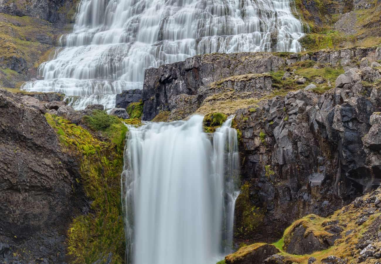 Dynjandi waterfall cascading 100 meters down tiered rock ledges like an immense bridal veil.
The crown jewel of the Westfjords is Dynjandi (Fjallfoss)—a 100-meter-tall waterfall that fans out from 30 meters wide at the top to 60 meters wide at the base like a cascading lace bridal veil. Further south, the sheer 14-kilometer sea cliffs of Látrabjarg mark Europe's westernmost point, home to millions of nesting Atlantic puffins, razorbills, and guillemots. Don't miss walking along the rare pink-and-golden sands of Rauðasandur beach.
- Distance: ~950 km (590 miles) full circuit
- Recommended Time: 4 to 6 days
- Best Season: June to August only (many passes are blocked by heavy snow in winter)
- Reddit Tip: A 4WD vehicle is highly recommended due to steep gravel mountain passes, blind switchbacks, and unpaved fjord sections.
7. The Arctic Coast Way / Norðurströnd (North Coast of Iceland)
Stretching 900 kilometers across Iceland’s northern coastline from Hvammstangi in the west to Bakkafjörður in the east, the Arctic Coast Way is an officially designated touring route that winds close to the Arctic Circle.
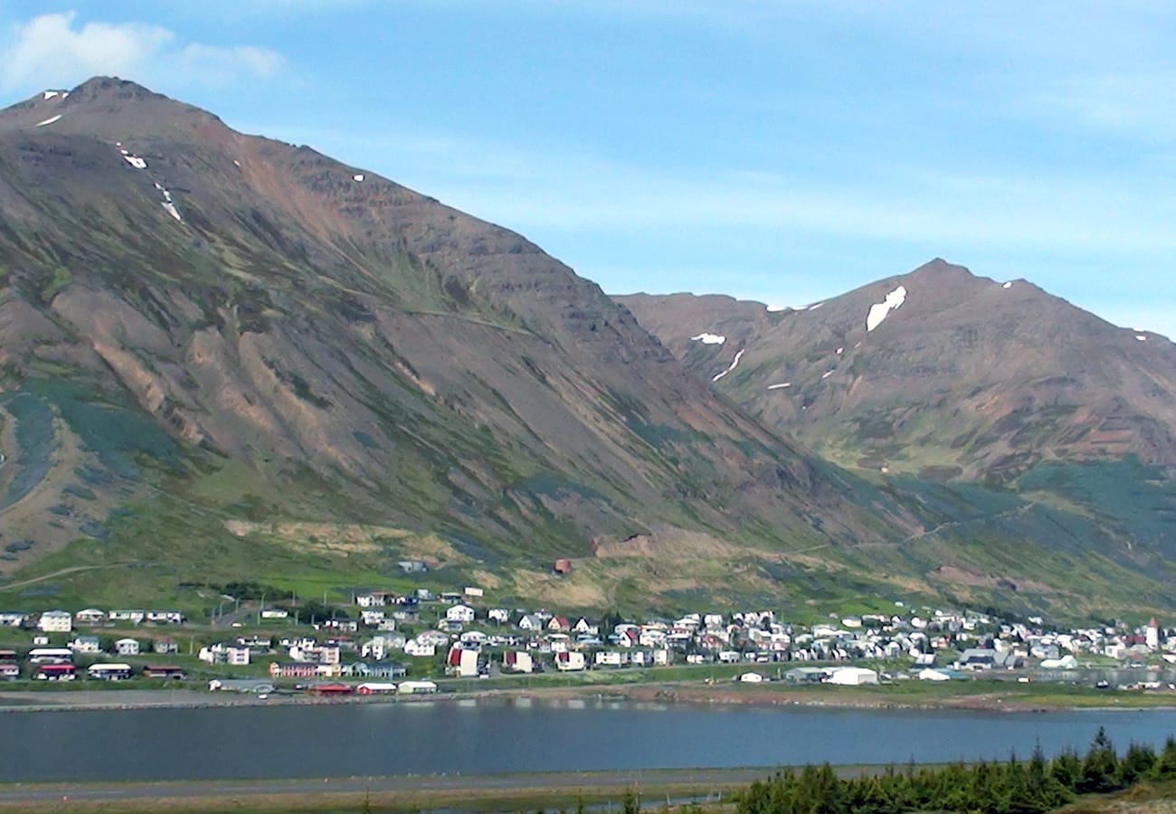 The picturesque historic herring fishing harbor of Siglufjörður surrounded by dramatic mountains.
The route hugs dramatic peninsulas, remote black sand headlands, and traditional fishing villages. A standout highlight is the drive around the mountainous Tröllaskagi Peninsula, where the highway traverses single-lane avalanche tunnels to reach the historic fjord village of Siglufjörður, home to the award-winning Herring Era Museum and geothermal beer spas in Árskógssandur.
- Distance: 900 km (560 miles)
- Recommended Time: 6 to 8 days
- Best Season: June to September
- Reddit Tip: Take a dip in the GeoSea geothermal sea baths in Húsavík, where warm mineral-rich ocean water fills infinity pools overlooking snow-dusted Arctic mountains.
8. Reykjanes Peninsula Volcanic Circuit (South-West Iceland)
Located immediately adjacent to Keflavík International Airport, the Reykjanes UNESCO Global Geopark is an active volcanic hotspot that serves as an ideal entry or departure road trip.
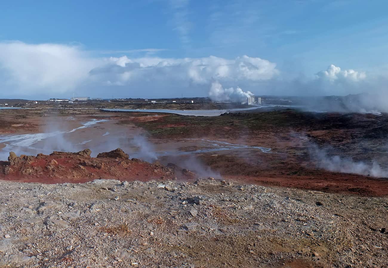 Steaming sulfuric fumaroles and mud caldrons at the Gunnuhver geothermal field on Reykjanes.
The peninsula is traversed by the Mid-Atlantic Ridge, where visitors can walk across the Bridge Between Continents spanning the expanding chasm between North America and Eurasia. Highlights include the steaming mud springs of Gunnuhver, the dramatic sea cliffs of Valahnúkamöl, the world-famous Blue Lagoon geothermal spa, and designated safe viewing vantage points overlooking the recent Fagradalsfjall and Sundhnúkur volcanic eruption fields.
- Distance: 150 km (93 miles) loop
- Recommended Time: Half to full day
- Best Season: Year-round
- Reddit Tip: Because Reykjanes is so close to Keflavík Airport, save this scenic drive for your arrival morning or your final afternoon before your outbound flight.
9. The Eastfjords Coastal Byways (Seyðisfjörður to Djúpivogur)
As Route 1 traverses eastern Iceland, winding coastal detours cut into ancient, glaciated fjords characterized by towering pyramid-shaped basalt mountains and peaceful artistic settlements.
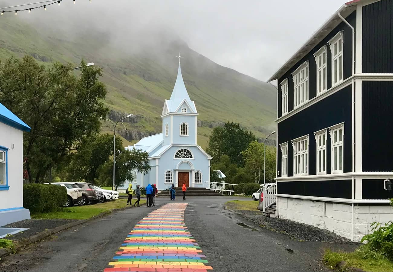 The picturesque blue church and vibrant rainbow-painted street of Seyðisfjörður in the Eastfjords.
From Egilsstaðir, Route 93 scales a high mountain pass before descending into the postcard-perfect harbor of Seyðisfjörður, famous for its pastel blue church, rainbow-painted street, and thriving community of artisans. North of Egilsstaðir, Borgarfjörður Eystri offers close encounters with nesting puffins at Hafnarhólmi harbor, while further south along Route 1, Djúpivogur features the unique coastal outdoor art installation "The Eggs of Merry Bay" (Eggin í Gleðivík).
- Distance: 250 km (155 miles) of coastal byways
- Recommended Time: 2 to 3 days
- Best Season: May to October
- Reddit Tip: Watch out for wild reindeer herds foraging along the coastal plains and mountainsides—the Eastfjords are the only region in Iceland where wild reindeer live.
10. The Landmannalaugar Highland Route / F208 (Fjallabak Nature Reserve)
For intrepid drivers seeking Iceland’s ultimate 4WD wilderness adventure, the highland route into Landmannalaugar reveals rainbow-colored rhyolite mountains and natural geothermal bathing rivers.
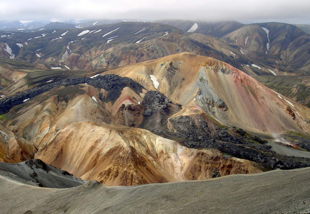 The surreal pastel pink, green, and ochre rhyolite peaks of Landmannalaugar in the southern Highlands.
Located in the Fjallabak Nature Reserve, the mountains glow in shades of ochre, pink, emerald green, and black obsidian lava. The northern approach via Road F208 / 26 is accessible to standard 4WD SUVs without deep river crossings, while the southern F208 is an advanced track crossing multiple unbridged glacial streams. After hiking the Brennisteinsalda lava loop, reward yourself by soaking in the natural geothermal hot river that flows directly past the mountain hut.
- Distance: 180 km (112 miles) round trip from Hella
- Recommended Time: Full day
- Best Season: Mid-June to mid-September only (highland F-roads are legally closed in winter and spring)
- Reddit Tip: Crossing unbridged rivers is strictly at your own risk; rental car insurance policies do not cover water damage from submerged vehicle engines. Inspect river depth on foot or watch a vehicle in front of you cross before attempting river fords.
Comparison of Iceland's Top Scenic Road Trips
| Road Trip Route | Region | Distance | Ideal Duration | Key Attraction | 4WD Needed? | Best Season |
|---|---|---|---|---|---|---|
| Ring Road (Route 1) | Entire Island | 1,322 km | 10–14 Days | Complete circuit & diverse biomes | Recommended | May – Sep |
| The Golden Circle | Southwest | 300 km | 1 Day | Þingvellir, Geysir & Gullfoss | No | Year-Round |
| Snæfellsnes Peninsula | West | 260 km | 2 Days | Kirkjufell & black pebble beaches | No | Year-Round |
| South Coast Drive | South | 380 km | 3–4 Days | Skógafoss, Vík & Jökulsárlón | No | Year-Round |
| The Diamond Circle | North | 250 km | 2–3 Days | Dettifoss, Húsavík & Ásbyrgi | Recommended | Jun – Sep |
| The Westfjords Way | Northwest | 950 km | 4–6 Days | Dynjandi waterfall & Látrabjarg | Yes | Jun – Aug |
| Arctic Coast Way | North Coast | 900 km | 6–8 Days | Siglufjörður & Tröllaskagi tunnels | Recommended | Jun – Sep |
| Reykjanes Peninsula | Southwest | 150 km | Half to Full Day | Volcanic fields & Bridge Between Continents | No | Year-Round |
| The Eastfjords | East | 250 km | 2–3 Days | Seyðisfjörður & wild reindeer | No | May – Oct |
| Landmannalaugar F208 | Highlands | 180 km | Full Day | Rainbow rhyolite peaks & hot springs | Mandatory | Jul – Sep |
Essential Tips for Driving in Iceland
- Monitor SafeTravel.is and Road.is Daily: Road conditions in Iceland change hour by hour due to gale-force winds, black ice, and blowing volcanic ash. Keep the SafeTravel Iceland app installed and heed all weather warnings.
- Understand F-Road Regulations: Roads designated with an "F" prefix (e.g., F208, F26) are rugged mountain tracks located in the interior highlands. It is illegal to drive a 2WD passenger car on F-roads; you must have an authorized 4WD vehicle.
- Beware of Wind Damaged Doors: Always hold car doors firmly with both hands when opening them. Icelandic wind gusts routinely tear doors completely off their hinges, resulting in non-insurable damages.
- Respect Subarctic Ecology: Never drive off marked roadways. Driving on delicate moss or volcanic gravel leaves scars that persist for centuries and incurs severe criminal fines.
Frequently Asked Questions
Which is better for a short trip: the Golden Circle or the Snæfellsnes Peninsula?
If you have only one day, the Golden Circle is the most efficient choice, offering dramatic geological icons (Þingvellir, Geysir, and Gullfoss) within 1.5 hours of Reykjavík. If you have two days, the Snæfellsnes Peninsula is overwhelmingly favored by Reddit travelers for its wilder coastal scenery, fewer tourist crowds, and diverse landscapes.
What is the best month to do a scenic road trip in Iceland?
For road trippers seeking open mountain passes, accessible hiking trails, and endless daylight, July and August offer the best driving conditions. For travelers hoping to combine scenic driving with the Northern Lights (Aurora Borealis), September and October provide the ideal balance of open roads and dark night skies.
Do I need a 4WD vehicle to explore Iceland?
For driving paved highways like the Golden Circle, Snæfellsnes Peninsula, South Coast, and the summer Ring Road, a standard 2WD car is entirely sufficient. However, if you travel in winter (November to April) or plan to visit the interior highlands (Landmannalaugar, Askja, or the remote Westfjords), a 4WD vehicle is legally required.
Related Travel Guides
Disclaimer
This article is for informational and educational purposes only. It does not constitute legal, financial, or professional advice. While we strive to provide accurate and up-to-date information, travel policies, regulations, and conditions change rapidly. Always verify information with official sources before making travel decisions. Nomad Lawyer makes no representations about the accuracy, reliability, completeness, or suitability of the information provided. Readers should consult qualified professionals for advice specific to their circumstances. The views expressed in this article are those of the author and do not necessarily reflect the views of Nomad Lawyer.
Raushan Kumar
Founder & Lead Developer
Full-stack developer with 11+ years of experience and a passionate traveller. Raushan built Nomad Lawyer from the ground up with a vision to create the best travel and law experience on the web.
Learn more about our team →