
Driving Canada's Dempster Highway: The 740-Kilometer Arctic Circle Road Trip to Inuvik and the Arctic Ocean

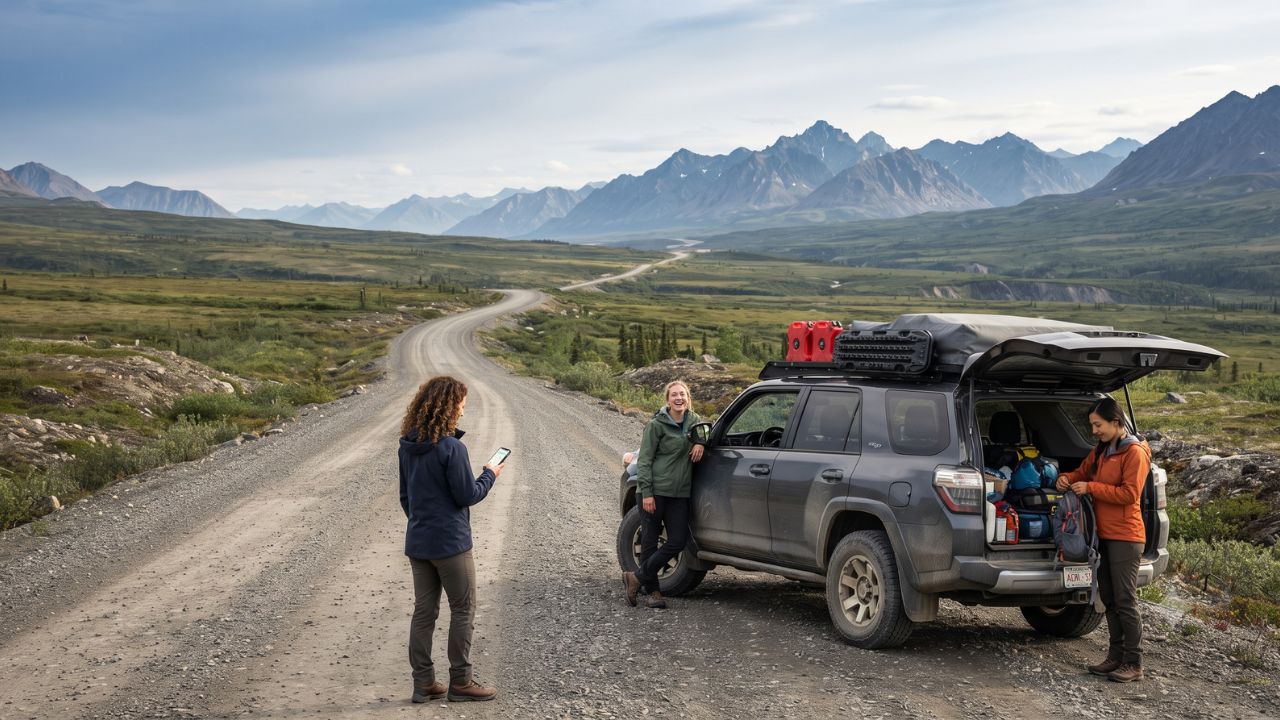
Built entirely on a thick gravel embankment over continuous permafrost to prevent the road from melting the frozen earth beneath it, the Dempster Highway is Canada's only public road crossing the Arctic Circle to reach the Arctic Ocean. Beginning 40 kilometers east of historic Dawson City and extending 740 kilometers north through the subarctic tundra of the Yukon and Northwest Territories, this remote overland corridor offers intrepid road-trippers an expedition through the ancestral territories of the Tr'ondëk Hwëch'in, across the jagged Ogilvie and Richardson Mountains, and into the northern delta hubs of Inuvik and Tuktoyaktuk.
With the governments of Yukon and Canada integrating the highway into the Yukon Resource Gateway initiative to upgrade roadbed stability, bridge culverts, and emergency satellite communications, the Dempster is entering an era of improved accessibility. However, crossing 370-kilometer stretches without a single gas station, cellular tower, or grocery store demands meticulous vehicular preparation, mechanical self-reliance, and deep respect for the fragile Arctic ecology.
Expedition Blueprint: Route Segments, Kilometre Markers, and Fuel Waypoints
The 740-kilometer journey traverses 465 kilometers of Yukon territory before crossing the continental divide into the Northwest Territories. Driving the Dempster is an exercise in distance management, where fuel stops must be calculated around sparse northern settlements.
Dempster Highway Expedition Waypoints and Service Matrix
| Route Waypoint | Kilometre Marker | Elevation / Geography | Available Services | Key Cultural & Natural Highlights |
|---|---|---|---|---|
| Klondike Highway Junction | Km 0.0 | 40 km East of Dawson City | Nil (Last Fuel in Dawson) | Southern Gateway & Highway Entry Point |
| Tombstone Interpretive Centre | Km 71.5 | Ogilvie Mountains / Tundra (1,050 m) | Info, Hiking Maps, Water, Campground | Tr'ondëk Hwëch'in Heritage & Grizzly Valley Trailheads |
| Two Moose Lake & Engineer Creek | Km 102 – Km 194 | Wetlands & Mineral Springs | Rustic Pull-Offs / Rest Stops | Moose Grazing Grounds & Dall Sheep Mineral Licks |
| Eagle Plains Hotel & Services | Km 369.0 | Rolling Tundra Ridge (710 m) | Fuel (Gas/Diesel), Hotel, Repairs, Dining | Sole Service Station on the 370 km Wilderness Gap |
| Arctic Circle Monument | Km 405.0 | Latitude 66°33′N | Scenic Viewpoint / Parking Area | Midnight Sun Panorama & Official Arctic Entry Point |
| Yukon / NWT Border | Km 465.0 | Richardson Mountains (Pass: 780 m) | Time Zone Boundary (PST to MST) | Subarctic Alpine Divide & Tundra Vistas |
| Fort McPherson (Peel River) | Km 550.0 | Gwich'in Community | Fuel, Groceries, Cable Ferry Crossing | Gwich'in Canvas Tent Crafts & Northern History |
| Tsiigehtchic (Mackenzie River) | Km 608.0 | Confluence of Arctic Red River | Cable Ferry / Community Store | Confluence Ferry Link & Church Architecture |
| Inuvik (NWT) | Km 740.0 | Mackenzie Delta Hub | Full Urban Services, Airport, Lodging | End of Dempster; Access to Tuktoyaktuk Highway |
Motorists must consult the official 511 Yukon road conditions network before departure. Because the highway is composed of crushed shale and gravel that turns slick during summer rainstorms and freezes during autumn blizzards, checking live maintenance advisories from Travel Yukon is mandatory prior to leaving Dawson City.
What Makes the Dempster Highway Experientially Unique
Driving above the 66th parallel presents sensory and cultural encounters unavailable on conventional paved highways:
- Tombstone Territorial Park and Tr'ondëk-Klondike: Located at Kilometre 71.5 (a 1.5-hour drive from Dawson City), the Tombstone Interpretive Centre serves as the cultural gateway to the traditional territory of the Tr'ondëk Hwëch'in, whose ancestral homeland is inscribed on the UNESCO World Heritage List. Towering granite monadnocks like Tombstone Mountain rise dramatically above black spruce taiga and golden dwarf birch tundra.
- The Richardson Mountains and Wind River Valley: As the road climbs through the Ogilvie and Richardson ranges, travelers cross the traditional hunting territories of the Porcupine Caribou herd. In late August and September, the entire tundra transforms into vivid crimson, copper, and gold foliage under the glow of the Northern Lights.
- Cable Ferry River Crossings: Reaching the Northwest Territories requires crossing the Peel River at Fort McPherson and the massive Mackenzie River at Tsiigehtchic aboard free seasonal cable ferries operating between late May and late October (converting to ice bridges in mid-winter).
Visitor Insider Tips: Preparing Your Vehicle for the Arctic
The Dempster's sharp crushed-shale surface is notoriously unforgiving on tires and windshields. Navigating the corridor successfully requires strict mechanical precautions outlined by Spectacular Northwest Territories:
- Carry Two Full-Sized Mounted Spare Tires: Standard highway tires easily puncture on sharp shale. Fit your vehicle with heavy-duty 10-ply all-terrain (A/T) tires, bring a functional tire plug kit, a 12-volt portable air compressor, and ensure your jack operates on uneven gravel shoulders.
- Respect the 370-Kilometre Fuel Window: Always top your gas tank to 100% capacity at the Klondike junction or Dawson City before heading north. Eagle Plains at Km 369 is the only commercial fuel stop before Fort McPherson at Km 550. Carrying a certified 20-liter emergency jerrycan of fuel provides peace of mind.
- Equip Satellite Emergency Devices: Cellular service disappears completely after leaving Dawson City and does not return until Inuvik, with only localized Wi-Fi available at Eagle Plains. Bring a two-way satellite communicator (such as Garmin inReach or ZOLEO) for emergency road dispatch.
- Protect Radiator and Headlights: Install a mesh bug and gravel guard over your front grille to prevent flying rocks from puncturing transmission coolers or cracking headlights when passing heavy transport trucks.
- Time Your Drive for the Golden Autumn Window: The optimal window for driving the Dempster runs from 15 August to 10 September. Biting tundra mosquitoes subside, daytime temperatures remain moderate (10°C to 16°C), alpine foliage peaks in vibrant color, and autumn auroras illuminate the night sky.
Cultural and Environmental Context: Permafrost Protection and Indigenous Lands
The engineering of the Dempster Highway is a triumph of cold-climate civil design. Rather than excavating into the fragile permafrost—which would trigger massive ground subsidence, sinkholes, and thermal erosion—builders laid a continuous structural gravel berm up to two meters deep directly over the frozen soil, insulating the ground below.
For the Tr'ondëk Hwëch'in and Gwich'in First Nations, the tundra is not an empty wilderness, but a sacred food basket and ancestral homeland. Seasonal hunting of caribou, moose, and waterfowl sustains local northern food security. Visitors are strictly required to stay on designated trails within Tombstone Territorial Park to prevent destroying delicate lichen mats that take over 50 years to recover from vehicular tire scarring.
FAQ: Driving the Dempster Highway 2026
What type of vehicle is needed to drive the Dempster Highway? While a high-clearance 4x4 SUV or all-wheel-drive truck equipped with 10-ply all-terrain tires is strongly recommended, any well-maintained vehicle with adequate ground clearance can complete the journey during dry summer conditions.
Can electric vehicles (EVs) drive the Dempster Highway? While Yukon's public charging network has expanded to Mayo, Pelly Crossing, and Ross River, the Dempster corridor lacks continuous EV charging infrastructure. EV drivers must confirm off-grid charging logistics before attempting the route.
When are the Peel and Mackenzie River ferries operational? The free vehicle ferries operate daily from late spring (late May) until autumn freeze-up (late October). During freeze-up and spring breakup, the highway closes for several weeks until ice bridges form.
Do you need a permit to drive the Dempster Highway? No highway permits or tolls are required to drive the Dempster Highway. However, backcountry camping within Tombstone Territorial Park requires a designated permit from Yukon Parks.
Related Travel Guides
- Yukon Golden Circle Road Trip: Klondike Gold Rush History and Dawson City Itinerary
- Arctic Canada Overland Packing and Wilderness Emergency Preparedness Guide
- Official Travel Yukon Wilderness Safety and Road Conditions Portal
Where the gravel road crests the Richardson Mountains under the Arctic midnight sun, the Dempster Highway proves that the greatest journeys are defined not by the destination, but by the wilderness in between.
Disclaimer
This article is for informational and educational purposes only. It does not constitute legal, financial, or professional advice. While we strive to provide accurate and up-to-date information, travel policies, regulations, and conditions change rapidly. Always verify information with official sources before making travel decisions. Nomad Lawyer makes no representations about the accuracy, reliability, completeness, or suitability of the information provided. Readers should consult qualified professionals for advice specific to their circumstances. The views expressed in this article are those of the author and do not necessarily reflect the views of Nomad Lawyer.
Kunal K Choudhary
Co-Founder & Contributor
A passionate traveller and tech enthusiast. Kunal contributes to the vision and growth of Nomad Lawyer, bringing fresh perspectives and driving the community forward.
Learn more about our team →