Wisconsin State Scenic Trail Connects Madison's Dual Park Loop
Military Ridge State Trail delivers miles of pristine cycling terrain across Wisconsin state scenic destinations in 2026, linking two major state parks near Madison for adventure travelers.
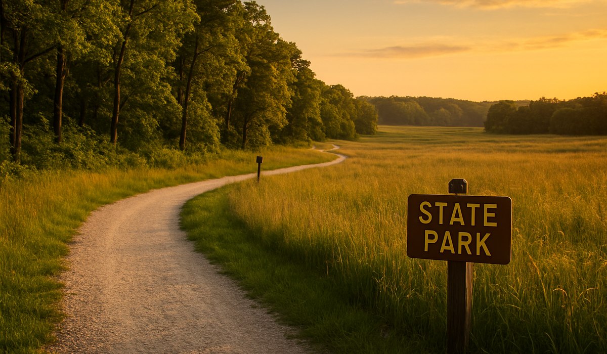
Image generated by AI
Military Ridge State Trail: Wisconsin's Premier Rail-Trail Experience
Military Ridge State Trail stands as one of Wisconsin's most celebrated wisconsin state scenic destinations, stretching across pristine countryside between two exceptional state parks near Madison. This former railroad corridor has been transformed into a world-class multi-use pathway, attracting remote workers, digital nomads, and leisure cyclists seeking authentic outdoor experiences. The trail's transformation from abandoned rail line to recreational treasure represents a growing trend of converting historic transportation corridors into accessible natural corridors for modern travelers.
Military Ridge State Trail Overview
The Military Ridge State Trail spans approximately 40 miles of continuous, well-maintained cycling and hiking pathway through south-central Wisconsin. This wisconsin state scenic route begins at Dodgeville and extends to Fitchburg, passing through rolling prairie landscapes, dense woodlands, and charming small communities. The trail accommodates cyclists of all skill levels, with gentle grades and consistent surface conditions making it accessible for families and experienced riders alike.
The trail's designation as a rails-to-trails conversion means users benefit from the historic railroad bed's engineering—minimal elevation changes and strategic routing through stunning natural areas. Digital nomads appreciate the trail's proximity to Madison's amenities while offering escape from urban settings. The entire route can be completed in a single day or broken into multiple cycling adventures throughout the season.
What to Expect: Terrain and Distance
This wisconsin state scenic pathway features remarkably consistent terrain characteristics across its 40-mile length. Riders encounter predominantly flat-to-rolling landscapes with occasional gentle climbs that rarely exceed 100 feet in elevation gain. The surface composition varies between packed limestone, crushed stone, and asphalt sections, with limestone dominating the majority of the route.
Trail conditions remain excellent year-round due to professional maintenance standards. Summer riding offers full canopy coverage through forested sections, while spring and fall provide spectacular seasonal foliage displays. Winter users should anticipate potential snow coverage and adjust equipment accordingly. The trail's width accommodates two-way traffic comfortably, with designated rest areas occurring every 5-10 miles. Most cyclists complete the entire route in 4-6 hours, depending on pace and photo stops along the scenic vistas.
State Parks Along the Route
The trail connects Tower Hill State Park and Cam Rock Cave State Park, anchoring the Wisconsin state scenic experience at both terminus points. Tower Hill State Park offers historic limestone tower structures, scenic overlooks, and riverfront picnic areas overlooking the Sugar River valley. This park serves as an excellent starting point with full visitor facilities including parking, water stations, and interpretive signage explaining the region's geological and cultural heritage.
The opposite terminus near Fitchburg provides access to additional recreational infrastructure and Madison's broader outdoor network. Cam Rock Cave presents underground geological formations and cool microclimates that offer respite during warm weather cycling. Both parks maintain visitor centers, restroom facilities, and educational programs explaining the Military Ridge region's significance to Wisconsin's natural and human history. Park passes are available through the Wisconsin Department of Natural Resources website.
Best Time to Visit and Planning Your Trip
Cycling season peaks from May through October, with June and September offering ideal temperature ranges and minimal precipitation. The wisconsin state scenic trail experiences heaviest usage during summer weekends, so weekday visits provide solitude and superior photo opportunities. Spring conditions bring wildflower displays and active wildlife viewing, though trail sections near streams may remain muddy through early May.
Fall foliage reaches peak saturation between mid-September and early October, transforming the corridor into a photographer's paradise. Winter cycling requires appropriate fat-bike or hybrid equipment, with trail conditions dependent on recent snow management. Plan your visit by consulting the Wisconsin Department of Natural Resources trail conditions hotline and downloading offline maps for cellular coverage gaps. Bring adequate water, sun protection, and mechanical repair supplies, as some trail sections pass through areas with limited commercial services.
How to Book the Best Fare
Trail access requires no booking or fees, maintaining the spirit of public recreation throughout Wisconsin's state system. However, lodging near the wisconsin state scenic trail benefits from advance reservations during peak seasons. Many Madison-area hotels offer bike-friendly accommodations and shuttle services to trail trailheads. Digital platforms like Airbnb and Booking.com provide filtering options for cycle-friendly properties within 15 minutes of trail access points.
For comprehensive trip planning, the Wisconsin Department of Natural Resources maintains an official Military Ridge State Trail guide with detailed maps, facility information, and seasonal updates. Group cycling packages through local outfitters often include guides, meals, and logistical support for travelers preferring structured experiences. Consider purchasing a Wisconsin State Parks annual pass ($35) for unlimited access to facilities across the system if planning multiple visits.
| Feature | Details |
|---|---|
| Total Distance | 40 miles Dodgeville to Fitchburg |
| Surface Type | Limestone, crushed stone, asphalt mix |
| Elevation Gain | Minimal; rarely exceeds 100 feet |
| Season | Year-round; peak May–October |
| Difficulty Level | Beginner to intermediate |
| Parking | Multiple lots at trailheads and parks |
| Water/Restrooms | Available every 5–10 miles |
| State Park Fee | No trail access fee required |
| Nearest City | Madison (30 miles north) |
| Equipment Needed | Road/hybrid bike; summer: water bottle |
What This Means for Travelers
The Military Ridge wisconsin state scenic trail delivers substantial benefits for both short-term visitors and extended-stay digital nomads:
-
Flexible Daily Routing — Break the 40-mile route into manageable 10-15 mile daily segments, allowing time for state park exploration and Madison day trips.
-
Remote Work Access — Madison's internet infrastructure supports full digital nomad operations while trail proximity provides daily exercise and nature immersion between work sessions.
-
Seasonal Flexibility — Visit during off-peak months (March, April, November) for solitude while maintaining excellent trail conditions and lower accommodation rates.
-
Gateway to Wisconsin Outdoor Culture — The trail connects broader cycling networks extending throughout south-central Wisconsin, enabling multi-week cycling adventures combining rail-trails with regional attractions.
-
Family Travel Integration — Gradual terrain and multiple exit points accommodate varying fitness levels, enabling multi-generational travel planning without compromise.
FAQ
What is the best starting point for first-time visitors to Military Ridge State Trail? Tower Hill State Park near Dodgeville offers comprehensive visitor facilities, parking, and interpretive programs ideal for orientation. The park's overlook provides stunning views explaining the trail's geological context, making it the logical beginning point for most cyclists.
Can I rent bicycles near Military Ridge State Trail? Multiple cycle shops in Madison and Dodgeville offer hourly and daily rental equipment. Contact the Dodgeville Chamber of Commerce for current vendor listings and reservation procedures. Most rental shops provide basic repair kits and trail maps with equipment.
Are there lodging options directly on the Military Ridge State Trail route? Small communities including Barneveld and Black Earth offer modest lodging within 1-2 miles of the trail corridor. Madison provides comprehensive hotel, hostel, and vacation rental inventory within 30 minutes of both trailheads, offering greater choice and amenities.
What should I bring for a full-day Military Ridge State Trail cycling adventure? Essential items include water bottles (minimum two quarts), sun protection, basic bike repair tools, snacks, and a charged mobile device. Helmet use is strongly recommended. Download offline maps before departing populated areas, as cellular coverage becomes intermittent along portions of the route.
Related Travel Guides
Disclaimer
This article is for informational and educational purposes only. It does not constitute legal, financial, or professional advice. While we strive to provide accurate and up-to-date information, travel policies, regulations, and conditions change rapidly. Always verify information with official sources before making travel decisions. Nomad Lawyer makes no representations about the accuracy, reliability, completeness, or suitability of the information provided. Readers should consult qualified professionals for advice specific to their circumstances. The views expressed in this article are those of the author and do not necessarily reflect the views of Nomad Lawyer.

Preeti Gunjan
Contributor & Community Manager
A passionate traveller and community builder. Preeti helps grow the Nomad Lawyer community, fostering engagement and bringing the reader experience to life.
Learn more about our team →