
America's Mountain Parklands Confront Stricter Access Rules: From Glacier's 50-Mile Corridor to Smoky Ridge Trails

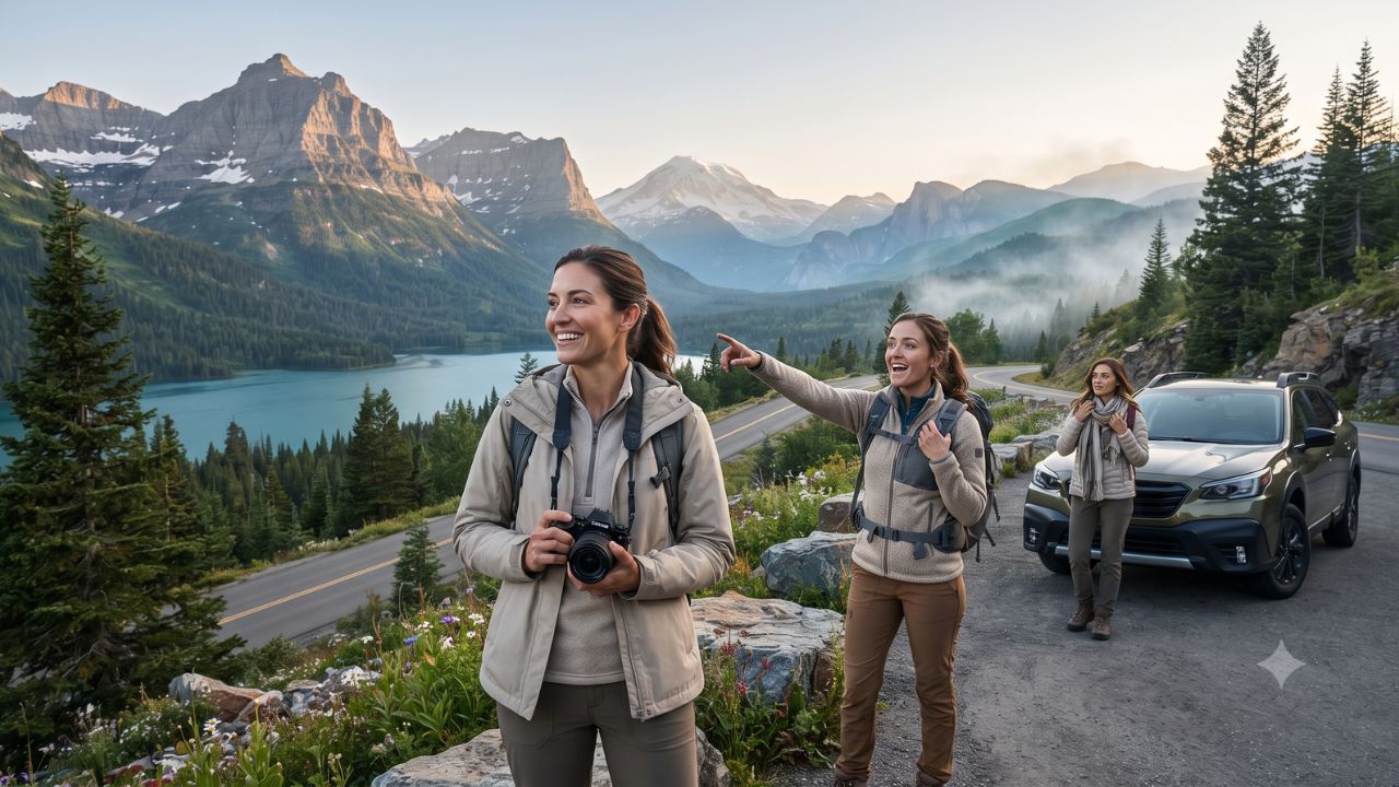
Across more than 800 miles of maintained trails in the Great Smoky Mountains and 105 miles of continuous ridge driving along Shenandoah's Skyline Drive, America's mountain parklands are undergoing a fundamental transformation in visitor access management. With vehicle reservation mandates governing 50 miles of Montana's Going-to-the-Sun Road and late-lingering winter snow blocking Cascade Canyon footpaths into late July, high-altitude recreation across the United States now demands rigorous logistical planning rather than spontaneous road-tripping.
From the ancient, mist-draped ridges of the southern Appalachians to the glaciated volcanic massifs of the Pacific Northwest and the colossal scale of Alaska's Wrangell-St. Elias National Park, federal land managers are confronting record visitation. Administered by the National Park Service (NPS), these alpine sanctuaries showcase starkly distinct geologies, microclimates, and regional identities. Yet as visitor numbers expand, travelers must balance environmental preservation against escalating regulatory barriers, timed permits, and narrowing seasonal operational windows.
Glacier and Grand Teton: High-Elevation Chokepoints and Vehicle Reservations
In Montana, Glacier National Park represents both the crown of northern alpine touring and the testing ground for federal crowd-mitigation policy. The park's central artery, Going-to-the-Sun Road, spans more than 50 miles across the Continental Divide, connecting West Glacier to St. Mary across sheer rock walls, alpine cirques, and turquoise glacial lakes. Engineered in the 1930s, this historic route was never designed for modern vehicle volumes. To prevent severe traffic gridlock and protect fragile subalpine tundra, park authorities enforce strict vehicle reservations in designated high-demand sectors during peak summer months.
Travelers without advance entry slots must rely on regional shuttle transit, enter outside controlled daytime hours, or pivot toward secondary entrances. Beyond vehicle controls, Glacier requires distinct preparation for trail access: while casual visitors can complete low-elevation shoreline strolls, longer backcountry expeditions demand certified wilderness permits and bear safety gear.
Southward in Wyoming, Grand Teton National Park presents a dramatic contrast where flat sagebrush plains terminate abruptly at the foot of vertical, jagged granite spires. The Teton Range offers rapid access to rugged backcountry, with routes like Cascade Canyon drawing heavy foot traffic between Jenny Lake and high-altitude cirques. However, seasonal reality often surprises unwary visitors: high alpine trails routinely remain buried under deep snow through late July, requiring mountaineering ice axes and crampons long after summer tourism starts in the valley.
Logistically, Grand Teton operates in direct symbiosis with the gateway town of Jackson. While Jackson provides commercial hospitality, luxury resorts, and airport connectivity, its lodging rates rank among the highest in North America, forcing budget-conscious road-trippers to compete for limited national forest campsites or drive long distances from peripheral Wyoming towns.
Washington Volcanoes and Sierra Granite: Ephemeral Alpine Operational Windows
In the Pacific Northwest, Mount Rainier in Washington State asserts itself not merely as an isolated peak, but as an active, heavily glaciated stratovolcano that anchors an entire ecological system. The national park transitions across elevation zones, beginning in ancient old-growth temperate rainforests before rising into subalpine wildflower fields and permanent ice fields.
Visitor traffic concentrates within two primary high-elevation hubs: Paradise on the southern slopes, celebrated for sweeping views and trailheads leading toward high climbing routes, and Sunrise on the northeast shoulder, the park's highest vehicle-accessible point. Because Pacific maritime snowstorms deposit enormous snowpacks, Sunrise and upper road segments operate on a severely truncated calendar, often opening only in late June or early July and closing at the first heavy autumn snowfall in October. Drivers must consistently monitor road alerts, as abrupt weather fronts can shutter major corridors with little advance warning.
Down the Pacific coast, Yosemite National Park in California illustrates the sharp divide between overcrowded valley floors and remote alpine plateaus. While Yosemite Valley absorbs the vast majority of day-use crowds beneath granite monoliths, Tuolumne Meadows in the high Sierra Nevada presents a sprawling, open expanse shaped by glacial action and crossed by the winding Tuolumne River. Flanked by massive granite domes and jagged ridgelines, this subalpine high country provides access to premier wilderness trails.
Yet Tuolumne Meadows remains one of the most operationally constrained mountain zones in the park system. Because Tioga Road crosses passes exceeding 9,900 feet, winter snow closures typically seal off the high country from November until late May or June. Services, campgrounds, and rustic lodging in Tuolumne operate on brief summer timetables, requiring visitors to time excursions to an eight-to-ten-week window.
Appalachian Mist to Alaskan Wilderness: Trail Networks and Route Infrastructure
In the eastern United States, Great Smoky Mountains National Park straddles the border of Tennessee and North Carolina, offering a vastly different mountain character defined by ancient, weathered ridgelines, dense deciduous forests, and pervasive blue atmospheric haze. Containing more than 800 miles of maintained hiking trails, the Smokies stand as the most heavily visited national park in the country.
Autumn creates an intense tourism influx. Across several weeks from late September through early November, brilliant foliage displays cascade down from high peaks into deep hollows. Popular driving routes such as the 11-mile historic loop at Cades Cove experience severe vehicle slowdowns, with October marking the peak operational strain of the year. To manage parking congestion, park authorities mandate parking tags for all vehicles staying longer than fifteen minutes, a regulatory measure intended to fund trail repairs and maintain aging infrastructure.
Further north along Virginia's Blue Ridge, Shenandoah National Park delivers accessible mountain exploration via Skyline Drive, a 105-mile scenic highway traversing the spine of the mountains with panoramic views overlooking the Shenandoah Valley to the west and the Piedmont region to the east. Designed specifically for low-speed touring, Skyline Drive provides dozens of scenic overlooks and intersects directly with the Appalachian Trail, catering to travelers seeking scenic motoring without rigorous backcountry treks.
At the far geographical extreme, Wrangell-St. Elias National Park and Preserve in Alaska stands as the single largest national park in the United States, spanning 13.2 million acres of glaciated ranges, active volcanoes, and historic copper mining heritage at Kennecott. Unlike paved lower-48 routes, accessing Wrangell-St. Elias requires driving rugged gravel corridors or chartering bush planes, representing a true wilderness frontier where travelers must maintain absolute self-sufficiency. From Colorado's high sand dunes sheltered beneath towering peaks to Alaska's glacial expanses, America's mountain regions require tailored operational strategies.
Mountain Parklands Operational and Access Matrix
To assist travelers in evaluating regulatory frameworks, seasonal windows, and road corridors, the following comparison synthesizes logistical baselines across these primary alpine regions:
| Mountain Park & State | Primary Driving Corridor or Landmark | Main Footpath or Backcountry Highlight | Key Environmental & Seasonal Constraints | Access Permitting & Transit Framework |
|---|---|---|---|---|
| Glacier National Park (Montana) | Going-to-the-Sun Road (50+ miles) | Highline Trail & Grinnell Glacier Footpaths | Severe snowpack; upper road typically open late June to mid-October | Vehicle reservation system in peak hours; public shuttle system |
| Grand Teton National Park (Wyoming) | Teton Park Road & Outer Highway Corridors | Cascade Canyon & Paintbrush Divide Routes | Snow persists on high-elevation passes through late July | Standard park entrance pass; costly gateway lodging in Jackson |
| Mount Rainier National Park (Washington) | Paradise & Sunrise Access Corridors | Skyline Trail & Wonderland Trail System | Glacial volcano weather; Sunrise road closes early autumn | Timed-entry reservation pilots; strict chains and road checks |
| Yosemite National Park (California) | Tioga Road across Tuolumne Meadows | Cathedral Lakes & Lembert Dome Ascents | Subalpine passes shut by snow November to early summer | Seasonal valley/highway reservation controls; limited high-country beds |
| Great Smoky Mountains (Tennessee/NC) | Newfound Gap Road & Cades Cove Loop | Over 800 miles of trails, including Appalachian Trail | October autumn foliage peaks bring extreme vehicle gridlock | Mandatory paid parking tag system; no general entrance gate fee |
| Shenandoah National Park (Virginia) | Skyline Drive (105 miles along Blue Ridge crest) | Old Rag Mountain & Dark Hollow Falls | Dense fog, ice events, and autumn foliage slowdowns | Day-use entrance fee; day-use ticket required for Old Rag scramble |
| Wrangell-St. Elias (Alaska) | McCarthy Road (59-mile unpaved gravel corridor) | Root Glacier Treks & Kennecott Mining Ruins | Remote subarctic wilderness; limited towing and services | Zero entrance fee; high private transport, bush plane, and tire costs |
Expert Analysis: The Economics of Timed Entry, Gateway Real Estate, and Conservation Bottlenecks
The structural evolution of mountain travel in the United States demonstrates a decisive transition from open-access recreation to regulated capacity management. As post-pandemic domestic travel collided with deferred highway maintenance and ecological erosion, the U.S. Department of the Interior accelerated the deployment of digital reservation systems administered through Recreation.gov.
For travelers booking this route, the direct consequence is that vacation spontaneousness has been effectively replaced by rigid pre-trip scheduling, where missing an online permit release window by mere minutes can lock a family out of marquee driving corridors like Going-to-the-Sun Road or Sunrise at Mount Rainier. This structural friction forces travelers to design entire itineraries around permit availability rather than personal preference, turning permits into the primary constraint of western road trips.
The pricing pressure this creates means that gateway communities immediately adjacent to national park boundaries—such as Jackson, Wyoming; Whitefish, Montana; and Gatlinburg, Tennessee—capture immense real estate and lodging premiums. With daily hotel rates in peak season frequently exceeding $450 to $700 per night near park entrances, visitors face a stark economic trade-off: pay premium prices for proximity, or accept two-hour daily commutes from distant peripheral towns. These extended commutes, in turn, increase morning entrance gate queues and generate regional highway congestion.
Additionally, dynamic access regulations reflect a permanent conservation imperative. Fragile alpine environments—from subalpine meadows in Yosemite to lichen-rich tundra in Glacier—cannot withstand unmanaged foot and vehicle traffic without suffering irreversible erosion. By shifting visitor streams toward public shuttles, timed entry slots, and peripheral trailheads, federal land managers are establishing a durable operational model designed to protect irreplaceable mountain resources for future generations.
Key Takeaways
- Permit-Centric Logistics: Marquee mountain routes, including Glacier's 50-mile Going-to-the-Sun Road and select corridors at Mount Rainier, require advance vehicle reservations during peak summer periods.
- Narrow Alpine Windows: High-altitude passes and trailheads in Yosemite's Tuolumne Meadows and Grand Teton's Cascade Canyon often remain snowbound until late June or late July.
- East Coast Autumn Congestion: Great Smoky Mountains National Park, featuring over 800 miles of trails, and Shenandoah's 105-mile Skyline Drive face extreme visitor volume during October foliage season.
- Mandatory Parking Tags: Great Smoky Mountains National Park enforces paid parking tags for all vehicle stops exceeding 15 minutes to generate revenue for trail and facility maintenance.
- Gateway Town Lodging Premiums: Constrained accommodation inventory in towns like Jackson, Wyoming, drives elevated average daily room rates, requiring advance lodging reservations.
FAQ: United States Mountain Park Travel 2026
Do I need a vehicle reservation to drive Glacier National Park's Going-to-the-Sun Road?
Yes. During peak summer months, vehicle reservations are required for designated sectors of Going-to-the-Sun Road between morning and late afternoon, unless you enter outside restricted hours or hold commercial tour bookings.
When do high-altitude hiking trails clear of snow in Grand Teton National Park?
High-elevation mountain passes and trails like Cascade Canyon frequently retain heavy snowpack through late July. Hikers tackling upper routes in early summer should carry traction devices and verify current trail reports.
Are there entrance fees for Great Smoky Mountains National Park?
Great Smoky Mountains National Park charges no general entrance fee, but all visitors parking a vehicle for longer than 15 minutes must purchase and display a valid daily, weekly, or annual parking tag.
How long does it take to drive Shenandoah's Skyline Drive?
Skyline Drive covers 105 miles with a strictly enforced 35 mph speed limit. Driving the full length typically requires three to four hours without stops, or a full day when pausing at scenic overlooks.
[In the high country of the American wilderness, the ultimate luxury is no longer speed, but the foresight to secure your passage before the season turns.]
Related Travel Guides
- South Beach Seafood Festival 2026: Miami Beach Unveils 14th Edition with Stone Crab and Chef Showdowns
- US Airlines Navigate Saudi Airspace Risks: FAA Warning and Riyadh Strike Halt Delta Route Across 10 State Hubs
- Mauritius Lifts Overnight Curfew as US, UK, and Canada Issue Fresh Travel Warnings Over Civil Unrest
Disclaimer
This article is for informational and educational purposes only. It does not constitute legal, financial, or professional advice. While we strive to provide accurate and up-to-date information, travel policies, regulations, and conditions change rapidly. Always verify information with official sources before making travel decisions. Nomad Lawyer makes no representations about the accuracy, reliability, completeness, or suitability of the information provided. Readers should consult qualified professionals for advice specific to their circumstances. The views expressed in this article are those of the author and do not necessarily reflect the views of Nomad Lawyer.
Kunal K Choudhary
Co-Founder & Contributor
A passionate traveller and tech enthusiast. Kunal contributes to the vision and growth of Nomad Lawyer, bringing fresh perspectives and driving the community forward.
Learn more about our team →