United States Issues Urgent Mountain Advisory as Late-Season Winter Storm Hammers Cascade Range and Glacier National Park: New Travel Alert
An unexpected late-season winter storm hits high-altitude corridors in Oregon, Washington, and Montana, bringing up to 18 inches of snow and hazardous road conditions.
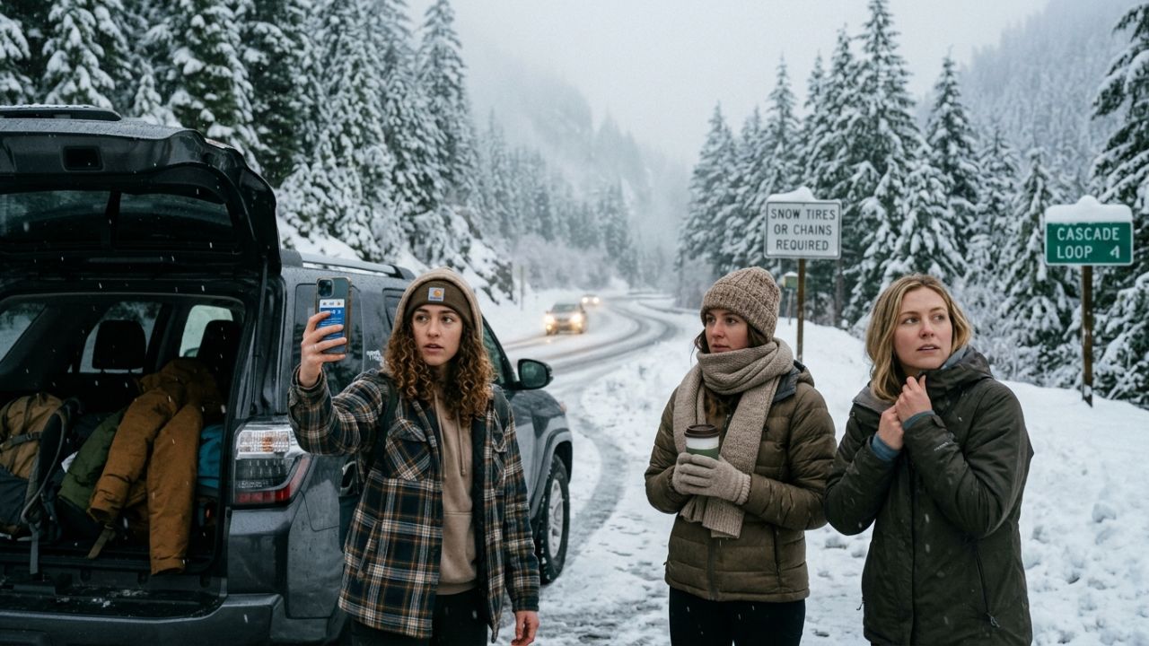
Image generated by AI
A major weather alert has been issued for the Pacific Northwest and northern Rockies today, as an unexpected late-season winter storm brings heavy snow and freezing conditions to key mountain corridors. The U.S. National Weather Service (NWS) has released urgent winter weather advisories for high-altitude zones in Oregon, Washington, and Montana. The unseasonable storm has caught spring hikers and national park visitors off guard, creating hazardous driving conditions and raising backcountry risks for outdoor travelers.
Quick Summary
- Unexpected Snow Totals: High-altitude mountain corridors above 4,000 feet are experiencing unseasonable snow accumulations of 4 to 8 inches, with high terrain reaching 8 to 18 inches.
- Treacherous Mountain Passes: Vital roads, including routes through the Cascade Range passes and Glacier National Park's Going-to-the-Sun Road, face delays, slush, and tire chain requirements.
- Outdoor Safety Warning: Freezing temperatures, high winds, and heavy snow showers have created slippery trails and increased the risk of hypothermia for hikers.
- Tourism Impact: Local lodges and tour operators are adjusting to the winter conditions, with hiking guides rescheduling itineraries and ski resorts seeing late-season bookings.
- Lingering Cold: Colder-than-normal temperatures are expected to persist, though weather conditions should gradually improve by early next week.
Context: Unseasonable Weather Patterns and Backcountry Safety
The unseasonable late-season winter storm hitting the mountains on May 17, 2026, represents a significant atmospheric shift. For spring hikers planning trips through Oregon's Cascades or Montana's Continental Divide, the sudden arrival of winter conditions has highlight the need for careful preparation.
By tracking the storm's progress, the U.S. National Weather Service is helping to ensure that commercial freight drivers and recreational travelers can navigate mountain passes safely. With cold temperatures and heavy snow expected to persist, authorities are urging all travelers to verify road conditions and pack essential winter gear before heading out.
Specific Details of the Cascade and Rockies Late-Season Winter Storm (H2)
The unseasonable weather system is bringing significant winter conditions to the region's high-altitude passes:
- Atmospheric Trough Formation: The storm is driven by an unusually cold upper-level atmospheric trough sweeping moisture into the Pacific Northwest and northern Rockies, pulling frigid air aloft even as valleys experience milder temperatures.
- High-Elevation Snowfall: Accumulations of 4 to 8 inches are forecast across the Cascade Range above 4,000 feet in Oregon and Washington, with similar patterns along Montana's Continental Divide.
- High-Altitude Accumulations: Peak elevations and high-mountain terrain are expected to receive between 8 and 18 inches of unseasonable snow.
- Treacherous Highway Corridors: Slush and slick spots are developing quickly along key Cascade Range pass roads, creating hazards for commuters and transport drivers.
- Glacier National Park Delays: Access roads into Glacier National Park, including high-altitude stretches of the Going-to-the-Sun Road, face delays and potential closures due to rapid snow accumulation.
Severe Backcountry Hazards and Highway Pass Slush
The combination of freezing temperatures and high winds introduces significant risks for backcountry travelers and motorists:
- Slippery Trails and Hazards: Sudden snow accumulation is masking mountain trails, making hiking and backcountry camping in the Cascades and Continental Divide highly risky.
- Hypothermia Risks: Rapid temperature drops and wet snow can cause hypothermic conditions for unprepared outdoor enthusiasts.
- Reduced Visibility: Strong wind gusts are creating near-blizzard conditions at peak elevations, significantly reducing visibility on high mountain roads.
- Tire Chain Requirements: Slushy mountain roads may require the use of tire chains or specialized snow tires for commercial and private vehicles.
- Travel and Lodge Cancellations: Poor road conditions are forcing some lodging guests to cancel bookings, while other areas are seeing a late surge in winter sports bookings.
What National Weather Service and Park Rangers Are Recommending
Sovereign park authorities and weather service meteorologists have issued clear safety directives for all visitors:
- Carry Winter Gear Year-Round: Rangers advise that winter gear, including insulated clothing and waterproof boots, must be carried in mountain regions regardless of the season.
- Monitor Real-Time Advisories: Motorists should check local NWS forecast pages and state DOT road reports before attempting to cross high-altitude passes.
- Prepare Vehicles for Snow: Commuters heading through the mountains must ensure their vehicles are equipped with ice scrapers, snow chains, and emergency kits.
- Maintain Flexible Itineraries: Tour operators and hiking guides are encouraged to maintain flexible cancellation and rescheduling policies to ensure guest safety.
Practical Traveler Advice: Essential Winter Driving and Outdoor Checklists
To help travelers navigate the unseasonable winter conditions safely, safety experts recommend the following checklist:
- Check Forecasts Before Departure: Visit local U.S. National Weather Service forecast offices online to verify active weather warnings for your specific route.
- Pack Winter Essentials: Ensure your vehicle has warm layers, blankets, waterproof gloves, high-energy snacks, a shovel, and an ice scraper.
- Equip Communication Aids: Carry a portable battery charger or a satellite communicator when venturing into remote mountain zones with spotty cellular coverage.
- Drive with Extreme Caution: Reduce your speed on mountain passes, particularly on bridges and shaded road segments where black ice can form.
- Share Your Travel Plans: Always inform a family member or friend of your planned route, destination, and expected return time.
Broader Context: Atmospheric Troughs and Changing Regional Travel Windows
The arrival of an unseasonable late-season winter storm in May highlights the complex atmospheric patterns that can affect the Pacific Northwest and Rockies. While unseasonable snow at elevation is not completely unprecedented, it highlights how quickly mountain weather can change.
For the regional tourism sector, these unseasonable weather patterns require high operational flexibility. Tour operators and guides must be prepared to adjust itineraries to protect visitors, proving that adapting to unseasonable weather is a vital part of modern travel planning.
What to Expect Next: Gradual Temperature Improvement and Lingering Snows
Looking ahead, weather conditions are forecast to gradually improve by early next week, with temperatures returning to normal spring levels. However, lingering snow and freezing temperatures will persist at higher elevations longer than typical spring patterns.
Travelers planning national park trips or scenic drives should prepare for potential delays and consider scheduling trips mid-week when conditions are expected to improve. By keeping safety at the center of travel plans, visitors can continue to enjoy the beautiful landscapes of the Pacific Northwest and Rockies safely.
Conclusion
The unseasonable late-season winter storm serves as an important reminder of the power of nature in high-altitude mountain corridors. While the sudden snow and freezing temperatures present challenges for spring travelers, the active monitoring by the U.S. National Weather Service and park rangers ensures that visitors can navigate the region safely. By staying informed, carrying essential winter gear, and choosing flexible travel options, tourists can enjoy a safe, memorable spring adventure.
Frequently Asked Questions (FAQ)
1. What is causing the unseasonable snow in Oregon, Washington, and Montana?
The unseasonable snow is driven by a cold upper-level atmospheric trough pulling frigid air aloft and sweeping moisture into the Pacific Northwest and northern Rockies.
2. How much snow is forecast to accumulate in the Cascades and Continental Divide?
Mountain corridors above 4,000 feet are experiencing 4 to 8 inches of snow, with peak elevations and high-terrain zones receiving between 8 and 18 inches.
3. Are major scenic roads like Going-to-the-Sun Road affected by the storm?
Yes. High-altitude passes, including Glacier National Park's Going-to-the-Sun Road and Cascade Range passes, face significant delays, slush, and potential chain requirements.
4. What safety gear should I carry when traveling through the mountains?
Travelers should carry warm layers, waterproof boots, blankets, tire chains, a shovel, an ice scraper, high-energy snacks, and a portable charger or satellite communicator.
5. When are weather conditions in the region expected to improve?
Meteorologists expect weather conditions to gradually improve by early next week, though unseasonably cold temperatures and lingering snow will persist at higher elevations.
Meta Title: Late-Season Winter Storm: Cascade & Rockies Snow Alert
Meta Description: An unexpected late-season winter storm hits high-altitude passes in Oregon, Washington, and Montana, bringing up to 18 inches of unseasonable snow.
URL Slug: oregon-washington-montana-late-season-winter-storm-2026
Tags: Late-Season Winter Storm, Cascade Range Snow, Glacier National Park, Oregon Weather, Montana Travel Alert, 2026
Featured Image Alt Text: A majestic snow-covered mountain pass road winding through evergreen forests under cloudy skies in May 2026.
Disclaimer
This article is for informational and educational purposes only. It does not constitute legal, financial, or professional advice. While we strive to provide accurate and up-to-date information, travel policies, regulations, and conditions change rapidly. Always verify information with official sources before making travel decisions. Nomad Lawyer makes no representations about the accuracy, reliability, completeness, or suitability of the information provided. Readers should consult qualified professionals for advice specific to their circumstances. The views expressed in this article are those of the author and do not necessarily reflect the views of Nomad Lawyer.

Kunal K Choudhary
Co-Founder & Contributor
A passionate traveller and tech enthusiast. Kunal contributes to the vision and growth of Nomad Lawyer, bringing fresh perspectives and driving the community forward.
Learn more about our team →