
Budhi Gandaki Floods Sever Access to Nepal's Manaslu and Tsum Valley Trekking Corridors
Severe flash flooding along the Budhi Gandaki River destroys the Soti steel bridge and key suspension spans, cutting off 1,663 sq km of the Manaslu Conservation Area in Gorkha.

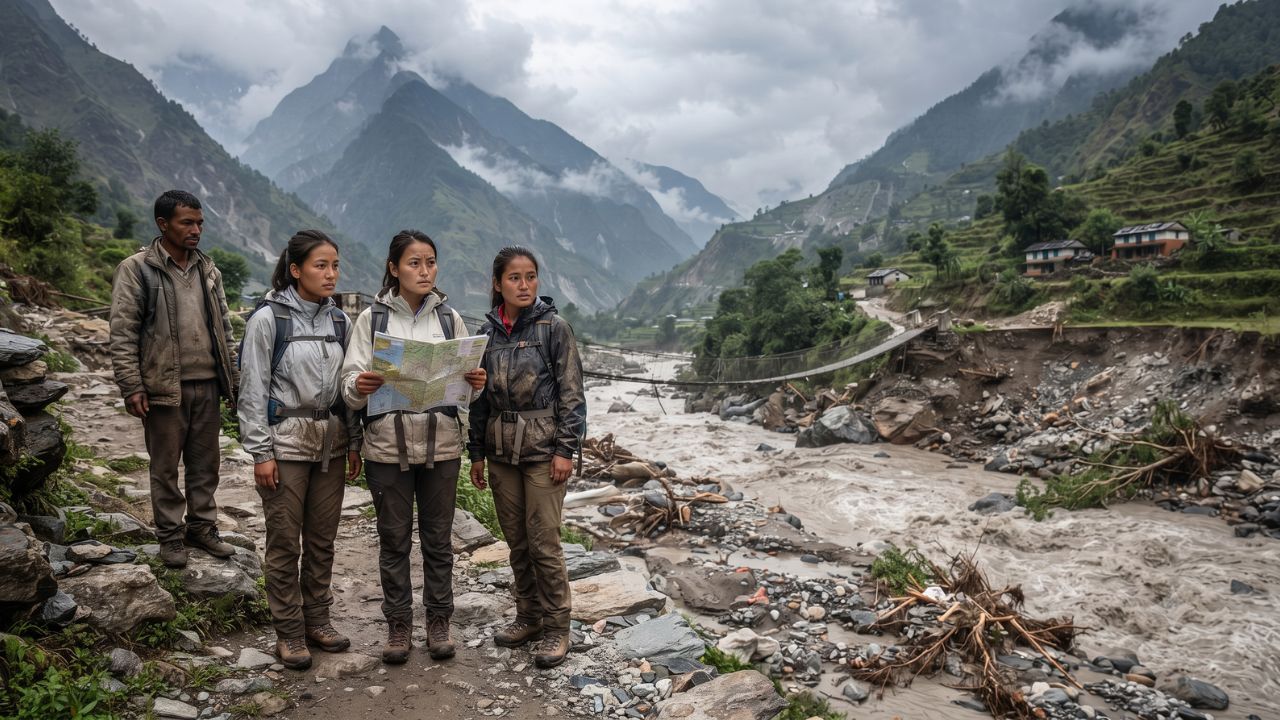
A catastrophic flash flood along the Budhi Gandaki River on 11 October 2026 severed primary pedestrian access across 1,663 square kilometers of the Manaslu Conservation Area, sweeping away the Soti steel bridge and key suspension crossings while displacing approximately 50 households in Gorkha district. Triggered by an early-morning landslide dam breach near Chumchet, the surge of water, sediment, and heavy debris paralyzed peak autumn trekking operations into the high-altitude Nubri, Kutang, and Tsum valleys. The immediate collapse of arterial footbridges prompted an updated travel advisory on 13 October from the Australian Department of Foreign Affairs and Trade (Smartraveller), warning international mountaineers and trekking parties that search, rescue, and recovery operations remain active across northern Gorkha.
The disaster strikes at the height of Nepal's premier post-monsoon climbing season, transforming a heavily booked adventure corridor into an impassable zone of physical isolation. With critical pedestrian spans washed away and telecommunications disrupted, tour agencies, independent guides, and conservation authorities are scrambling to reroute expeditions. For international travelers holding non-refundable trekking permits, the event highlights the extreme operational fragility of Himalayan mountain transit, where the loss of a single suspension bridge severs access to an entire mountain circuit.
Geomorphic Genesis: Landslide Damming and Torrential Debris Surges
The destructive surge originated during the early hours of 11 October 2026. According to a preliminary scientific assessment issued by the International Centre for Integrated Mountain Development (ICIMOD), the flood was likely initiated by a massive slope failure that temporarily impounded the Budhi Gandaki River near Chumchet in Gorkha district. Rather than an abrupt glacial lake outburst flood (GLOF), the evidence indicates that an unstable slope collapsed into the narrow river gorge, creating a temporary earthen dam.
When the impounded reservoir breached around 4:00 am Nepal time, an estimated wall of turbulent water, rocky sediment, and uprooted timber rushed down the canyon. The surge tore through riverside settlements in Chumnubri and Dharche rural municipalities. The force of the torrent undermined bridge footings and sheared high-tensile steel cables, causing systemic structural failures downriver.
ICIMOD scientists emphasized that the early assessment reflects immediate field data and satellite monitoring. Because Himalayan river dynamics involve complex, cascading hazards—where heavy monsoon saturation destabilizes upper slopes, leading to secondary blockages—hydrologists warned that unstable riverbanks continue to pose downstream risks to trail networks and essential utilities.
Infrastructure Damage Assessment and Conservation Area Impact
The physical toll on local communities and adventure transit routes is outlined in situational reporting compiled by humanitarian and conservation agencies.
| Infrastructure / Community Asset | Official Reported Status | Location / Geographic Zone | Impact on Regional Trekking & Logistics |
|---|---|---|---|
| Soti Steel Bridge | Completely washed away by floodwaters | Lower Budhi Gandaki entry point | Primary vehicular and mule transit route into Manaslu severed |
| Nayapul Bridge | Partially destroyed; structural compromise | Dharche Rural Municipality | Trailhead connection impassable for porters and pack animals |
| Chumnubri Suspension Bridges | Multiple pedestrian spans destroyed | Chumnubri Rural Municipality | High-altitude villages cut off from lowland resupply convoys |
| Dharche Trail Network | Extensive pathway erosion and debris blockages | Lower canyon approaches | Walking stages between Jagat and Philim rendered hazardous |
| Displaced Households | Approximately 50 households affected | Gorkha District riverbanks | Nepal Red Cross Society emergency relief mobilized |
| Manaslu Conservation Area | 1,663 km² protected territory isolated | Jagat gateway through Tsum Valley | Ecotourism circuit halted; ecotourism programs suspended |
| Telecommunications Links | Severe regional network outages | Upper Gorkha settlements | Satellite communication required for emergency coordination |
According to an emergency situation bulletin released on 11 October by the Nepal Red Cross Society (NRCS), preliminary estimates indicate that roughly 50 households suffered direct displacement or property destruction. The humanitarian response is currently focused on providing temporary shelter, food rations, and medical assistance to cut-off mountain villages.
For the adventure travel sector, the damage represents a total blockade of the Manaslu Conservation Area Project (MCAP). Managed by the National Trust for Nature Conservation (NTNC) since its ecotourism program began in 1997 with support from the Asian Development Bank, the 1,663-square-kilometer reserve relies on a single arterial valley floor. With the main entry gateway at Jagat cut off from downstream supply heads, lodge owners face severe food and cooking fuel shortages, forcing local authorities to halt incoming commercial expeditions.
Regional Disruption Profile: Localized Impact Versus National Mountain Operations
A vital distinction for international travelers is the geographic concentration of the emergency. While the flooding has decimated the Budhi Gandaki corridor in Gorkha, the disruption remains regional. Nepal's other premier mountain circuits—including the Annapurna Circuit, the Everest Base Camp trek in the Khumbu region, and the Langtang Valley—continue normal autumn operations.
However, for travelers booked specifically on the Manaslu Circuit or the sacred Tsum Valley route, proceeding as scheduled is impossible. The Australian Smartraveller advisory explicitly instructs visitors to avoid flood-affected areas in Gorkha and maintain direct contact with expedition operators. Because local authorities and rescue teams are actively deploying helicopters and ground personnel to evacuate displaced residents and stranded trekking parties, commercial tourists are barred from entering the gorge.
Neither the Nepal Tourism Board nor local district administration offices have published an official reconstruction timetable or target reopening date. Rebuilding washed-out steel suspension spans in roadless Himalayan canyons requires transporting heavy steel cables, concrete anchors, and prefabricated decking via cargo helicopters or manual porter teams—a logistical undertaking that will require months to execute.
Expert Analysis: Single-Point-of-Failure Topography and the Mountain Insurance Void
The Budhi Gandaki disaster exposes a fundamental structural vulnerability in high-altitude Himalayan tourism: single-point-of-failure linear geography. Unlike the Swiss Alps or the Colorado Rockies, where extensive valley road systems and parallel trail networks offer built-in redundancy, the Manaslu Circuit is carved directly into a sheer, vertical river gorge.
For travelers booking this route, the direct consequence is complete itinerary collapse. When a cantilever crossing or suspension bridge fails over the Budhi Gandaki, there is no viable bypass around the sheer granite cliffs. A trekking permit alone does not guarantee a passable route. Furthermore, because Manaslu and Tsum Valley are designated Restricted Areas requiring Department of Immigration Restricted Area Permits (RAPs), specialized Conservation Area permits, and mandatory licensed Nepali guides, travelers cannot legally divert onto unofficial mountain passes without violating immigration laws.
The pricing pressure this creates means that international travelers face complex insurance hurdles. Mountain travel insurance policies frequently contain strict exclusions regarding force majeure cancellations. Standard travel insurance may cover medical evacuation, but trip cancellation provisions often require formal government travel bans or carrier cancellations to trigger compensation. If an independent trekking company offers an alternative route, insurers may refuse cash refunds for the canceled Manaslu segment.
Moreover, emergency rescue operations in remote canyons present extreme logistical hurdles. Commercial travel insurance policies mandate pre-authorization before dispatching emergency medical evacuation helicopters from Kathmandu. With ground telecommunications and cellular towers severed in Chumnubri, tour leaders must rely exclusively on satellite messengers to communicate with insurers. Trekkers currently in Nepal must obtain dated, written statements from their trekking agencies and local police authorities confirming infrastructure destruction to ensure cancellation and trip interruption claims survive insurance underwriting reviews.
Key Takeaways
- Major Infrastructure Destruction: Early morning flash flooding on 11 October 2026 destroyed the Soti steel bridge, damaged the Nayapul crossing, and severed suspension bridges in Gorkha.
- Conservation Corridor Cut Off: 1,663 square kilometers of the Manaslu Conservation Area, including the Nubri and Tsum valleys, are completely inaccessible to foot traffic.
- Landslide Dam Breach Confirmed: ICIMOD scientists identified a breached landslide blockage near Chumchet as the primary trigger, disproving initial assumptions of a glacial lake outburst.
- Diplomatic Travel Warnings: Australia's Smartraveller issued an updated advisory on 13 October warning travelers to avoid flood-ravaged Budhi Gandaki areas during active rescue efforts.
- No Reopening Timetable: District authorities have not established a reconstruction timeline; travelers holding Manaslu permits must seek alternative trekking corridors through licensed agencies.
FAQ: Manaslu Floods and Nepal Trekking Safety 2026
Can travelers currently access the Manaslu Circuit or Tsum Valley?
No. The primary footbridges and trailheads along the Budhi Gandaki River, including the Soti steel bridge, have been completely washed away, making the trekking corridor impassable.
Has Nepal suspended tourism nationwide due to the Gorkha floods?
No. The flood crisis is localized to the Budhi Gandaki River basin in Gorkha district. Popular trekking regions like Everest (Khumbu), Annapurna, and Langtang remain open and fully operational.
What caused the Budhi Gandaki flash flood?
Preliminary scientific assessments from ICIMOD indicate that an unstable slope collapsed near Chumchet, creating a temporary landslide dam that breached around 4:00 am on 11 October 2026.
What should travelers holding Manaslu trekking permits do?
Contact your licensed trekking agency immediately to arrange an alternative route, such as the Annapurna Sanctuary or Langtang Valley, and obtain written confirmation of bridge closures for insurance claims.
In the high Himalayas, the integrity of a trekking permit is only as sound as the steel cables anchoring the nearest river crossing.
Related Travel Guides
Disclaimer
This article is for informational and educational purposes only. It does not constitute legal, financial, or professional advice. While we strive to provide accurate and up-to-date information, travel policies, regulations, and conditions change rapidly. Always verify information with official sources before making travel decisions. Nomad Lawyer makes no representations about the accuracy, reliability, completeness, or suitability of the information provided. Readers should consult qualified professionals for advice specific to their circumstances. The views expressed in this article are those of the author and do not necessarily reflect the views of Nomad Lawyer.
Kunal K Choudhary
Co-Founder & Contributor
A passionate traveller and tech enthusiast. Kunal contributes to the vision and growth of Nomad Lawyer, bringing fresh perspectives and driving the community forward.
Learn more about our team →