
Denali Park Road Reopening 2027: Pretty Rocks Bridge, Wonder Lake Access, and Alaska Wilderness Guide

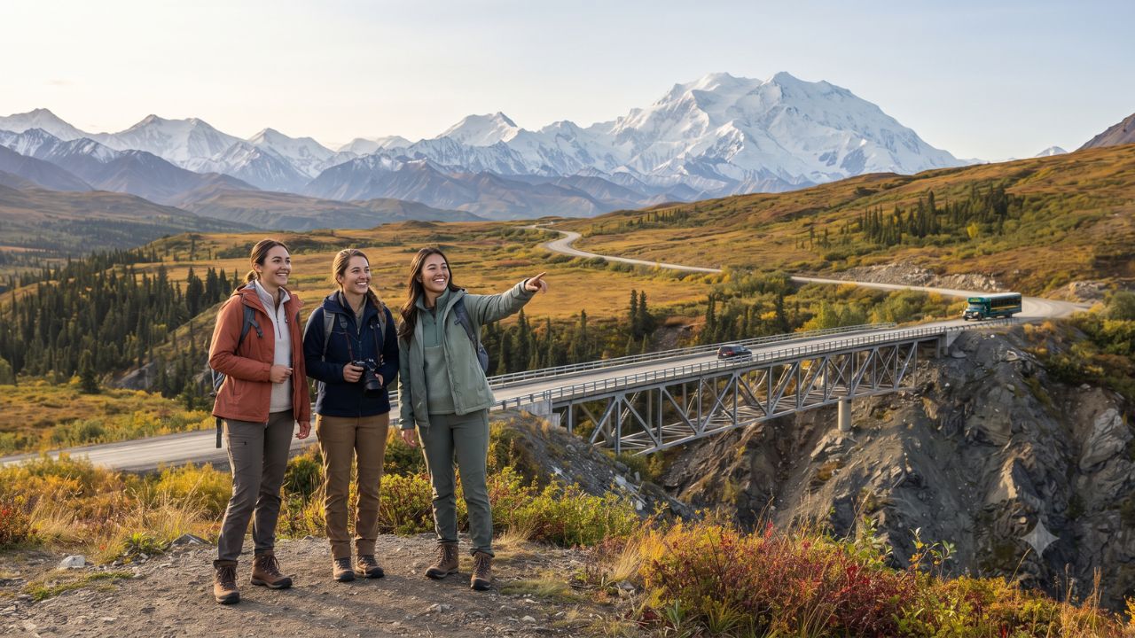
Between 2019 and August 2021, an accelerating slope of thawing permafrost beneath Denali’s Polychrome Pass escalated from sliding inches per day to tumbling downhill at over 10 inches every 24 hours—slicing Alaska’s only park road in half and cutting off access to more than 49 miles of sub-Arctic wilderness. On 27 August 2026, the National Park Service marked a major breakthrough by allowing hikers and cyclists to cross the newly completed 475-foot, $230 million Pretty Rocks Bridge near Mile 45. With full transit bus operations scheduled to resume across the entire 92-mile corridor in summer 2027, this engineering achievement arrives alongside California’s Death Valley National Park reopening Lower Wildrose Road after nearly three years of catastrophic flood repairs—restoring access to some of North America's most revered protected wilderness areas.
The Thawing Permafrost Crisis: How Pretty Rocks Sliced Denali in Half
The closure of Denali Park Road at Mile 43 (East Fork) in August 2021 fundamentally disrupted how travelers experienced Alaska's premier national park. For five operating seasons, public tour buses and independent visitors were turned around halfway through the park, leaving iconic western destinations—including Eielson Visitor Center, Wonder Lake, and the historic mining outpost of Kantishna—virtually inaccessible except via chartered bush plane.
The underlying geological mechanism illustrates the dramatic speed of sub-Arctic warming. Before 2014, the Pretty Rocks rock glacier crept downward by mere inches per year. By 2017, movement accelerated to inches per month; by 2018, inches per week; and by 2019, inches per day. During the final weeks before the 2021 closure, the slope shifted at rates up to 0.65 inches per hour, sliding over 10 inches daily. Park engineers determined that continuous gravel dumping was no longer viable or safe as climate-driven permafrost thaw undermined the mountain's structural integrity.
The resulting engineering solution is among the most sophisticated ever undertaken by the National Park Service. Rather than anchoring into moving scree, the 475-foot steel truss bridge spans the entire unstable fault zone at a height of 50 feet and width of 24 feet. To preserve the ground beneath its eastern foundation, engineers installed 23 specialized thermosiphons—passive heat-exchange pipes that extract warmth from the subsoil during winter, artificially keeping the underlying permafrost frozen year-round. Built to endure for 50 years, the bridge provides the physical foundation for the full return of visitor bus traffic across the park in summer 2027.
Concurrently, 2,500 miles south in the Mojave Desert, Death Valley National Park reopened Lower Wildrose Road after nearly three years of closure following tropical storm flood damage. Together, Alaska and California demonstrate how massive capital investments in resilient infrastructure are restoring access to national treasures damaged by severe environmental events.
Denali Park Road Corridor & Landmark Reopening Matrix
The following table outlines the 92-mile corridor, detailing elevation, infrastructure markers, and the access changes occurring between the 2026 partial opening and the full summer 2027 season:
| Road Mile Marker | Landmark Station | Elevation & Topography | Current Access Status | Wilderness Significance & Sights |
|---|---|---|---|---|
| Mile 15 | Savage River | 2,700 ft; boreal forest / taiga edge | Open to private vehicles & buses | End of paved road; boundary for unescorted private passenger cars |
| Mile 29–30 | Teklanika River | 2,500 ft; braided glacial gravel | Open to park transit & tour buses | Multi-night camper bus access; prime moose and caribou willow habitat |
| Mile 43 | East Fork River | 2,800 ft; river bar crossing | Bus terminus through end of 2026 | Historic road closure checkpoint from August 2021 through August 2026 |
| Mile 45–46 | Pretty Rocks & Polychrome | 3,700 ft; dramatic multi-colored cliffs | Open to hikers & cyclists; buses in 2027 | Site of the $230M, 475-foot bridge; sweeping views over the Alaska Range |
| Mile 53 | Toklat River | 3,000 ft; wide braided glacial gravel | Reopening to transit buses in 2027 | High-density grizzly bear foraging zone; rustic ranger station |
| Mile 66 | Eielson Visitor Center | 3,733 ft; high alpine tundra | Reopening to transit buses in 2027 | Direct panoramic views of Denali's north face and Muldrow Glacier |
| Mile 85–86 | Wonder Lake & Reflection Pond | 2,100 ft; kettle lake & spruce taiga | Reopening to transit buses in 2027 | Famous mirror reflections of Denali (20,310 ft); premier photography spot |
| Mile 92 | Kantishna | 1,700 ft; historical gold mining basin | Reopening to transit buses in 2027 | End of Denali Park Road; private backcountry lodges and historic cabins |
What Makes Western Denali Different: From Savage River to Kantishna's Tundra
Covering roughly 6,075,030 acres—more than 9,492 square miles—Denali National Park and Preserve is larger than the state of New Hampshire. Yet despite this immense geographic scale, the park contains only 35.5 miles of formally maintained hiking trails. The 92-mile Denali Park Road serves as the sole managed artery guiding travelers through 2.146 million acres of federally designated wilderness.
The road’s eastern stretch (Miles 1 to 15) winds through dense spruce taiga populated by red squirrels and willow ptarmigan. But the real essence of Denali begins where private vehicles are barred. Past Teklanika River, trees thin out into vast sub-Alpine shrub tundra. The western sector beyond Mile 43 ascends through Highway Pass, reaching 3,980 feet—the highest roadway elevation in the park—where panoramic vistas reveal jagged snowfields, Dall sheep traversing steep scree slopes, and grizzly bears foraging on low-bush cranberries.
At Mile 66, Eielson Visitor Center provides an unparalleled vantage point directly across the Thorofare River valley toward Denali’s massive 20,310-foot granite peak. Further west at Mile 85 sits Wonder Lake, a 3.5-mile-long glacial kettle lake. When the morning air is still, the surface of Reflection Pond at Mile 85.5 catches an exact, inverted reflection of North America's tallest mountain—an iconic sight that has defined Alaskan wilderness travel for over a century.
Visitor Insider Tips: Planning Your 2027 Denali Expedition
With transit buses returning to the western road corridor in 2027, competition for seats and backcountry permits will be intense. Use these strategic recommendations to plan your trip:
- Mark 1 December 2026 for Reservations: The National Park Service opens booking for all 2027 summer transit buses, narrated tour buses, and campgrounds (including Wonder Lake and Teklanika River) on 1 December 2026. Because pent-up demand for Wonder Lake and Eielson is extraordinary after five years of closure, reserve your preferred dates within the first 48 hours of booking release.
- Choose Transit Buses Over Tour Buses: To hike freely, book non-narrated green Transit Buses rather than tan Tour Buses. Transit buses permit hop-on, hop-off travel anywhere along the 92-mile gravel corridor. You can step off in an alpine riverbed to hike off-trail for five hours, then flag down any eastbound transit bus with an empty seat by waiting along the road.
- Off-Trail Navigation and Wildlife Buffer Zones: Denali is designed as an off-trail park; hikers follow dry river bars and open ridgelines. Carry physical topographic maps and a compass, as GPS signals can falter in deep mountain passes. Federal law requires keeping at least 300 yards (274 meters) from bears and 25 yards (23 meters) from moose and caribou. Always carry bear spray in an accessible hip holster and carry bear-resistant food canisters (BRFCs) on overnight excursions.
- Pack for Unforgiving Sub-Arctic Weather: Even in late July, temperatures at Highway Pass can plunge from 20 degrees Celsius down to freezing rain or wet snow within 30 minutes. Dress in complete moisture-wicking layers, including high-grade waterproof jackets and pants, thermal undergarments, and fine-mesh mosquito head nets for low-lying tundra bogs.
Cultural and Environmental Context: Permafrost Thaw and Climate Resilience
The reopening of Denali Park Road provides essential economic stability for interior Alaska. In 2025, recreational visits rose to 543,300 (+16.53% over 2024). In 2024, park visitors spent over US$600 million across gateway communities like Healy and Cantwell, supporting more than 5,600 local jobs and generating nearly US$880 million in total economic output. Restoring full road access enables backcountry lodges, raft guides, and transport companies to rebuild multi-day itineraries that had been curtailed since 2021.
However, the Pretty Rocks project also stands as a stark testament to climate realities. As the sub-Arctic warms at roughly three times the global average rate, thawing permafrost threatens highway foundations, airport runways, and pipeline corridors across the north. By engineering a bridge with active thermosiphons and preserving strict restrictions on private automobile traffic, park administrators are demonstrating that future tourism access requires building with environmental realities in mind, safeguarding one of the planet's grandest ecosystems for generations to come.
FAQ: Visiting Denali National Park 2026–2027
When will public buses travel the full 92-mile Denali Park Road again?
Public buses are scheduled to resume service along the entire 92-mile road to Eielson Visitor Center, Wonder Lake, and Kantishna in summer 2027, with the operating season running from mid-May through mid-September.
When do summer 2027 bus and campground reservations open?
Official reservations for 2027 transit buses, narrated tour buses, and road campgrounds open to the public on 1 December 2026 through the National Park Service reservation concession.
Can private passenger vehicles drive past Mile 15?
No. Private vehicles are restricted past Savage River at Mile 15 during the summer season to protect wildlife corridors, reduce road dust, and preserve wilderness solitude.
Which California national park reopened a major road alongside Denali?
Death Valley National Park reopened Lower Wildrose Road after nearly three years of comprehensive rebuilding following severe flash flood damage.
Beneath the granite shadow of North America’s highest peak, the road ahead is finally open to those willing to listen to the wilderness.
Related Travel Guides
Disclaimer
This article is for informational and educational purposes only. It does not constitute legal, financial, or professional advice. While we strive to provide accurate and up-to-date information, travel policies, regulations, and conditions change rapidly. Always verify information with official sources before making travel decisions. Nomad Lawyer makes no representations about the accuracy, reliability, completeness, or suitability of the information provided. Readers should consult qualified professionals for advice specific to their circumstances. The views expressed in this article are those of the author and do not necessarily reflect the views of Nomad Lawyer.
Naina Thakur
Contributor & Travel Specialist
Travel enthusiast and legal writer covering visa regulations, responsible tourism, and cultural journeys across global destinations.
Learn more about our team →