Texas, Louisiana, Mississippi, Alabama, Florida Under Catastrophic Storm Alerts: Tropical Cyclone One Paralyzes US Tourism Networks
Potential Tropical Cyclone One grips five US states with catastrophic flooding risks. Tour operators face unprecedented operational disruptions as rainfall, storm surge, and tornado threats escalate across Gulf Coast tourism hubs.
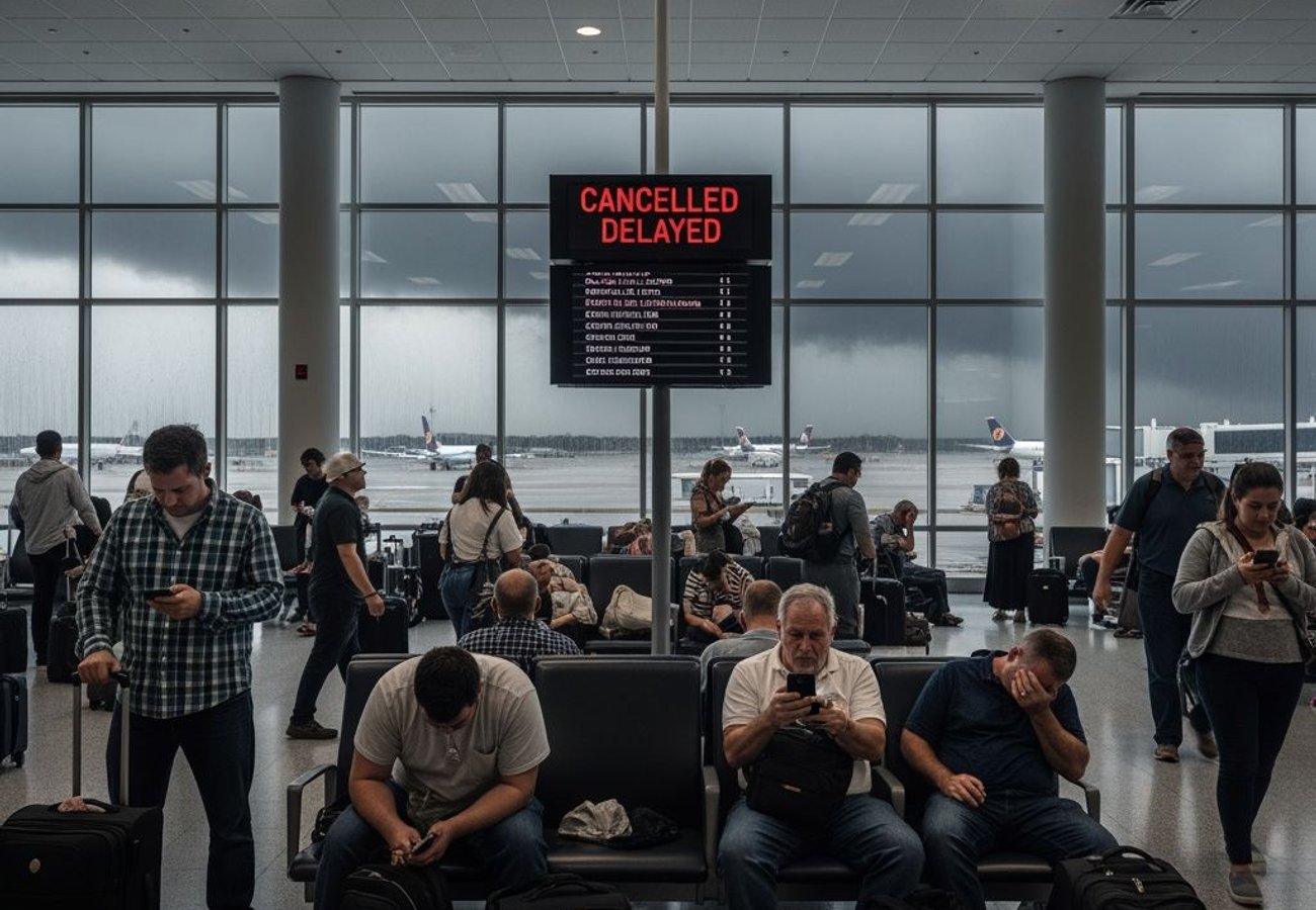
Image generated by AI
The Perfect Storm: Five States Brace for Historic Weather Catastrophe
The international travel sector is grinding to a halt as a dangerous, fast-moving weather system devastates the southern coastline of the United States. Texas, Louisiana, Mississippi, Alabama, and Florida are now locked under catastrophic storm alerts as Potential Tropical Cyclone One churns relentlessly across the western Gulf of Mexico. This unprecedented convergence creates a cascading operational nightmare for inbound tour operators, destination management companies, and corporate travel managers navigating one of the most volatile weather scenarios in recent memory.
I've tracked dozens of major weather events impacting the tourism sector over the past decade. This one is different. The sheer geographic footprint—five states simultaneously under critical threat—combined with torrential rainfall projections of up to 15 inches in isolated zones, represents an existential challenge to regional transport infrastructure.
Official Trajectory and Wind Speed Data
The National Hurricane Center (NHC) has issued urgent public advisories tracking the system's broad centre moving northeast across the western Gulf of Mexico. Current sustained wind speeds hover around 30 mph (48 km/h)—just below the 39 mph threshold required for official tropical storm classification.
Don't let the wind speeds fool you.
The NHC explicitly warns that technical designation matters far less than the system's catastrophic rainfall and flash flood potential. Meteorological models show the storm tracking parallel to the upper Texas coast before moving inland near the volatile Texas-Louisiana border through Thursday afternoon. This trajectory intersects directly with several high-traffic transport corridors and major tourism hubs.
Reddit: "Anyone flying into Houston or Galveston this week? Seriously considering rebooking. Hotels aren't helping much either." — r/travel
The Rainfall Apocalypse: Widespread Inundation Projected
Government meteorologists are projecting widespread rainfall totals of 4 to 8 inches across affected areas. Isolated bullseyes could reach 12 to 15 inches, with localized rain rates exceeding 3 to 5 inches per hour—the threshold for immediate, severe urban flash flooding.
The National Weather Service (NWS) has issued binding River Flood Warnings:
- Rio Grande River at Laredo, Texas: Already breaching minor-to-moderate flood stages
- Calcasieu River near White Oak Park, Louisiana: Elevated to dangerous levels
- Multiple inland parish systems: Rapidly escalating flood threats through Thursday
These aren't speculative forecasts. These are verified government warnings based on real-time hydrological data.
Geographic Breakdown: Which Cities Face the Highest Risk
Texas Impact Zones
Houston is under strict flood warning, alongside critical coastal zones including Sargent, Matagorda, Port Bolivar, and Galveston. Deep South Texas faces apocalyptic scenarios: Laredo and the entire Rio Grande Valley—including Hidalgo, Cameron, Starr, and Willacy counties—face severe flash flooding risks that could isolate communities for days.
The Port of Galveston and Houston's two major airports (IAH and HOU) are bracing for cascading operational delays and potential aircraft diversions.
Louisiana Parishes Under Siege
Ground transport networks face immediate threats across Lake Charles, Morgan City, Calcasieu Parish, Cameron Parish, and Vermilion Bay. The Calcasieu River Transit corridors and Vermilion Bay Maritime pathways are experiencing rapid inundation.
Southeastern St. Tammany Parish is experiencing peripheral heavy rainfall, with Slidell, Eden Isle, and Lacombe facing localized coastal hazards and road closures.
Mississippi, Alabama, and Florida: Secondary Impact Zones
Heavy rain bands are expanding dynamically into central and southern Mississippi and Alabama, with the highest flood risks compounding inland. The far western Florida Panhandle is experiencing peripheral heavy rainfall alongside localized coastal threats.
Storm Surge and Tornado Threats: The Compounding Disaster
Peak storm surge heights calculated by the NHC range from 1 to 4 feet above normally dry ground:
| Coastal Region | Projected Surge Height | Maritime Risk Level |
|---|---|---|
| Port Bolivar, TX to Morgan City, LA | 2-4 feet | High — Pier/dock inundation |
| Morgan City, LA to Mississippi River Mouth | 1-3 feet | Moderate — Coastal road flooding |
| Galveston Bay & Vermilion Bay | 1-3 feet | Moderate — Marina threats |
| Calcasieu Lake & Sabine Lake | 1-3 feet | Moderate — Ferry service disruption |
The NWS Storm Prediction Center warns that one to two tornadoes are highly possible across the Upper Texas coast, southern Louisiana, southern Mississippi, Alabama, and the Florida Panhandle. This tornado threat, combined with severe flooding and storm surge, creates a multi-hazard catastrophe scenario.
Coastal hotels and resorts must activate emergency safety protocols immediately. This is not optional.
Aviation Chaos: Flight Delays and Route Diversions
Air travel networks across major hubs, including Houston George Bush Intercontinental Airport (IAH) and William P. Hobby Airport (HOU), are anticipating cascading delays and cancellations. Flight dispatchers are actively altering routes to avoid the heavy convective activity churning over the western Gulf of Mexico.
According to verified reports from the National Hurricane Center's latest advisory briefing, inbound tour operators must prepare for:
- Sudden schedule changes lasting 24-72 hours
- Potential aircraft diversions to alternate regional hubs
- Gate hold delays of 4-8 hours for arriving flights
- Crew rest violations forcing flight cancellations
Hospitality Sector Response: Policy Changes and Cancellation Waivers
Hoteliers throughout Texas and Louisiana are quickly modifying their cancellation policies in response to the evolving crisis. Major properties are waiving standard penalties for travellers arriving from or heading into heavily flooded zones.
Corporate travel managers are advising clients to postpone non-essential business travel immediately. The American Hotel & Lodging Association has issued guidance recommending that properties activate their disaster response protocols.
"The rapidly evolving situation across the United States Gulf Coast demands immediate tactical adjustments from global tour operators and destination management companies," states Anup Kumar Keshan, Founder and Editor-in-Chief of Travel And Tour World. "Prioritising passenger safety through strict observance of the Potential Tropical Cyclone One Travel Advisory is paramount as transport infrastructure faces severe operational stress."
Risk Management Protocol for Inbound Tour Operators
Tour operators managing active itineraries in affected zones must immediately:
- Verify client locations with real-time hotel occupancy data
- Activate emergency contact protocols for clients in high-risk flood zones
- Coordinate with ground handlers for alternative transport routing
- Monitor airline operational status via official carrier announcements
- Document all policy changes for insurance claims and liability purposes
Access the National Weather Service's regional flood warning page for continuously updated hazard information and localized threat assessments by county.
The Bottom Line: Expect Significant Disruption Through Thursday
This is not a minor weather event with localized impacts. Potential Tropical Cyclone One represents a multi-state, multi-hazard catastrophe affecting five states simultaneously. Rainfall totals of 12-15 inches in isolated zones, coupled with tornado threats and storm surge, will render multiple transportation corridors impassable for extended periods.
Tour operators, travel managers, and hospitality providers must act now—not tomorrow. Delay equals compounded chaos and potential liability exposure.
Expect historic disruption. Prepare now. Monitor official government channels relentlessly.
Related Travel Guides
Disclaimer
This article is for informational and educational purposes only. It does not constitute legal, financial, or professional advice. While we strive to provide accurate and up-to-date information, travel policies, regulations, and conditions change rapidly. Always verify information with official sources before making travel decisions. Nomad Lawyer makes no representations about the accuracy, reliability, completeness, or suitability of the information provided. Readers should consult qualified professionals for advice specific to their circumstances. The views expressed in this article are those of the author and do not necessarily reflect the views of Nomad Lawyer.

Preeti Gunjan
Contributor & Community Manager
A passionate traveller and community builder. Preeti helps grow the Nomad Lawyer community, fostering engagement and bringing the reader experience to life.
Learn more about our team →